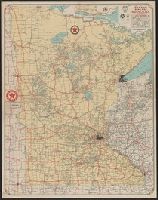
"Texaco road map, 1932, United States," local route maps of Minneapolis-St. Paul and Duluth, distance table, indexes, ill., and text on verso., In lower right: A4 2820., and Includes inset of northeastern Minnesota.
Texaco touring map of California, Nevada. and Texaco touring map of Washington, Oregon.
Description:
"3-4400-27.", "3-4432-29.", "Copyright by Rand McNally & Company.", Date based on gasoline tax table dated Jan. 1954., Includes indexes., Panel title., Relief shown pictorially and by spot heights., and Texaco touring map of Washington, Oregon -- Texaco touring map of California, Nevada.
"Engraved and indexed for use with the Rand McNally commercial atlas and marketing guide.", Date inferred from 1950 population table of counties., and Indexed.
Publisher:
The Company,
Subject (Geographic):
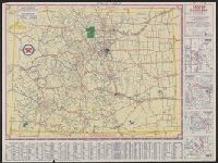
Colorado--Administrative and political divisions--Maps and Colorado--Maps
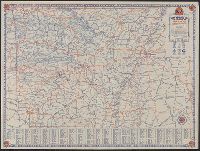
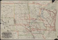
Sectional trip map., Texaco sectional trip map., Texaco touring map of Colorado., and Touring map of Colorado.
Description:
"X 3805" in lower right of Colorado map and "X.4113(N)" in lower right of Sectional trip map., Includes index, 4 local route maps, distance table, and text., Panel title., Relief shown pictorially and by spot heights., and Texaco touring map of Colorado -- Texaco
Publisher:
Rand McNally and Co.,
Subject (Geographic):
Colorado--Maps
Subject (Name):
Texas Company
Subject (Topic):
Roads--Colorado--Maps and Roads--West (U.S.)--Maps
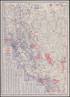
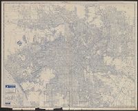
In lower right: 534506. and Includes indexes, and maps of "Kings Canyon and Sequoia national parks," "Yosemite National Park," and "Fresno, Stockton, Yosemite, Kings Canyon, and Sequoia Region, Calif.," and ill. on verso.
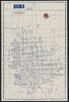
Copyright: Rand McNally & Company., In lower right: Y.3897., Includes inset of "Pacific Palisades.", and Indexes, "Los Angeles and vicinity (recreational map)," (scale [ca. 1:323,136]), and ill. on verso.
Publisher:
Rand McNally & Co.,
Subject (Geographic):
Los Angeles (Calif.)--Maps and Los Angeles Metropolitan Area (Calif.)--Maps
Subject (Name):
Union Oil Company of California
Subject (Topic):
Roads--California--Los Angeles Metropolitan Area--Maps and Streets--California--Los Angeles--Maps
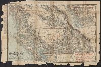
Rand, McNally & Co.'s indexed indexed atlas of the world map of British Columbia
Description:
"British Columbia Railroads"--Lower right corner., "Copyright, 1895, by Rand, McNally & Co.", "Rand, McNally & Co.'s New Business Atlas Map of British Columbia.", Inset: Northern part of British Columbi, and Railroads; settlements; mining districts and divisions.