Skip to search
Skip to main content
Skip to first result
Search
You Searched For
Repository
Beinecke Rare Book and Manuscript Library
Format
cartographic
Creator
Geological Survey (U.S.)
New Search
Search Results
Creator:
Published / Created:
1906
Call Number:
BrSides Folio 2019 61
Image Count:
1
Resource Type:
Maps, Atlases & Globes
Alternative Title:
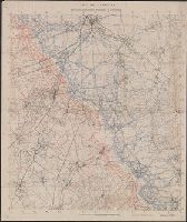
Central City special map
Description:
"Surveyed in 1904.", Relief shown by contours and hachures., and Shows mining activity.
Publisher:
The Survey,
Subject (Geographic):
Central City (Colo.)--Maps. and Colorado--Central City
Subject (Name):
Chapman, Pearson, Douglas, E. M. (Edward Morehouse), 1855-1932, Moor, D. F., and Tweedy, Frank, 1854-1937
Subject (Topic):
Gold mines and mining--Colorado--Central City--Maps. and Mines and mineral resources--Colorado--Central City--Maps.
Found in:
Beinecke Rare Book and Manuscript Library > Colorado, Central City special map [cartographic material] / U.S. Geological Survey ; E.M. Douglas, geographer ; Frank Tweedy, in charge of section ; topography by Pearson Chapman and D.F. Moor ; triangulation by Frank Tweedy.
Creator:
Published / Created:
1905?]
Call Number:
837gce T764 1905
Container / Volume:
BRBL_00594
Image Count:
1
Resource Type:
Maps, Atlases & Globes
Description:
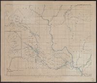
"Third annual report Reclamation Service, Pl. XXXI.", Relief shown by hachures and spot heights., and Shows irrigable lands, surveyed canal lines, and irrigation canals under construction.
Publisher:
U.S. G.P.O,
Subject (Name):
A. Hoen & Co and Geological Survey (U.S.). Reclamation Service. Annual report of the Reclamation Service
Subject (Topic):
Irrigation projects--Carson River Watershed (Nev.)--Maps, Irrigation projects--Truckee River Watershed (Calif. and Nev.)--Maps, and Irrigation--Nevada--Maps
Found in:
Beinecke Rare Book and Manuscript Library > General map of Truckee-Carson Project, Nevada / U.S. Geological Survey.
Creator:
Published / Created:
1905?]
Call Number:
847 Y12 1905
Container / Volume:
BRBL_00627
Image Count:
1
Resource Type:
Maps, Atlases & Globes
Description:
In upper margin: U.S. Geological Survey, Third annual report Reclamation Service PL. LVII. and Relief shown by hachures and spot heights.
Publisher:
G.P.O.?,
Subject (Geographic):
Yakima River Watershed (Wash.)--Maps
Subject (Name):
Geological Survey (U.S.). Reclamation Service. Annual report of the Reclamation Service and Norris Peters Co
Found in:
Beinecke Rare Book and Manuscript Library > General map of the Yakima Basin, Washington.
Creator:
Published / Created:
1912
Call Number:
848 G95 1912
Container / Volume:
BRBL_00632
Image Count:
1
Resource Type:
Maps, Atlases & Globes
Alternative Title:
Geological Survey bulletin. 498. and Headwater region of Gulkana and Susitna Rivers, Alaska
Description:
"Bulletin 498, Plate I.", Relief shown by contours and spot heights., and Surveyed in 1896, 1909, 1910.
Publisher:
Geological Survey,
Subject (Geographic):
Gulkana River Region (Alaska)--Maps and Susitna River Region (Alaska)--Maps
Subject (Name):
Bagley, James Warren, 1881-1947, Brooks, Alfred H. (Alfred Hulse), 1871-1924, Giffin, C. E, and Witherspoon, D. C
Subject (Topic):
Geology--Alaska--Gullkana River Region--Maps and Geology--Alaska--Sustina River Region--Maps
Found in:
Beinecke Rare Book and Manuscript Library > Geologic reconnaissance map of headwater region of Gulkana and Susitna Rivers, Alaska / U.S. Geological Survey. Alfred H. Brooks, geologist in charge of division, topography and triangulation by D.C. Witherspoon, C.E. Giffin and J.W. Bagley.
Creator:
Published / Created:
[1918]
Call Number:
848 J953 1918
Container / Volume:
BRBL_00633
Image Count:
1
Resource Type:
Maps, Atlases & Globes
Description:
"1918.", "Surveyed in 1914-1916.", Includes notes., and Relief shown by contours and spot heights.
Publisher:
U.S. Geological Survey,
Subject (Geographic):
Juneau Region (Alaska)--Maps
Subject (Name):
Brooks, Alfred H. (Alfred Hulse), 1871-1924 and Witherspoon, D. C
Found in:
Beinecke Rare Book and Manuscript Library > Juneau and vicinity, Alaska / Alfred H. Brooks, geologist in charge of division ; topography by D.C. Witherspoon.
Creator:
Published / Created:
[1900]
Call Number:
847gc Se18 1897
Container / Volume:
BRBL_00628
Image Count:
1
Resource Type:
Maps, Atlases & Globes
Alternative Title:
Washington, Seattle quadrangle :
Description:
"Henry Gannett, chief topographer; R.U. Goode, geographer in charge; control by W.T. Griswold and R.H. McKee; topography by G.E. Hyde and R.H. McKee; surveyed in 1893-94-95." and "Henry Gannett, geographer in charge; land classification by J.W. Rankine and G.
Publisher:
U.S.G.S.,
Subject (Geographic):
King County (Wash.)--Maps and Snohomish County (Wash.)--Maps
Subject (Name):
Gannett, Henry, 1846-1914
Subject (Topic):
Forests and forestry--Washington (State)--King County--Maps, Forests and forestry--Washington (State)--Snohomish County--Maps, Land use--Washington (State)--King County--Maps, and Land use--Washington (State)--Snohomish County
Found in:
Beinecke Rare Book and Manuscript Library > Land classification and density of standing timber, Washington, Seattle quadrangle / U.S. Geological Survey.
Branch:v1.61.8 ,Deployed:2024-06-20T11:15:02-04:00