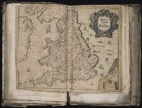
[Atlas factice of 96 maps by Blaeu, Visscher, Jansson, Hondius and others]
Image Count:
1
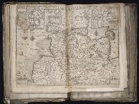
Description:
Imperfect: mutilated and repaired, with loss of cartouche and coat of arms and partial loss of eastern coast of England, replicated (minus coat of arms) in ms. with new cartouche title Anglia Regnum vulgo Engeland. Sheet measures 39.9 x 50 cm. No. 6 of 92 maps bound together.
Publisher:
Willem J. Blaeu
Subject (Geographic):
England --Maps --Early works to 1800 and Wales --Maps --Early works to 1800
Blaeu, Willem Janszoon, 1571-1638 Mercator, Gerhard, 1512-1594
Published / Created:
[1647]
Call Number:
1983 Folio 19
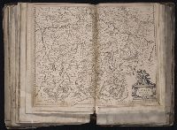
Collection Title:
[Atlas factice of 96 maps by Blaeu, Visscher, Jansson, Hondius and others]
Image Count:
1
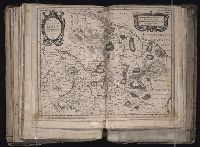
Description:
Imperfect: mutilated along fold, with some loss of text. Reinforced along edges with manuscript and printed waste. Sheet measures 39.1 x 50.8 cm. No. 77 of 92 maps bound together. and Numbered 83 on verso.
Blaeu, Joan, 1596-1673. Theatrum orbis terrarum Blaeu, Willem Janszoon, 1571-1638
Published / Created:
[ca. 1630]
Call Number:
1983 Folio 19
Collection Title:
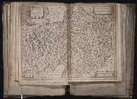
[Atlas factice of 96 maps by Blaeu, Visscher, Jansson, Hondius and others]
Image Count:
1
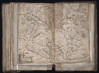
Description:
Imperfect: torn and mutilated along fold and edges, partially repaired, with some loss of text [partially duplicated in ms.]. Ms. no. on verso: 15. Sheet measures 39.8 x 50 cm. No. 12 of 92 maps bound together.
Publisher:
Guiljelmus Blaeuw excudit
Subject (Geographic):
Schleswig-Holstein (Germany) --Maps --Early works to 1800
Blaeu, Joan, 1596-1673 Blaeu, Willem Janszoon, 1571-1638
Published / Created:
[ca. 1634]
Call Number:
1983 Folio 19
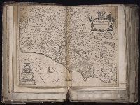
Collection Title:
[Atlas factice of 96 maps by Blaeu, Visscher, Jansson, Hondius and others]
Image Count:
1
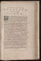
Description:
Imperfect: torn along fold, with some loss of text. Sheet measures 40.5 x 51.0 cm. Reinforced along edges with printed waste. No. 88 of 92 maps bound together. and Numbered 94 on verso.