Skip to search
Skip to main content
Skip to first result
Search
You Searched For
Resource Type
Maps, Atlases & Globes
Publication Place
London :
New Search
Search Results
Published / Created:
1790
Call Number:
556 1790
Container / Volume:
BRBL_00292
Image Count:
1
Resource Type:
Maps, Atlases & Globes
Publisher:
Robert Sayer,
Subject (Geographic):
Southeast Asia--Maps--Early works to 1800
Found in:
Beinecke Rare Book and Manuscript Library > A new chart of the Oriental Seas and Islands ... from the Isle of Ceylon to Amoye in China ... Mosr. Daprès de Mannevillette.
Published / Created:
[1760?]
Call Number:
3211cea 1760A
Container / Volume:
BRBL_00055
Image Count:
1
Resource Type:
Maps, Atlases & Globes
Description:
Inset: The Rivers Dee and Mersey ca. 1:400,000.
Publisher:
R. Mount and T. Page,
Subject (Geographic):
English Channel--Maps--Early works to 1800
Found in:
Beinecke Rare Book and Manuscript Library > A new chart of the Sea Coasts between England and Ireland.
Creator:
Published / Created:
June 1st, 1805.
Call Number:
60 1805
Container / Volume:
BRBL_00324
Image Count:
1
Resource Type:
Maps, Atlases & Globes
Description:
Pg. no. on verso: 48.
Publisher:
Published by J. Cary, engraver & map-seller, 181 Strand,
Subject (Geographic):
Africa--Maps
Found in:
Beinecke Rare Book and Manuscript Library > A new map of Africa, from the latest authorities / by John Cary, engraver, 1805.
Creator:
Published / Created:
April 28, 1811.
Call Number:
60 1811
Container / Volume:
BRBL_00325
Image Count:
1
Resource Type:
Maps, Atlases & Globes
Description:
Pg. no. on verso: 48.
Publisher:
Published by J. Cary, engraver & map-seller, 181 Strand,
Subject (Geographic):
Africa--Maps
Found in:
Beinecke Rare Book and Manuscript Library > A new map of Africa, from the latest authorities / by John Cary, engraver, 1811.
Published / Created:
1794
Call Number:
52 1794
Container / Volume:
BRBL_00282
Image Count:
1
Resource Type:
Maps, Atlases & Globes
Publisher:
Published by Laurie & Whittle,
Subject (Geographic):
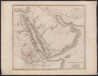
Arabian Peninsula--Maps--Early works to 1800
Found in:
Beinecke Rare Book and Manuscript Library > A new map of Arabia divided into its several regions and districts ...
Creator:
Published / Created:
Apr. 28, 1811.
Call Number:
52 1811
Container / Volume:
BRBL_00684
Image Count:
1
Resource Type:
Maps, Atlases & Globes
Description:
Appears in Cary's New universal atlas ... London: Printed for J. Cary ..., 1811., Hand col. Backed with rice paper. Sheet measures 53 x 68 cm. Cross Collection no. 103., and Relief shown pictorially.
Publisher:
J. Cary, engraver & map seller,
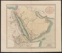
Subject (Geographic):
Africa, Northeast--Maps, Arabian Peninsula--Maps, and Egypt--Maps
Subject (Name):
Cary, John, ca. 1754-1835. Cary's new universal atlas
Found in:
Beinecke Rare Book and Manuscript Library > A new map of Arabia, including Egypt, Abyssinia, the Red Sea &c. &c [electronic resource] : from the latest authorities / by John Cary, engraver.
Creator:
Published / Created:
Apr. 28, 1811.
Call Number:
52 1811
Container / Volume:
BRBL_00282
Image Count:
1
Resource Type:
Maps, Atlases & Globes
Description:
Appears in Cary's New universal atlas ... London: Printed for J. Cary ..., 1811., Printed no. "45" pasted on verso. Hand col. Sheet measures 55 x 64 cm., and Relief shown pictorially.
Publisher:
J. Cary, engraver & map seller,
Subject (Geographic):
Africa, Northeast--Maps, Arabian Peninsula--Maps, and Egypt--Maps
Subject (Name):
Cary, John, ca. 1754-1835. Cary's new universal atlas
Found in:
Beinecke Rare Book and Manuscript Library > A new map of Arabia, including Egypt, Abyssinia, the Red Sea &c. &c [electronic resource] : from the latest authorities / by John Cary, engraver.
Published / Created:
1811
Call Number:
50 1811
Container / Volume:
BRBL_00272
Image Count:
1
Resource Type:
Maps, Atlases & Globes
Publisher:
J. Cary,
Subject (Geographic):
Asia--Maps
Found in:
Beinecke Rare Book and Manuscript Library > A new map of Asia ... By John Cary, Engraver.
Published / Created:
1811
Call Number:
435 1811
Container / Volume:
BRBL_00252
Image Count:
1
Resource Type:
Maps, Atlases & Globes
Publisher:
J. Cary,
Subject (Geographic):
Bohemia (Czech Republic)--Maps
Found in:
Beinecke Rare Book and Manuscript Library > A new map of Bohemia and Moravia ... By John Cary, Engraver.
Creator:
Published / Created:
Apr. 28, 1811.
Call Number:
56 1811
Container / Volume:
BRBL_00685
Image Count:
1
Resource Type:
Maps, Atlases & Globes
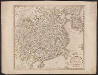
Description:
From Cary's new universal atlas ... London : Printed for J. Cary, 1808., Ms. no. on verso: 26. Hand col. Sheet measures 52.1 x 68.2 cm. Cross Collection no. 106., Prime meridian: Greenwich., and Relief shown pictorially.
Publisher:
J. Cary,
Subject (Geographic):
China--Maps
Subject (Name):
Cary, John, ca. 1754-1835. Cary's new universal atlas
Found in:
Beinecke Rare Book and Manuscript Library > A new map of China, from the latest authorities / by John Cary, engraver.
Branch:v1.61.6 ,Deployed:2024-06-12T09:55:31-04:00