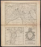
"Dedicated to His Highness William Duke of Glocester.", Appears in E. Wells' A new sett of maps both of antient and present geography., English, with Latin place names., Has watermark., Includes ornamental cartouche., and Relief shown pictorially.
Publisher:
s.n.,
Subject (Geographic):
Italy--Historical geography--Maps--Early works to 1800, Italy--History--To 476--Maps--Early works to 1800, and Rome--Maps--Early works to 1800
Subject (Name):
Nicholls, Sutton and Wells, Edward, 1667-1727. New sett of maps both of antient and present geography
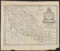
"Dedicated to His Highness William Duke of Glocester.", Appears in E. Wells' A new sett of maps both of antient and present geography., English, with Latin place names., Includes ornamental cartouche., Relief shown pictorially., and Watermarks: RDS, and fleur-de-l
Publisher:
s.n.,
Subject (Geographic):
Italy--Historical geography--Maps--Early works to 1800, Italy--History--To 476--Maps--Early works to 1800, and Rome--Maps--Early works to 1800
Subject (Name):
Nicholls, Sutton and Wells, Edward, 1667-1727. New sett of maps both of antient and present geography
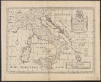
"Iohan. Senex scu, Imprint derived from other maps in the same atlas., London meridian., Ms. no. on verso: 34. Sheet measures 53 x 68 cm. Cross Collection no. 96., Relief shown pictorially., and Shows boundaries, forests, rivers, roads and settlements, with notes.
Publisher:
John Senex,
Subject (Geographic):
Mediterranean Region--Historical geography--Early works to 1800--Maps
Subject (Name):
Senex, John, d. 1740. New general atlas
Subject (Topic):
Ecclesiastical geography--Africa, North--Maps--Early works to 1800
Bookplate and bookstamp on binding of Frederick Perkins. Bookplate of Lucius Wilmerding. Bookplate of Sir John Arthur Brooke. Bookplate of Charles J. Rosenbloom. Bookplate of William Amherst Tyssen-Amherst Amherst. Autograph of James Birchenough, 1745. Autograph of William Newall Allen, 1810., Colophon: Emprynted at London in the Flete-strete at the sygne of ÿ Sonne by Wynkyn de Worde. In the yere of oure Lorde.MCCCCC.viii. ÿ.xvi.day of ÿ moneth of Juyn., and Signatures: aa-yy8.4zz8[?]6.
Publisher:
Wynkyn de Worde,
Subject (Name):
Perkins, Frederick,--1780-1860--Bookplate, Perkins, Frederick,--1780-1860--Stamp, Rosenbloom, Charles J.--Bookplate, and Wilmerding, Lucius,--1880-1949--Bookplate