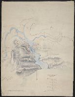
Color: Possibly pen and water color drawing. and Purpose of this map is to illustrate the movements and positions of the British warships & forces under Lord John Hays on the N. Coast of Spain.
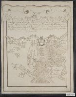
Backed with paper., Copied from plate 9 in Alexandre de Humboldt's Atlas geographique et physique du royaume de la Nouvelle-Espagne., Imperfect: mutilated along folds., Relief shown by hachures., and Title devised by cataloger.
Subject (Geographic):
Veracruz-Llave (Mexico : State)
Subject (Name):
Humboldt, Alexander von, 1769-1859. Atlas geographique et physique du royaume de la Nouvelle-Espagne.
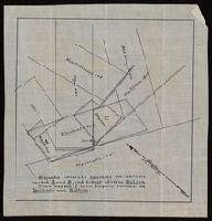
"Magnolia adversed Ypsilanti on conflicts marked A and B, and did not adverse Bullion. Piece marked C is in dispute between the Ypsilanti and Bullion.", From the Richard H. Rickard Papers., and Title devised by cataloger.
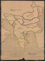
Map includes historical regions of Eastern Roumelia, Dobruja, and Bessarabia. Borders drawn in black ink, countries outlined in crayon. and Title supplied by cataloger.
Publisher:
s.n.,
Subject (Geographic):
Balkan Peninsula--Maps and Europe, Eastern--Maps
Subject (Topic):
Boundaries--Balkan Peninsula--Maps and Boundaries--Europe, Eastern--Maps