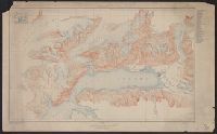
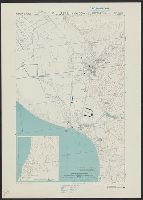
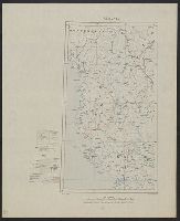
Port Valdez District, Prince William Sound region, Port Valdez District, and Topography, Alaska, Prince William Sound region, Port Valdez District
Description:
"Alaska Sheet no. 602 B.", "Control by Coast and Geodetic Survey. Surveyed in 1911 and 1912.", "Entire area within Chugach National Forest.", Includes index to the mines and prospects in the area and location map., Relief shown by contours and spot heights., and Title, upper center margin: Topography.
Publisher:
The Survey,
Subject (Geographic):
Port Valdez Region (Alaska)--Maps and Prince William Sound Region (Alaska)--Maps
Great Britain. Royal Air Force. Central Interpretation Unit
Published / Created:
1943
Call Number:
475 1944
Container / Volume:
BRBL_00262
Image Count:
1
Resource Type:
Maps, Atlases & Globes
Alternative Title:
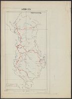
Geographical Section, General Staff ; no. 4415, GSGS (Series) ; 4415., and Vlonë (Valona) city plan
Description:
"1-44.", "1943.", "First G.S.G.S. edition, 1943.", "Ground information supplied by I.S.T.D.", "War Office 1943.", Inset: [Krionero]., Military grid., and Relief shown by contours, land form drawings, and one spot height.
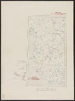
"War Office, November 1918." and Red overprint: At head of map, "Map No.1, Portion of sheets Sofiya & Athenai. International Map 1:1,000,000"; on body of map, reference chart showing land claims corresponding to lines on map; at bottom left margin, "Geographi