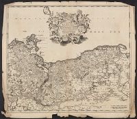
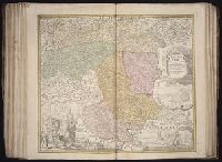
Imperfect: torn along folds and chipped at edges, with no loss of text. Sheet measures 54.0 x 61.9 cm., Prime meridian: Ferro., Relief shown pictorially., and Variant of Koeman, C. Atlantes Neerlandici, III, p. 215, map 99 (without privilege statement
Publisher:
Frederik de Wit?,
Subject (Geographic):
Pomerania (Poland and Germany)--Maps--Early works to 1800
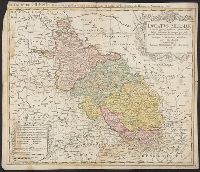
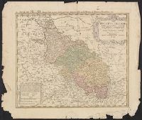
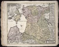
Bar scales in Milliaria Germanica Communia and Milliaria Gallica Communia., Ferro meridian., No. 37 of 69 maps bound together in composite atlas., Relief shown pictorially., and Scale [ca. 1:775 000].
Publisher:
[Frederik de Wit]
Subject (Geographic):
Prussia, east (Poland and Russia) --Maps --Early works to 1800