Appeared in Valk and Schenk's Atlantis sylloge compendiosa, ca. 1702., Backed with paper. Ms. no. "61" in upper right-hand corner. Sheet measures 53.1 x 62.3 cm. No. 56 of 87 maps bound together., Bar scales given in "milliaria Gallica" and "milliaria Germanica.", Prime meridian: Ferro., and Relief shown pictorially.
Publisher:
Ger. et Leo. Valk,
Subject (Geographic):
Orléanais (France)--Maps--Early works to 1800.
Subject (Name):
Schenk, Peter, 1660-1718 or 1719. Atlantis sylloge compendiosa., Valck, G. (Gerard), 1651 or 1652-1726. Atlantis sylloge compendiosa., and Valck, Leonard, 1675-1746.
Britannia prout divisa fuit temporibus Anglo-Saxonum praesertim durante illorum heptarchia.
Description:
Border illustrations include seven Anglo-Saxon kings on the left; the conversion to Christianity of a further seven are depicted on the right., Manuscript number in upper left corner: 7., Relief shown pictorially., and Shows kingdom boundaries, rivers, settlements and shields.
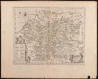
Appeard in Gerard Valck and Peter Schenk's Atlantis sylloge, ca. 1702., Backed with paper. Ms. no. "28" in upper left-hand corner. Sheet measures 53.7 x 63.0 cm. No. 28 of 87 maps bound together., Bar scales given in "milliaria Germanica" and "milliaria Gallica"., Prime meridian: Ferro., Relief shown pictorially., and Watermark.
Publisher:
Edente Gerardô Valck,
Subject (Geographic):
Baden-Württemberg (Germany)--Maps--Early works to 1800.
Subject (Name):
Schenk, Peter, 1660-1718 or 1719. Atlantis sylloge compendiosa. and Valck, G. (Gerard), 1651 or 1652-1726. Atlantis sylloge compendiosa.
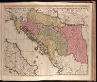
Backed with paper. Ms. no. "77" in upper right corner. Sheet measures 53.6 x 62.5 cm. No. 71 of 87 maps bound together., Bar scales given in "milliaria Hungarica" and "milliaria Germanica.", Covers Croatia, Bosnia and Hercegovina, Serbia, Montenegro and portions of Italy, Albania, Greece, Macedonia and Hungary., In Latin with place names in Italian., and Relief shown pictorially.
Dimidia Tribvs Manasse ultra Jordanem, tribus Neptalim et partes orientales Tribuum Zabvion et Isachar
Description:
Appears in Jansson's historical atlas editions from 1652-1684 and in his Accuratissima orbis antiqui delineatio. From 1653 on, this work is known under the name of Hornius, who wrote the text and compiled all the maps for the atlases--(Koeman-Krogt. 1:601-1:607)., Coordinates not present on map and are approximated., Inset: Peregrinatio Abrahae., Map indexed with grid lines and alphabet letters P-R at top., Oriented with north toward the left., Printed on one and a half sheets., Relief shown pictorially., and Watermark. Manuscript numbers in upper left and right corners: 46. No. 4 of 6 maps housed together.
Publisher:
[Jan Jansson],
Subject (Geographic):
Palestine--History--To 70 A.D.--Maps--Early works to 1800. and Palestine--Maps--Early works to 1800.
"Cum privilegio Amsteld. et Regis Poloniae .", Backed with paper. Ms. no. "3" in upper right-hand corner. Sheet measures 53.4 x 62.0 cm. No. 2 of 87 maps bound together., Includes two insets showing the path of the solar eclipse of May 12, 1706., Prime meridian: Ferro., and Relief shown pictorially.
Publisher:
Á Petro Schenk,
Subject (Geographic):
Europe--Maps--Early works to 1800.
Subject (Name):
Moolen, Simon van de. and Schenk, Peter, 1660-1718 or 1719.
Keere, Pieter van den, 1571-approximately 1646, cartographer.
Published / Created:
[between 1652 and 1684]
Call Number:
BrSides Double Folio 2019 103
Image Count:
1
Resource Type:
Maps, Atlases & Globes
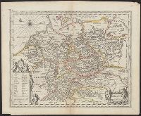
Description:
Appears in Jansson's historical atlas editions from 1652-1684., Manuscript number in upper left corner: 13., and Relief shown pictorially.
Publisher:
Apud Joannem Janssonium,
Subject (Geographic):
Benelux countries--Historical geography--Maps--Early works to 1800., Benelux countries--Maps--Early works to 1800., Europe, Central--Historical geography--Maps--Early works to 1800., and Europe, Central--Maps--Early works to 1
Subject (Name):
Jansson, Jan, 1588-1664, publisher.
Subject (Topic):
Ethnology--Europe--Maps--Early works to 1800. and Germanic peoples--Maps--Early works to 1800.
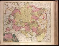
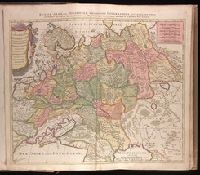
Appears in Jansson's historical atlas editions from 1652-1684., Hand colored., and Relief shown pictorially.
Publisher:
Apud Joannem Janssonium,
Subject (Geographic):
Benelux countries--Historical geography--Maps--Early works to 1800., Benelux countries--Maps--Early works to 1800., Europe, Central--Historical geography--Maps--Early works to 1800., Europe, Central--Maps--Early works to 1800., Europe, Eastern--Historical geography--Maps--Early works to 1800., Europe, Eastern--Maps--Early works to 1800., Germany--Historical geography--Maps--Early works to 1800., and Germany--Maps--Early works to 1800.
Subject (Name):
Jansson, Jan, 1588-1664
Subject (Topic):
Ethnology--Europe--Maps--Early works to 1800. and Germanic peoples--Maps--Early works to 1800.
Russiae, Albae, sive Moscoviae delineatio geographica accurata et nova
Description:
Appeared in Peter Schenk's Atlas contractus [ca. 1700]., BEIN 1973 Folio 18: Backed with paper. Ms. no. "4" in upper right-hand corner. Sheet measures 53.4 x 62.0 cm. No. 3 of 87 maps bound together., Includes six bar scales., Prime meridian: Ferro., and Relief shown pictorially.
Publisher:
Studio et labore Petr. Schenck,
Subject (Geographic):
Europe, Eastern--Maps--Early works to 1800. and Russia--Maps--Early works to 1800.
Subject (Name):
Schenk, Peter, 1660-1718 or 1719. Atlas contractus.
Bookplate: From the collection of Laura K. and Valerian Lada-Mocarski., From Joan Blaeu's Grooten atlas, Dutch edition, 1664., In Dutch on verso, paginated 5a, with signature D, and caption titles "Nova Zembla.", Verso includes hand colored engraving (17 x 22 cm) by Hessel Gerritsz with letterpress title: Afbeelding van een Walrus, met een sijner jongen., and Watermark.
Publisher:
[Joan Blaeu],
Subject (Geographic):
Novai͡a Zemli͡a (Russia)--Maps--Early works to 1800.
Subject (Name):
Blaeu, Joan, 1596-1673. Grooten atlas., Gerritsz., Hessel, approximately 1581-1632., Lada-Mocarski, Laura K.--(Laura Klots),--1902-1997--Bookplate., and Lada-Mocarski, Valerian,--1898-1971--Bookplate.