Skip to search
Skip to main content
Skip to first result
Search
You Searched For
Language
French
New Search
Search Results
Published / Created:
[1713?]
Call Number:
37 1713
Image Count:
1
Resource Type:
Maps, Atlases & Globes
Subject (Geographic):
Switzerland--Maps--Early works to 1800
Found in:
Beinecke Rare Book and Manuscript Library > Carte de Suisse ... Dressée sur les memoires de Mr. Merveilleux ... Par Guillaume del I'sle ...
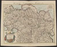
Published / Created:
[1745?]
Call Number:
35 1745
Container / Volume:
BRBL_00100
Image Count:
1
Resource Type:
Maps, Atlases & Globes
Description:
Title at the top of the map: Magnae Tartariae Tabula.
Publisher:
Chez I. Còvens et C. Mortier,
Subject (Geographic):
Russia--Maps--Early works to 1800
Found in:
Beinecke Rare Book and Manuscript Library > Carte de Tartarie ... Par Guillaume De l'Isle.
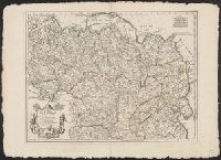
Creator:
Call Number:
54 1706
Container / Volume:
BRBL_00290
Image Count:
1
Resource Type:
Maps, Atlases & Globes
Description:
In title cartouche: "A Paris chez l'auteur sur le Quai de l'Horloge a l'Aigle d'Or avec priv, Lower left of title cartouche: erased text., and Verso: stamped "Yale UL", "Yale University Library Karpinski-von Wieser Map Collection"; annotation in ink manuscript.
Subject (Geographic):
Russia--Maps--Early works to 1800
Subject (Name):
Desrosiers. engraver
Found in:
Beinecke Rare Book and Manuscript Library > Carte de Tartarie : dressée sur les relations de plusieurs voyageurs de differentes nations et sur quelques observations qui ont été faites dans ce païs la / par Guillaume Del'Isle premier geog. du Roy de l'Academie Royale des Sciences.
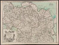
Published / Created:
1706
Call Number:
35 1706
Container / Volume:
BRBL_00722
Image Count:
1
Resource Type:
Maps, Atlases & Globes
Publisher:
Chez l'auteur ... ,
Subject (Geographic):
Russia--Maps--Early works to 1800
Found in:
Beinecke Rare Book and Manuscript Library > Carte de Tartarie, dressée sur les relations de plursieurs voyageurs ... / par Guillaume del'Isle ... ; N. Guerard inues. fecit ; des Rosiers sc.
Creator:
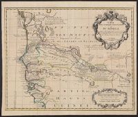
Published / Created:
[1730?]
Call Number:
655 1730
Container / Volume:
BRBL_00345
Image Count:
1
Resource Type:
Maps, Atlases & Globes
Description:
Covers portion of western Africa from Mauritania to Guinea., Includes text and ornamental cartouche., Prime meridian: Ferro., Relief shown pictorially., and Verso: stamped "Map Collection Yale Univ. Library" and numbered "46" in ink in upper right corner.
Publisher:
Chez Jean Ćovens et Corneille Mortier,
Subject (Geographic):
Africa, West--Maps--Early works to 1800
Subject (Name):
Ćovens et Mortier
Found in:
Beinecke Rare Book and Manuscript Library > Carte de l'Afrique françoise ou du Senegal : dresśee sur un grand nombre de cartes manuscrites et d'itineraires rectifíes par diverses observations / par G. de l'Isle ...
Creator:
Published / Created:
1811
Call Number:
64 1811
Container / Volume:
BRBL_00338
Image Count:
1
Resource Type:
Maps, Atlases & Globes
Description:
Pg. no. on verso: 41.
Subject (Geographic):
Africa, Southern--Maps
Found in:
Beinecke Rare Book and Manuscript Library > Carte de l'Afrique méridionale / par Fx. Delamarche fils, 1811.
Creator:
Published / Created:
1935
Call Number:
62 1935D
Container / Volume:
BRBL_00333
Image Count:
1
Resource Type:
Maps, Atlases & Globes
Alternative Title:
Illustration (Paris, France)
Description:
"Supplément au numéro de L'Illustration du 2 novembre 1935.", Includes inset map of Africa., and Relief shown by gradient tints and spot heights.
Publisher:
L'Illustration,
Subject (Geographic):
Ethiopia--Maps and Somalia--Maps
Found in:
Beinecke Rare Book and Manuscript Library > Carte de l'Afrique orientale [cartographic material] : (Erythrée, Côte Française des Somalis, Somalie Britannique, Somalie Italienne, Kenya, Ouganda, Soudan Anglo-Egyptien) / dressée et dessinée par le Commandant P. Pollachi.
Published / Created:
1811
Call Number:
60 1811A
Container / Volume:
BRBL_00325
Image Count:
1
Resource Type:
Maps, Atlases & Globes
Description:
No. on verso: 40.
Subject (Geographic):
Africa--Maps
Found in:
Beinecke Rare Book and Manuscript Library > Carte de l'Afrique septentrionale / par Fx. Delamarche fils.
Creator:
Published / Created:
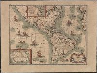
1624]
Call Number:
70 1624
Container / Volume:
BRBL_00353
Image Count:
1
Resource Type:
Maps, Atlases & Globes
Alternative Title:
Carte de l'Ameriqve, L'Amerique [cartographic material], and L'Ameriqve [cartographic material]
Description:
Includes ill., text, and insets of Greenland area and Antarctica., Mounted on linen. Stamp on verso: Karpinski-von Wieser Map Collection., Relief shown pictorially., and State 1 according to Burden.
Publisher:
P. Bertius,
Subject (Geographic):
America--Maps--Early works to 1800 and Western Hemisphere--Maps--Early works to 1800
Found in:
Beinecke Rare Book and Manuscript Library > Carte de l'Amerique : corrigée et augmentée, dessus toutes les aultres cy deuant / faictes par P. Bertius, 1624.
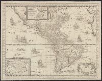
Published / Created:
1671]
Call Number:
70 1671
Container / Volume:
BRBL_00354
Image Count:
1
Resource Type:
Maps, Atlases & Globes
Description:
Has watermark., Includes text in margins, insets of Greenland region and "Terre Antarctique incognue," and ill., Library's copy stamped on backing: Yale University Library, Karpinski-Von Wieser Map Collection., and Relief shown pictorially.
Publisher:
s.n.,
Subject (Geographic):
America--Maps--Early works to 1800
Found in:
Beinecke Rare Book and Manuscript Library > Carte de l'Amerique : corrigée et augmentée, dessus toutes les aultres cy deuant, 1671.
Branch:v1.61.6 ,Deployed:2024-06-12T09:55:19-04:00