Skip to search
Skip to main content
Skip to first result
Search
You Searched For
Language
Latin
Creator
L'Isle, Guillaume de, 1675-1726
New Search
Search Results
Creator:
Published / Created:
1712
Call Number:
400 1712
Container / Volume:
BRBL_00232
Image Count:
1
Resource Type:
Maps, Atlases & Globes
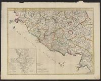
Description:
"Cum priveilegio.", Inset: Urbs septicollis., and Relief shown pictorially.
Publisher:
Sold by John Senex at the Globe against St. Dunstan's Church in Fleetstreet ...,
Subject (Geographic):
Italy, Central--Historical geography--Maps--Early works to 1800 and Rome (Italy)--Historical geography--Maps--Early works to 1800
Found in:
Beinecke Rare Book and Manuscript Library > Regionum Italiae mediarum tabula geographica : pernoscendis historiae Romanae primordiis praesertium utilis, sed et cui multa sequioris aevi addita / auctore G. DelIisle, e Regiâ Scientiarum Academiae socio.
Creator:
Published / Created:
Apr. 1711.
Call Number:
400 1711
Container / Volume:
BRBL_00232
Image Count:
1
Resource Type:
Maps, Atlases & Globes
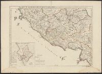
Description:
"Cum priveilegio.", Has watermarks., Inset: Urbs septicollis., and Relief shown pictorially.
Publisher:
Apud Auctorem ... [sur] le Quai de l'Horloge,
Subject (Geographic):
Italy, Central--Historical geography--Maps--Early works to 1800 and Rome (Italy)--Historical geography--Maps--Early works to 1800
Subject (Name):
Desrosiers
Found in:
Beinecke Rare Book and Manuscript Library > Regionum Italiae mediarum tabula geographica : pernoscendis historiae Romanae primordiis praesertium utilis, sed et cui multa sequioris aevi addita / autore G. DelIisle, Regiae Scientiarum Academiae socio ; Dereosier sculp.
Creator:
Published / Created:
1741
Call Number:
1975 Folio 31
Collection Title:
[Atlas factice of 42 maps, produced by the Homann Erben firm]
Image Count:
1
Alternative Title:
Carte de France dressee par Guillaume de L’Isle et accommodee par les Heritiers d’Homann
Publisher:
Homann Erben
Subject (Geographic):
France --Maps --Early works to 1800
Subject (Topic):
Atlases, German --Early works to 1800
Collection Created:
[Nuremberg,
Found in:
Beinecke Rare Book and Manuscript Library > Regni Galliae seu Franciae et Navarrae [cartographic material] : tabula geographica in usum elementorum geographiae schazianorum accom[m]odata / per Homannianos Heredes
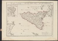
Creator:
Published / Created:
Dec. 1714.
Call Number:
408 1714
Container / Volume:
BRBL_00238
Image Count:
1
Resource Type:
Maps, Atlases & Globes
Alternative Title:
Veterum Syracusarum typus.
Description:
Inset: Veterum Syracusarum typus., Relief shown pictorially., Shows Malta and parts of Italy and Tunisia., and Watermarks include Maltese cross in rosary.
Publisher:
Apud auctorem in Ripa Sequanae, vulgo dicta le Quay de lHorologe,
Subject (Geographic):
Sicily (Italy)--Historical geography--Maps--Early works to 1800 and Syracuse (Italy)--Historical geography--Maps--Early works to 1800
Found in:
Beinecke Rare Book and Manuscript Library > Siciliae antiquae quae et Sicania et Trinacria dicta, tabula geographica / auctore Guillelmo DelIsle è Regia scientarum Academiâ.
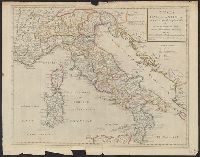
Creator:
Published / Created:
[between 1715 and 1720?]
Call Number:
400 1715A
Container / Volume:
BRBL_00232
Image Count:
1
Resource Type:
Maps, Atlases & Globes
Description:
Relief shown pictorially.
Publisher:
Sold by I. Senex at the globe over against St. Dunstan's Church in Fleetstreet ... ,
Subject (Geographic):
Italy--Historical geography--Maps--Early works to 1800, Italy--History--To 476--Maps--Early works to 1800, and Rome--Maps--Early works to 1800
Subject (Name):
Senex, John, d. 1740
Found in:
Beinecke Rare Book and Manuscript Library > Tabula Italiae antiquae in regiones XI ad Augusto divisiae et tum ad mensuras itineraris tum ad observationes astronomicas exactae / accurante Guillelmo Del'isle ... ; Joan. Bap. Liébaux sculpsit.
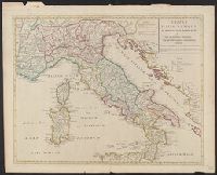
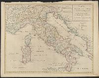
Creator:
Published / Created:
1715
Call Number:
400 1715
Container / Volume:
BRBL_00232
Image Count:
1
Resource Type:
Maps, Atlases & Globes
Description:
"Cum privilegio Regis.", Has watermarks., and Relief shown pictorially.
Publisher:
Apud auctorem in Ripa vulgò dicta le Quay de l'Horloge,
Subject (Geographic):
Italy--Historical geography--Maps--Early works to 1800, Italy--History--To 476--Maps--Early works to 1800, and Rome--Maps--Early works to 1800
Subject (Name):
Liébaux, Jean Baptiste
Found in:
Beinecke Rare Book and Manuscript Library > Tabula Italiae antiquae in regiones XI ad Augusto divisiae et tum ad mensuras itineraris tum ad observationes astronomicas exactae / accurante Guillelmo Del'isle ... ; Joan. Bap. Liébaux sculpsit.
Branch:v1.61.6 ,Deployed:2024-06-12T09:55:37-04:00