Search
You Searched For
Search Results
- Call Number:
- 771 W528 1867
- Container / Volume:
- BRBL_00492
- Image Count:
- 1
- Resource Type:
- Maps, Atlases & Globes
- Found in:
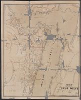
- Beinecke Rare Book and Manuscript Library > Map of West Point.
- Creator:
- Colton, G. Woolworth (George Woolworth), 1827-1901
- Call Number:
- 771 1869C
- Container / Volume:
- BRBL_00479
- Image Count:
- 1
- Resource Type:
- Maps, Atlases & Globes
- Found in:
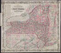
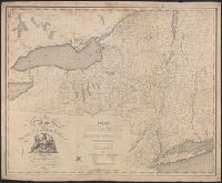
- Beinecke Rare Book and Manuscript Library > Colton's railroad & township map of the state of New York : with parts of the adjoining states & Canada / drawn by Geo. W. Colton ; J.M. Atwood, sculpt.
- Published / Created:
- [n.d.]
- Call Number:
- WC 13991
- Image Count:
- 54
- Found in:
- Beinecke Rare Book and Manuscript Library > Sad tale of the courtship of Chevalier Slyfox-Wikof, showing his heart-rending, astounding & most wonderful love adventures with Fanny Elssler and Miss Gambol. With near 200 comic engravings.
- Published / Created:
- 1795
- Call Number:
- 802 1795B
- Container / Volume:
- BRBL_00542
- Image Count:
- 1
- Resource Type:
- Maps, Atlases & Globes
- Found in:
- Beinecke Rare Book and Manuscript Library > Map of the State of Kentucky; with the Adjointing Territories.
- Published / Created:
- 1795
- Call Number:
- 777 1795A
- Container / Volume:
- BRBL_00503
- Image Count:
- 1
- Resource Type:
- Maps, Atlases & Globes
- Found in:
- Beinecke Rare Book and Manuscript Library > The States of Maryland and Delaware from the latest Surveys.
- Published / Created:
- 1796
- Call Number:
- 90 1796
- Container / Volume:
- BRBL_00661
- Image Count:
- 1
- Resource Type:
- Maps, Atlases & Globes
- Found in:
- Beinecke Rare Book and Manuscript Library > A General Map Of South America. from the Best Surveys.
- Published / Created:
- 1796
- Call Number:
- 783 1796A
- Container / Volume:
- BRBL_00507
- Image Count:
- 1
- Resource Type:
- Maps, Atlases & Globes
- Found in:
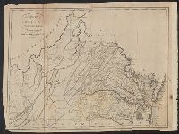
- Beinecke Rare Book and Manuscript Library > The State of Virginia from the best Authorities.
- Published / Created:
- [1796?]
- Call Number:
- 763 1796B
- Container / Volume:
- BRBL_00452
- Image Count:
- 1
- Resource Type:
- Maps, Atlases & Globes
- Found in:
- Beinecke Rare Book and Manuscript Library > Vermont from the latest Authorities.
- Published / Created:
- 1796
- Call Number:
- 762 1796A
- Container / Volume:
- BRBL_00450
- Image Count:
- 1
- Resource Type:
- Maps, Atlases & Globes
- Found in:
- Beinecke Rare Book and Manuscript Library > The State of New Hampshire, Compiled chiefly from Actual Surveys.
- Creator:
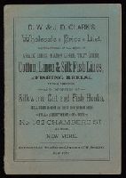
- D.W. & J.D. Clark (Firm)
- Published / Created:
- [18--?]
- Call Number:
- 1984 80
- Image Count:
- 14
- Found in:
- Beinecke Rare Book and Manuscript Library > D.W. & J.D. Clark's wholesale price list : manufacturers of all kinds of cotton, linen & silk fish lines, chark lines, mason lines, trot lines, fishing reels of every description, and importers of silkworm, cut and fish hooks ...
- Published / Created:
- 1804
- Call Number:
- 773 J487 1804
- Container / Volume:
- BRBL_00496
- Image Count:
- 1
- Resource Type:
- Maps, Atlases & Globes
- Found in:
- Beinecke Rare Book and Manuscript Library > A map of that part of the town of Jersey, commonly called Powles Hook / surveyed by Joseph F. Mangin.
- Published / Created:
- [1804?]
- Call Number:
- 771 1804
- Container / Volume:
- BRBL_00477
- Image Count:
- 1
- Resource Type:
- Maps, Atlases & Globes
- Found in:
- Beinecke Rare Book and Manuscript Library > Map of the State of New York by Simeon DeWitt, Surveyor General ...
- Published / Created:
- 1815
- Call Number:
- 771 1815
- Container / Volume:
- BRBL_00478
- Image Count:
- 1
- Resource Type:
- Maps, Atlases & Globes
- Found in:
- Beinecke Rare Book and Manuscript Library > Map of the Southern part of the State of New York including Long Island, the Sound, the State of Connecticut part of the State of New Jersey and Island's adjacent. Compiled from actual surveys.
- Creator:
- Tanesse, I
- Published / Created:
- 1817
- Call Number:
- 795 N47 1817
- Container / Volume:
- BRBL_00522
- Image Count:
- 1
- Resource Type:
- Maps, Atlases & Globes
- Found in:
- Beinecke Rare Book and Manuscript Library > Plan of the city and suburbs of New Orleans : from an actual survey made in 1815 / by I. Tanesse ; Rollinson, sc.
- Published / Created:
- 1823
- Call Number:
- 85 1492
- Container / Volume:
- BRBL_00636
- Image Count:
- 1
- Resource Type:
- Maps, Atlases & Globes
- Found in:
- Beinecke Rare Book and Manuscript Library > Map of The Route of Colombus on arriving among the Bahama Islands. Plan by D.G. Johnson
- Published / Created:
- 1823
- Call Number:
- 85 1492
- Container / Volume:
- BRBL_00636
- Image Count:
- 1
- Resource Type:
- Maps, Atlases & Globes
- Found in:
- Beinecke Rare Book and Manuscript Library > Map of The Route of Colombus on arriving among the Bahama Islands. Plan by D.G. Johnson
- Published / Created:
- 1823
- Call Number:
- 792cea 1823
- Container / Volume:
- BRBL_00519
- Image Count:
- 1
- Resource Type:
- Maps, Atlases & Globes
- Found in:
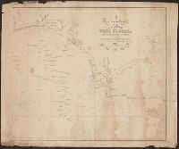
- Beinecke Rare Book and Manuscript Library > A particular Chart of the coasts of West Florida Louisiana Mississippi & Alabama ...
- Published / Created:
- 1825
- Call Number:
- 23cea 1825
- Container / Volume:
- BRBL_00021
- Image Count:
- 2
- Resource Type:
- Maps, Atlases & Globes
- Found in:
- Beinecke Rare Book and Manuscript Library > A Chart of the West Coast of America ... from the latest Spanish surveys. Engraved by J.M. Taylor, NY.
- Published / Created:
- 1825
- Call Number:
- 21cea 1825
- Container / Volume:
- BRBL_00016
- Image Count:
- 1
- Resource Type:
- Maps, Atlases & Globes
- Found in:
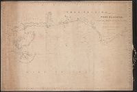
- Beinecke Rare Book and Manuscript Library > The Coasts of West Florida, Alabama, Mississippi & Louisiana ...
- Published / Created:
- 1826
- Call Number:
- 75 1826B
- Container / Volume:
- BRBL_00398
- Image Count:
- 1
- Resource Type:
- Maps, Atlases & Globes
- Found in:
- Beinecke Rare Book and Manuscript Library > Map of the United States : drawn from the most approved surveys.
- Creator:
- Hooker, William, 1782-1856
- Call Number:
- 771 N49 1828
- Container / Volume:
- BRBL_00485
- Image Count:
- 1
- Resource Type:
- Maps, Atlases & Globes
- Found in:
- Beinecke Rare Book and Manuscript Library > Hooker's new pocket plan of the city of New York / compiled & surveyed by William Hooker, A.C.S.A., hydrographer & engraver.
- Published / Created:
- 1829
- Call Number:
- 771 W25 1829
- Container / Volume:
- BRBL_00492
- Image Count:
- 1
- Resource Type:
- Maps, Atlases & Globes
- Found in:
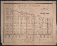
- Beinecke Rare Book and Manuscript Library > Map of the county of Warren [NY].
- Published / Created:
- 1829
- Call Number:
- 771 Sa71 1829
- Container / Volume:
- BRBL_00491
- Image Count:
- 1
- Resource Type:
- Maps, Atlases & Globes
- Found in:
- Beinecke Rare Book and Manuscript Library > Map of the County of Saratoga [NY].
- Published / Created:
- 1829
- Call Number:
- 771 OT7 1829A
- Container / Volume:
- BRBL_00490
- Image Count:
- 1
- Resource Type:
- Maps, Atlases & Globes
- Found in:
- Beinecke Rare Book and Manuscript Library > Map of the County of Otsego. By David H. Burr. Published by the Surveyor General pursuant to an act of the Legislature.
- Published / Created:
- 1829
- Call Number:
- 771 OT7 1829
- Container / Volume:
- BRBL_00490
- Image Count:
- 1
- Resource Type:
- Maps, Atlases & Globes
- Found in:
- Beinecke Rare Book and Manuscript Library > Map of the County of Otsego [N.Y.].
- Published / Created:
- 1829
- Call Number:
- 771 OS9 1829
- Container / Volume:
- BRBL_00490
- Image Count:
- 1
- Resource Type:
- Maps, Atlases & Globes
- Found in:
- Beinecke Rare Book and Manuscript Library > Map of the County of Oswego [N.Y.].
- Published / Created:
- 1829
- Call Number:
- 771 ON6 1829
- Container / Volume:
- BRBL_00490
- Image Count:
- 1
- Resource Type:
- Maps, Atlases & Globes
- Found in:
- Beinecke Rare Book and Manuscript Library > Map of the County of Onondaga [N.Y.]
- Published / Created:
- 1829
- Call Number:
- 771 On2 1829
- Image Count:
- 1
- Resource Type:
- Maps, Atlases & Globes
- Found in:
- Beinecke Rare Book and Manuscript Library > Map of the County of Oneida [N.Y.].
- Creator:
- Poppleton, Thomas H.
- Call Number:
- 771 N49 1829
- Container / Volume:
- BRBL_00485
- Image Count:
- 1
- Resource Type:
- Maps, Atlases & Globes
- Found in:
- Beinecke Rare Book and Manuscript Library > Plan of the city of New-York : the greater part from actual survey made expressly for the purpose (the rest from authentic documents) / by Thos. H. Poppleton, city surveyor ; revised & corrected by Wm. Hooker ; P. Maverick sc. Newark.
- Published / Created:
- 1829
- Call Number:
- 771 M766 1829
- Container / Volume:
- BRBL_00483
- Image Count:
- 1
- Resource Type:
- Maps, Atlases & Globes
- Found in:
- Beinecke Rare Book and Manuscript Library > Map of the County of Montgomery [N.Y.]