[Atlas nouveau contenant toutes les parties du monde ou sont exactement marques les empires
Image Count:
1
Resource Type:
Maps, Atlases & Globes
Abstract:
Factitious collection of about 549 maps taken from the atlases of the 17th and the beginning of the 18th century, put together with the title "Atlas" and bound in 6 volumes. These volumes originally bore the imprint: Amstelaedamii apvd Reiniervm & Josvam Ottens. Over these words on the title pages of volumes 1-2 and 4-6 is the name of Henrik de Leth who painted them.
Description:
Verso blank.
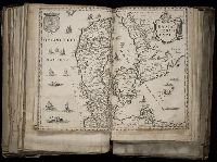
Subject (Geographic):
British Isles --Maps --Early works to 1800
Subject (Name):
Leth, Hendrik de, 1703-1766, Reiner et Josua Ottens (Firm), Schenck, Peter, 1661-1715, Schenck, Peter, ca. 1698-1752, Valck, G. (Gerard), 1651 or 2-1726, and Wit, Frederik de
Subject (Topic):
Atlases --Early works to 1800
Collection Created:
[A Amsterdam, chez J. Covens & C. Mortier, ca. 1730-ca. 1800]
[Atlas factice of 96 maps by Blaeu, Visscher, Jansson, Hondius and others]
Image Count:
2
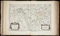
Description:
Imperfect: lower left corner [imprint] cut-out and replaced with ms. ill.; edges reinforced with ms waste. Sheet measures 38.5 x 48.9 cm. No. 67 of 92 maps bound together. and Numbered 72 on verso.
Broeck, Crispin van den, 1524-ca. 1591 Visscher, Nicolaes, 1618-1679
Published / Created:
[ca. 1660]
Call Number:
1983 Folio 19
Collection Title:
[Atlas factice of 96 maps by Blaeu, Visscher, Jansson, Hondius and others]
Image Count:
2
Alternative Title:
Armenia Maior and Asia et Armenia Minor
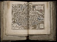
Description:
Imperfect: illustrations at top cut-out and replaced with ms. titles "Asia et Armenia minor" (upper left) and "Armenia minor" (in upper right); torn along fold and at left edge, with some loss of text. Sheet measures 32 x 47.8 cm. Reinforced along edges with printed waste. No. 85 of 92 maps bound together. and Numbered 91 on verso.
Publisher:
[Nicolaes Visscher]
Subject (Geographic):
Armenia --Maps --Early works to 1800, Assyria --Maps, Egypt --Maps --Early works to 1800, Middle east --Maps --Early works to 1800, Palestine --Geography --Maps --Early works to 1800, Saudi Arabia --Maps, Syria --Maps, and Turkey --Maps
[Atlas factice of 96 maps by Blaeu, Visscher, Jansson, Hondius and others]
Image Count:
2
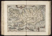
Description:
A set of 9 maps (no. IIII-XII) are from the Stumpf-Chronik., Hand col. Sheet measures 38.8 x 50 cm. Ms. notes in 19th century hand at bottom. Reinforced along edges with manuscript waste. No. 45 of 92 maps bound together., and Numbered 49 on verso.
Publisher:
[Christoffel Froschauer]
Subject (Geographic):
Germany, Southern --Maps --Early works to 1800 and Switzerland --Maps --Early works to 1800