Appears in Justus Danckerts's first two Atlas editions; see Koeman, C. Atlantes Neerlandici, vol. III, Dan 1, Dan 2., Backed with paper. Ms. no. "59" in upper right-hand corner. Sheet measures 53.8 x 62.8 cm. No. 54 of 87 maps bound together., Bar scales given in "milliaria Germanica communia" and "milliaria Gallica communia"., Prime meridian: Ferro., and Relief shown pictorially.
Publisher:
Theodore Danckerts,
Subject (Geographic):
Alsace (France)--Maps--Early works to 1800., Baden-Württemberg (Germany)--Maps--Early works to 1800., Lorraine (France)--Maps--Early works to 1800., and Saarland (Germany)--Maps--Early works to 1800.
Appears in various editions of Jansson's Atlas novus., Inset: Iudaeae amplior descriptio., Relief shown pictorially., Sheet measures 50 x 61.5 cm., and Title in decorative cartouche.
Publisher:
Jan Jansson,
Subject (Geographic):
Middle East--Maps--Early works to 1800 and Palestine--Maps--Early works to 1800
Subject (Name):
Jansson, Jan, 1588-1664. Atlas novus and Keere, Pieter van den, 1571-ca. 1646
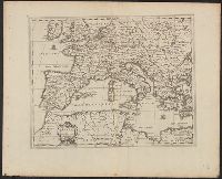
Backed with paper. Ms. no. in upper right corner: 21. Sheet measures 53.7 x 62.5 cm. No. 21 of 87 maps bound together., Bar scale given in "milliaria Germanica"., Dedication cartouche with blank text panel and blank shield., and Prime meridian: Ferro.
Publisher:
Joan Blaeu,
Subject (Geographic):
Saxony-Anhalt (Germany)--Maps--Early works to 1800.
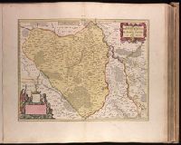
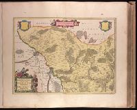
Backed with paper. Ms. no. in upper right corner: 18. Sheet measures 53.6 x 62.9 cm. No. 18 of 87 maps bound together., Bar scale given in "milliaria Germanica"., Prime meridian: Ferro., and With two blank shields.
Publisher:
Joan Blaeu,
Subject (Geographic):
Brandenburg (Germany : Landkreis)--Maps--Early works to 1800.
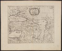
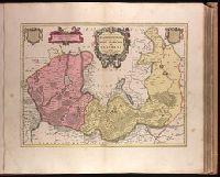
Bar scale given in "milliaria Germanica"., BEIN 1973 Folio 18: Backed with paper. Ms. no. in upper right corner: 20. Sheet measures 53.7 x 62.8 cm. No. 20 of 87 maps bound together., Prime meridian: Ferro., Relief shown pictorially., Watermark., and With two blank shields.
Publisher:
Joan Blaeu,
Subject (Geographic):
Brandenburg (Germany : Landkreis)--Maps--Early works to 1800. and Województwo Zachodniopomorskie (Poland)--Maps--Early works to 1800.
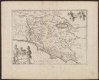
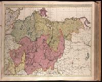
Appears in Valk and Schenk's Atlantis sylloge compendiosa, ca. 1702., Bar scales given in "milliaria Germanica communia" and "milliaria Gallica communia"., Imperfect: slight stains on verso and recto, with no loss of text. Backed with paper. Ms. no. in upper right corner: 23. Sheet measures 53.7 x 62.8 cm. No. 23 of 87 maps bound together., Prime meridian: Ferro., and Relief shown pictorially.
Publisher:
Gerard Valck,
Subject (Geographic):
Pomerania (Poland and Germany)--Maps--Early works to 1800.
Subject (Name):
Schenk, Peter, 1660-1718 or 1719. Atlantis sylloge compendiosa., Valck, G. (Gerard), 1651 or 1652-1726. Atlantis sylloge compendiosa., and Valck, Leonard, 1675-1746.