Search
You Searched For
Search Results
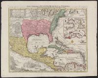
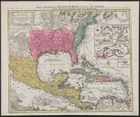
- Creator:
- Lotter, Tobias Conrad, 1717-1777, cartographer
- Published / Created:
- [between 1741 and 1760]
- Call Number:
- 85 1740D
- Image Count:
- 1
- Resource Type:
- cartographic image
- Found in:
- Beinecke Rare Book and Manuscript Library > Mappa geographica regionem Mexicanam et Floridam terrasque adjacentes, ut et anteriores Americae insulas, cursus itidem et reditus navigantium versus flumen Missisipi et alias colonias ob oculos ponens / [cartographic material]
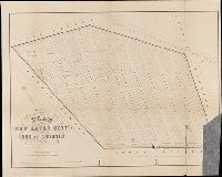
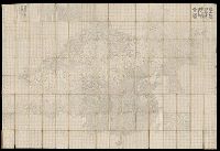
- Creator:
- Searl, S. W., cartographer
- Published / Created:
- [1863]
- Call Number:
- BrSides Folio 2014 10
- Image Count:
- 2
- Resource Type:
- cartographic image
- Found in:
- Beinecke Rare Book and Manuscript Library > Plan of the New Haven City burial ground
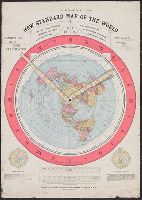
- Published / Created:
- 1892.
- Call Number:
- 11 1892
- Image Count:
- 2
- Resource Type:
- cartographic image
- Found in:
- Beinecke Rare Book and Manuscript Library > Gleason's new standard map of the world : on the projection of J.S. Christopher, Modern College, Blackheath, England ; scientifically and practically correct ; as "it is."
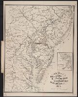
- Creator:
- J.L. Smith Co., cartographer, publisher
- Published / Created:
- 1874.
- Call Number:
- 754gme 1874
- Image Count:
- 1
- Resource Type:
- cartographic image
- Found in:
- Beinecke Rare Book and Manuscript Library > Map of the Baltimore, Chesapeake & Delaware Bay Railroad
- Creator:
- Lotter, Tobias Conrad, 1717-1777, cartographer
- Published / Created:
- [between 1741 and 1760]
- Call Number:
- 71 1737A
- Image Count:
- 1
- Resource Type:
- cartographic image
- Found in:
- Beinecke Rare Book and Manuscript Library > Mappa geographica regionem Mexicanam et Floridam terrasque adjacentes, ut et anteriores Americae insulas, cursus itidem et reditus navigantium versus flumen Missisipi et alias colonias ob oculos ponens / [cartographic material]
- Creator:
- Dong, Fangli, active 19th century, cartographer
董方立, active 19th century, cartographer
- Published / Created:
- Daoguang 12 [1842]
- Call Number:
- Covers 56 +1842
- Image Count:
- 1
- Resource Type:
- cartographic image
- Found in:
- Beinecke Rare Book and Manuscript Library > Huang chao yi tong yu di quan tu, 皇朝壹統輿地全圖
- Creator:
- Volčić, Vicko Dimitrije, 1563-1607, cartographer
- Published / Created:
- [1601]
- Call Number:
- Manuscript 49cea 1601
- Image Count:
- 2
- Resource Type:
- cartographic image
- Found in:
- Beinecke Rare Book and Manuscript Library > [Portolan chart of the Mediterranean Sea].
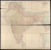
- Creator:
- Walker, John, 1786-1873, cartographer
- Published / Created:
- 1882.
- Call Number:
- Covers 59 +1882
- Image Count:
- 2
- Resource Type:
- cartographic image
- Found in:
- Beinecke Rare Book and Manuscript Library > Map of India : shewing the British territories, subdivided into collectorates and including British Burmah, with the position and boundary of each native state
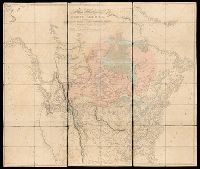
- Creator:
- Arrowsmith, Aaron, 1750-1823, cartographer
- Published / Created:
- [1820]
- Call Number:
- 71 1820B
- Image Count:
- 1
- Resource Type:
- cartographic image
- Found in:
- Beinecke Rare Book and Manuscript Library > A map exhibiting all the new discoveries in the interior parts of North America : inscribed by permission to the honorable governor and company of adventurers of England trading into Hudsons Bay, in testimony of their liberal communications to their most obedient and very humble servant, A. Arrowsmith, Hydrographer to His Majesty
- Creator:
- Mitchell, Donald Grant, 1822-1908, cartographer
- Published / Created:
- [1870?]
- Call Number:
- Manuscript 766 N46 1870F
- Image Count:
- 1
- Resource Type:
- cartographic image
- Found in:
- Beinecke Rare Book and Manuscript Library > Map of Horse Railroad, Westville, & part of New Haven : enlarged four-fold from the county survey