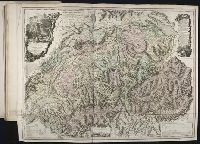
No. 13 of 69 maps bound together in composite atlas., Oriented with north towards upper left., Relief shown pictorially., Scale not given., and Title in Latin; place names in French.
[Atlas factice of 32 maps and 1 distance table, produced by the Homann Erben firm]
Image Count:
2
Alternative Title:
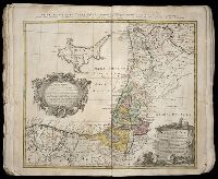
Carte des etats de la Covronne de Pologne
Publisher:
Luci publicae tradita per Homannianos Heredes
Subject (Geographic):
Belarus --Maps --Early works to 1800, Lithuania --Maps --Early works to 1800, Poland --Maps --Early works to 1800, and Ukraine --Maps --Early works to 1800
Also appeared in Faden's [General atlas. London : William Faden, 1811?]., Includes "Vue de la Vallee de Chamouny et des glaciers du Cote du Midi, prise de l'eglise de Chamouny en 1742," "Section des principales montagnes a l'est-sud-est, et au Sud de Geneve telles qu'on les voit de la plaine de cette ville," descriptive text, illustrated cartouches., No. 19 of 43 maps bound together in composite atlas., Prime meridian: Ferro., Relief shown pictorially., and Scale [ca. 1:404,000].
Hase, Johann Matthias, 1684-1742 Homann Erben (Firm) Lowitz, G. M. (George Moritz), 1722-1774
Published / Created:
1746
Call Number:
1975 Folio 31
Collection Title:
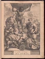
[Atlas factice of 42 maps, produced by the Homann Erben firm]
Image Count:
1
Alternative Title:
Mappe-monde qui represente les deux hemispheres savoir celui de l’orient et celui de l’occident, tiree des quatre cartes generales de feu M. le profess. Hasius, dressee par Mr. G.M. Lowitz et publiee par les Heritiers de Homann, avec privil. imper and Planiglobii terrestris mappa vniversalis
Publisher:
Homann Erben
Subject (Topic):
Atlases, German --Early works to 1800, Religion --Maps --Early works to 1800, and World maps --Early works to 1800
Hase, Johann Matthias, 1684-1742 Homann Erben (Firm) Lowitz, G. M. (George Moritz), 1722-1774
Published / Created:
1746
Call Number:
1973 Folio 30
Collection Title:
[Atlas factice of 32 maps and 1 distance table, produced by the Homann Erben firm]
Image Count:
1
Alternative Title:
Mappe-monde qui represente les deux hemispheres savoir celui de l’orient et celui de l’occident, tiree des quatre cartes generales de feu M. le profess. Hasius, dressee par Mr. G.M. Lowitz et publiee par les Heritiers de Homann and Planiglobii terrestris mappa vniversalis
Description:
Map colored to show distribution of religions.
Publisher:
[Homann Erben]
Subject (Topic):
Atlases, German --Early works to 1800, Religion --Maps --Early works to 1800, and World maps --Early works to 1800
[Atlas factice of 42 maps, produced by the Homann Erben firm]
Image Count:
1
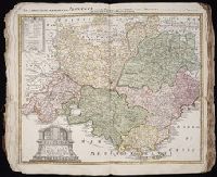
Alternative Title:
Praefectura Generalis et Comitatus Provinciae
Subject (Geographic):
Alpes de Haute-Provence (France) --Maps --Early works to 1800, Alpes-Maritimes (France) --Maps --Early works to 1800, Bouches-du-Rhone (France) --Maps --Early works to 1800, France, Southern --Maps --Early works to 1800, Var (France) --Maps --Early works to 1800, and Vaucluse (France : Dept.) --Maps --Early works to 1800
Composite atlas of 41 maps from Alexis Hubert Jaillot's Atlas nouveau.
Image Count:
1
Alternative Title:
Provinces-Unies des Pays-Bas, sc̦avoir le Duché de Gueldre, les Comtés de Hollande, Zeelande, Zutphen
Description:
"Avec privilege du Roy.", Boundaries hand colored. Sheets measure 62.8 x 47.0 cm or smaller. No. 17 of 41 maps bound together with binder's title: Carte de Sanson., Cartouche signed "F. Chauveau in. et fe.", From Jaillot's Atlas nouveau (1681)., Includes 6 bar scales., Prime meridan: Ferro., Relief shown pictorially., and Watermark.
Publisher:
Chez H. Iaillot joignant les grands Augustins aux deux globes,
Subject (Geographic):
Netherlands--Maps--Early works to 1800 and North Rhine-Westphalia (Germany)--Maps--Early works to 1800