Skip to search
Skip to main content
Skip to first result
Search
You Searched For
Language
Latin
New Search
Search Results
Creator:
Published / Created:
[between 1613 and 1619]
Call Number:
4069 1620
Container / Volume:
BRBL_00237
Image Count:
2
Resource Type:
Maps, Atlases & Globes
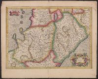
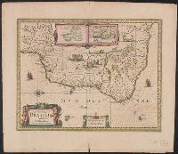
Description:
"Cum privilegio"., 4069 1620: Hand colored., Signature 6Q, page numbers 298-299 on verso., and Text on verso in Latin.
Publisher:
[publisher not identified],
Subject (Geographic):
Abruzzo (Italy)--Maps--Early works to 1800 and Campania (Italy)--Maps--Early works to 1800
Found in:
Beinecke Rare Book and Manuscript Library > Abruzzo et Terra di Lavoro / per Gerardum Mercatorem.
Published / Created:
Roman CE 225-235
Call Number:
YPC
Image Count:
1
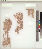
Abstract:
Tabulations
Found in:
Beinecke Rare Book and Manuscript Library > Yale Papyrus Collection (YPC) > Dura-Europos > Account
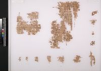
Published / Created:
Roman CE 250 or 251
Call Number:
YPC
Image Count:
1
Abstract:
Strength report of military unit
Found in:
Beinecke Rare Book and Manuscript Library > Yale Papyrus Collection (YPC) > Dura-Europos > Account or list
Creator:
From the Collection: Lavington, Ralph Payne, baron, 1738-1807
Published / Created:
1773-1774
Call Number:
OSB MSS 138
Container / Volume:
Box 5, folder 156
Image Count:
16
Found in:
Beinecke Rare Book and Manuscript Library > Ralph Payne, Baron Lavington family papers (OSB MSS 138) > Series III: Land and Plantation Records > Antigua > Carlisles > Accounts for "Carlile's Plantation"
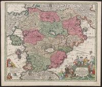
Published / Created:
1650?]
Call Number:
1an 1650
Container / Volume:
BRBL_00001
Image Count:
1
Resource Type:
Maps, Atlases & Globes
Description:
Latin and German.
Subject (Topic):
Cockaigne--Maps--Early works to 1800 and Imaginary places--Maps--Early works to 1800
Found in:
Beinecke Rare Book and Manuscript Library > Accurata Utopiæ tabula, das ist der neu-entdeckten Schalck-Welt, oder des so offt benannten, und doch nie erkannten Schlaraffenlandes ... / anmuthig und nutzlich vorgestelt durch Authorem Anonymum.
Published / Created:
1680?]
Call Number:
1an 1680
Container / Volume:
BRBL_00001
Image Count:
1
Resource Type:
Maps, Atlases & Globes
Description:
Latin and German.
Subject (Topic):
Cockaigne--Maps--Early works to 1800 and Imaginary places--Maps--Early works to 1800
Found in:
Beinecke Rare Book and Manuscript Library > Accurata Utopiæ tabula, das ist der neu-entdeckten Schalck-Welt, oder des so offt benanten, und doch nie erkanten Schlaraffenlandes ... / anmuthig und nutzlich vorgestellt werden durch Author Anonymu.
Creator:
Published / Created:
1734?]
Call Number:
71 1750C
Container / Volume:
BRBL_00362
Image Count:
1
Resource Type:
Maps, Atlases & Globes
Description:
Appears in the author's Grosser atlas ... [between 1734 and 1750?], Covers North America from Quebec to the Gulf of Mexico, and to New Mexico in the west., In French, with title in Latin., and Includes decorative cartouche, historical notes and inset of "Les cos
Publisher:
s.n. ,
Subject (Geographic):
North America--Maps--Early works to 1800
Subject (Name):
Rein, Melchior, Rogg, Gottfried, 1669-1742, and Seutter, Matthaeus, 1678-1756. Grosser atlas
Found in:
Beinecke Rare Book and Manuscript Library > Accurata delineatio celeberrimae regionis Ludovicianae vel Gallice Louisiane ot. Canadae et Floridae adpellatione in Septemtrionali America : descriptae quae hodie nomine fluminis Mississippi vel St. Louis per colonias et navigationes Gallorum ob immensas
Published / Created:
1730?]
Call Number:
71 1730B
Container / Volume:
BRBL_00725
Image Count:
1
Resource Type:
Maps, Atlases & Globes
Description:
"Gottfr. Rogg del. ; M. Rhein sc.", Franklin Collection no. 131 173-?., and Inset: "Les costes de la Louisiane ... "
Subject (Geographic):
France--Colonies--America--Maps--Early works to 1800 and North America--Maps--Early works to 1800
Found in:
Beinecke Rare Book and Manuscript Library > Accurata delineatio celeberrimæ regionis Ludovicianæ vel gallice Louisiane ... in lucem edita cura et manu Matthæi Seutteri ...
Published / Created:
[1780?]
Call Number:
39 1780
Container / Volume:
BRBL_00185
Image Count:
1
Resource Type:
Maps, Atlases & Globes
Subject (Geographic):
Spain--Maps--Early works to 1800
Found in:
Beinecke Rare Book and Manuscript Library > Accuratis sima Totius Regni Hispaniae tabula Per Gerardum a Schagen.
Creator:
Published / Created:
[1638]
Call Number:
911 1630
Container / Volume:
BRBL_00699
Image Count:
2
Resource Type:
Maps, Atlases & Globes
Alternative Title:
Baya de todos os Sanctos. and Villa d'Olinda de Pernambuco.
Description:
Bar scales in "Milliaria Germanica communia" and "Milliaria Gallica communia.", Cross Collection no. 339., From Hondius's Atlantis novi ... [Amsterdam] : Sumptibus & typis aeneis Henrici Hondij ..., 1638., Hand col., In Latin on verso, with caption title "Brasilia" and signature 5B., Insets: [1] Baya de todos os Sanctos -- [2] Villa d'Olinda de Pernambuco., Oriented with north to the right., Relief shown pictorially., and Shows the coast of Brazil from San Marcos bay to modern Curityba.
Publisher:
Henricus Hondius excudit,
Subject (Geographic):
Brazil--Maps--Early works to 1800
Subject (Name):
Hondius, Hendrik, 1597-1651. Atlas novus
Found in:
Beinecke Rare Book and Manuscript Library > Accuratissima Brasiliae tabula.
Branch:v1.64.0 ,Deployed:2024-09-11T10:25:40-04:00