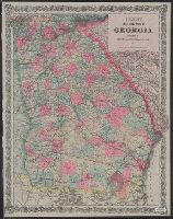
Includes key to state boundary, county boundary, township & range line, section line, state capitol, county seat, villages & P.O.s, mills, roads, railroads--finished and proposed.
Publisher:
G.W. & C.B. Colton & Co.,
Subject (Geographic):
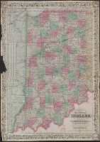
Illinois--Maps, Indiana--Maps, Michigan--Maps, and Ohio--Maps
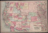
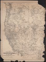
Map of the states and territories from the Mississippi River to the Pacific Ocean
Description:
"Entered according to act of Congress in the year 1867 by G.W. & C.B. Colton ... ", Also shows locations of Indian tribes., Includes text., Prime meridians: Greenwich and Washington., and Relief shown by hachures and spot heights.
Publisher:
G.W. and C.B. Colton,
Subject (Geographic):
Overland Trails--Maps and West (U.S.)--Maps
Subject (Topic):
Indians of North America--Maps and Railroads--West (U.S.)--Maps
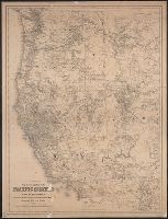
Map of the states and territories from the Mississippi River to the Pacific Ocean
Description:
"Entered according to act of Congress in the year 1874 by G.W. & C.B. Colton ... ", Also shows locations of Indian tribes., Includes text., Prime meridians: Greenwich and Washington., and Relief shown by hachures and spot heights.
Publisher:
G.W. and C.B. Colton,
Subject (Geographic):
Overland Trails--Maps and West (U.S.)--Maps
Subject (Topic):
Indians of North America--Maps and Railroads--West (U.S.)--Maps
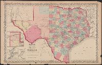
"No.35" and "No.36.", Includes Frio and Zavala counties which were formed in 1858 and which do not appear on Colton map dated 1857., Insets: Plan of the northern part of Te, and Library's copy annotated in pencil "This is in the same state as in the 1859 atlas."
Publisher:
Johnson & Browning,
Subject (Geographic):
Texas Panhandle (Tex.)--Maps, Texas--Administrative and political divisions--Maps, and Texas--Maps
Subject (Name):
De Cordova, Jacob, 1808-1868, J.H. Colton & Co, Johnson & Browning, and Streeter, Thomas W.--(Thomas Winthrop),--1883-1965--Ownership
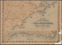
New topographical map of the eastern portion of the state of North Carolina
Description:
At upper left corner, outside margin & foliate border: No. 11., Cut into 2 sheets, Inset map: Plan of the, Prime meridans: Greenwich and Washington, D.C., Relief shown by hachures., and Shows names of counties, cities, towns, roads, railroads, rivers, and inlets.