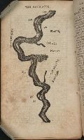
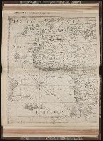
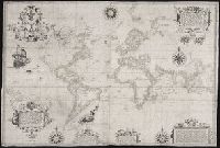
Descriptio ac delineatio geographica detectionis freti, sive, transitus ad occasum supra terras
Image Count:
1
Description:
Bound in after p. [40]., Map has water stain on recto in upper right corner., Printed on recto in lower right corner: F., and Scale [ca. 1:10,000,000].
Subject (Geographic):
Barents Sea --Maps --Early works to 1800. and Norwegian Sea --Maps --Early works to 1800
Collection Created:
Amsterodami Ex officina Hesse lij Gerardi. Anno 1613
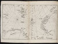
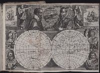
Journal ou relation exacte du voyage de Guill Schouten
Image Count:
1
Description:
Bound in after p. [8]., Busts of various explorers depicted around edges of map., Four small areas with stains on verso., Scale not given., and Western hemisphere of North and South America hand colored.
Subject (Topic):
Oceania --Discovery and exploration --Early works to 1800, Voyages around the world --Early works to 1800, and World maps --Early works to 1800
Collection Created:
A Paris : chez M. Gobert, au Palais en la gallerie des prisonniers, et les cartes, chez M. Tauernier, graueur du roy, demeurant au pont Marchand, 1618
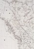
Certaine errors in nauigation / detected and corrected by Edw. Wright ; with many additions that
Image Count:
1
Description:
2d state, "William Kip sculpsit"., Formerly bound in Taylor 251., Housed and classed separately as BrSides Folio 2008 14., In pencil on verso: Beinecke / Library / Broadsides / Folio / 2008 / 14., Map has some small tears along previously folded edges that have been repaired., On verso: Yale proprietary stamp in center., and Scale not given.
Subject (Topic):
Nautical astronomy --Early works to 1800, Navigation --Early works to 1800, and Pilot guides --England --Early works to 1800
Collection Created:
[London] : Printed by Felix Kingsto[n] at London, 1610