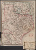
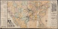
Rand, McNally & Co.'s Texas and Indian Territory and Texas and the Indian Territory
Description:
Includes map of western portion of Texas., Library's copy annotated in red ink and blue pencil., Library's copy attached to map showing, Prime meridians: Greenwich and Washington., Relief shown by hachures., and Shows county outlines, county seats, and railroads.
Publisher:
Rand, McNally & Co.,
Subject (Geographic):
Indian Territory--Maps, Texas--Administrative and political divisions--Maps, and Texas--Maps
Subject (Topic):
Railroads--Indian Territory--Maps, Railroads--Texas--Denison--Maps, and Railroads--Texas--Maps
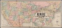
"Jno. B. Loveland, Gen'l European Passenger Agent, Liverpool, England.", "Martin B. Brown, Railroad Printer, 49 & 51 Park Place, New York.", Includes text and timetables on verso., Inset: Around the world, across the American continent via Erie Railway., and Show
Publisher:
Rand, McNally & Co.,
Subject (Name):
New York, Lake Erie, and Western Railroad Company and New York, Lake Erie, and Western Railroad Company--Maps
In lower right: X 3624., Indexed., Relief shown by shading and spot heights., and Road maps of Yellowstone National Park and Waterton-Glacier International Peace Park, text, distance table, and col. ill. on verso.
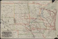
Missouri Pacific Railway for Kansas City and all points west
Description:
"Form 1. C D--1-15, 86.", Includes list of agents, fare chart, text and illus., Relief shown by hachures., and Timetables and tourist information on verso ([18] p.).
Publisher:
Missouri Pacific Railway,
Subject (Name):
Missouri Pacific Railway Company and Missouri Pacific Railway Company--Maps
Subject (Topic):
Railroads--Mexico--Maps and Railroads--United States--Maps
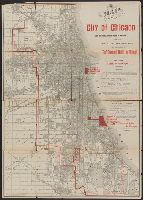
"For 'The standard guide to Chicago.'", "This map also shows the sites selected for the World's Columbian Exposition of 1893.", Caption title., and Imperfect: sheet torn along folds and separated into two pieces.
Publisher:
Rand McNally & Co.,
Subject (Geographic):
Chicago (Ill.)--Maps
Subject (Name):
Flinn, John J. (John Joseph), 1851-1929. Standard guide to Chicago and World's Columbian Exposition--(1893 :--Chicago, Ill.)--Maps
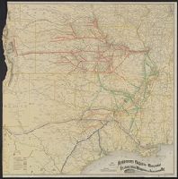
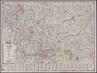
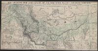
Map of Northern Pacific R.R. and Oregon Railway & Navigation Co., showing land grant., Map showing Northern Pacific Railroad system., Northern Pacific land grant map of Montana, and Preserve this Montana map, it shows the land grant of the Northern Pacific Railr
Description:
Date inferred from fare and freight rates "in effect Aug. 1, 1889," on verso., Includes inset with 2 titles, "Map showing Northern Pacific Railroad system" and "Map of Northern Pacific R.R. and Oregon Railway & Navigation Co., showing land grant.", and Relief shown by hachures.
Publisher:
Rand McNally & Co.,
Subject (Name):
Northern Pacific Railroad Company--Maps
Subject (Topic):
Railroad land grants--Northwest, Pacific--Maps and Railroads--Northwest, Pacific--Maps
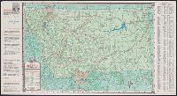
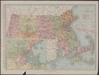
Includes index to counties and principal cities, list of Massachusetts railroads, and steamship routes., Inset: "Environs of Boston.", Ms. notes: some cities circled in black ink., and Relief shown by hachures and spot heights.
Publisher:
Rand McNally & Co.,
Subject (Geographic):
Massachusetts--Maps
Subject (Topic):
Railroads--Massachusetts--Maps and Roads--Massachusetts--Maps