Skip to search
Skip to main content
Skip to first result
Search
You Searched For
Genre
Hand coloring
Language
Latin
Creator
Homann Erben (Firm)
New Search
Search Results
Creator:
Published / Created:
1741
Call Number:
1975 Folio 31
Collection Title:
[Atlas factice of 42 maps, produced by the Homann Erben firm]
Image Count:
1
Alternative Title:
Carte de France dressee par Guillaume de L’Isle et accommodee par les Heritiers d’Homann
Publisher:
Homann Erben
Subject (Geographic):
France --Maps --Early works to 1800
Subject (Topic):
Atlases, German --Early works to 1800
Collection Created:
[Nuremberg,
Found in:
Beinecke Rare Book and Manuscript Library > Regni Galliae seu Franciae et Navarrae [cartographic material] : tabula geographica in usum elementorum geographiae schazianorum accom[m]odata / per Homannianos Heredes
Creator:
Published / Created:
1741
Call Number:
1973 Folio 30
Collection Title:
[Atlas factice of 32 maps and 1 distance table, produced by the Homann Erben firm]
Image Count:
2
Alternative Title:
Carte de France dressee par Guillaume de L’Isle et accommodee par les Heritiers d’Homann
Publisher:
[Homann Erben]
Subject (Geographic):
France --Maps --Early works to 1800
Subject (Topic):
Atlases, German --Early works to 1800
Collection Created:
[Nuremberg : s.n.,
Found in:
Beinecke Rare Book and Manuscript Library > Regni Galliae seu Franciae et Navarrae [cartographic material] : tabula geographica in usum elementorum geographiae schazianorum accom[m]odata / per Homannianos Heredes
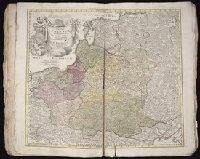
Creator:
Published / Created:
1739
Call Number:
1975 Folio 31
Collection Title:
[Atlas factice of 42 maps, produced by the Homann Erben firm]
Image Count:
1
Publisher:
[Homann Erben]
Subject (Geographic):
Baltic States --Maps --Early works to 1800 and Poland --Maps --Early works to 1800
Subject (Topic):
Atlases, German --Early works to 1800
Collection Created:
[Nuremberg,
Found in:
Beinecke Rare Book and Manuscript Library > Regni Poloniae magnique Ducatus Lithuaniae / [cartographic material] / nova et exacta tabula ad mentem Starovolcii descripta a Iohanne Bapt. Homanno, Sac. Caes. Mai. Geographo
Creator:
Published / Created:
[1750?]
Call Number:
1975 Folio 31
Collection Title:
[Atlas factice of 42 maps, produced by the Homann Erben firm]
Image Count:
1
Publisher:
Impensis Homan[n]ianorum Heredum
Subject (Geographic):
China --Maps --Early works to 1800
Subject (Topic):
Atlases, German --Early works to 1800
Collection Created:
[Nuremberg,
Found in:
Beinecke Rare Book and Manuscript Library > Regni sinae vel sinae propriae, mappa et descriptio geographica ex mappis particularibus quas sinarum rex Canghi opera patrum missionariorum e S.I. in provincias regni universi ejus rei gratia ablegatorum concinnari fecit perfecta publicoque primum commun
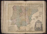
Creator:
Published / Created:
MDCCLXXXII [1782]
Call Number:
1983 Folio 23
Collection Title:
[Atlas factice of 50 maps, primarily by Johann Baptist Homann and/or issued by the Homann Erben
Image Count:
1
Publisher:
Edentibus Homannianis Haeredibus
Subject (Geographic):
Portugal --Maps --Early works to 1800 and Spain --Maps --Early works to 1800
Collection Created:
[Nuremberg : Homann Erben, 1710-1786]
Found in:
Beinecke Rare Book and Manuscript Library > Regnorum Hispaniae et Portugalliae [cartographic material] : tabula generalis ad statum hodiernum in suas provincias / divisa per D.T. Lopez ; in nonnullis emendavit F.L. Guessefeld
Creator:
Published / Created:
1749
Call Number:
1973 Folio 30
Collection Title:
[Atlas factice of 32 maps and 1 distance table, produced by the Homann Erben firm]
Image Count:
1
Alternative Title:
General map of Great Britain and Ireland with part of Holland Flandres France &c. agreable to modern history by the heirs of late Mr. Homann at Nueremburg 1749, priviledged by Emperours Majesty
Publisher:
Edentibg. Homan[n]ianis heredibus
Subject (Geographic):
Great Britain --Maps --Early works to 1800 and Ireland --Maps --Early works to 1800
Subject (Topic):
Atlases, German --Early works to 1800
Collection Created:
[Nuremberg : s.n., 1701-1760]
Found in:
Beinecke Rare Book and Manuscript Library > Regnorum Magnae Britanniae et Hiberniae mappa geographica : iuxta observationes astronomicas recentiores denuo correcta et ad formam legitimae projectionis reducta a Tobia Majero
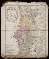
Creator:
Published / Created:
1736
Call Number:
1975 Folio 31
Collection Title:
[Atlas factice of 42 maps, produced by the Homann Erben firm]
Image Count:
1
Publisher:
Edita primum per I. B. Nolin, nunc recusa per H.H. [heredes Homannianos]
Subject (Geographic):
Portugal --Maps --Early works to 1800
Subject (Topic):
Atlases, German --Early works to 1800
Collection Created:
[Nuremberg,
Found in:
Beinecke Rare Book and Manuscript Library > Regnum Portugalliae divisum in quinque provincias majores & subdivisum in sua quaeque territoria una cum regno Algarbiae speciali mappa exhibitum
Creator:
Published / Created:
1747
Call Number:
1983 Folio 23
Collection Title:
[Atlas factice of 50 maps, primarily by Johann Baptist Homann and/or issued by the Homann Erben
Image Count:
1
Alternative Title:
Cercle d’Autriche : consistant dans l’Archiduche d’Autriche, le Duche de Stirie, de Carinthie, de Carniole, dans la Comte de Tyrol, et les pais autrichiens anterieurs dans la Souabe, avec ses confins, Circulus Austriacus, and Circvlvs Avstriacvs
Publisher:
Curantibus Homannianis Heridibus
Subject (Geographic):
Austria --Maps --Early works to 1800 and Europe, Central --Maps --Early works to 1800
Collection Created:
[Nuremberg : Homann Erben, 1710-1786]
Found in:
Beinecke Rare Book and Manuscript Library > S.R.I. circulus Austriacus [cartographic material] : quem componunt archid. Austriae, ducatus Stiriae, Carinthiae, Carnioliae, comit. Tyrolensis, ditionesque Sueviae austriacae, cum suis confiniis / a Tobia Majero ; curantibus Homannianis Heridibus = Le C
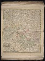
Creator:
Published / Created:
1747
Call Number:
1975 Folio 31
Collection Title:
[Atlas factice of 42 maps, produced by the Homann Erben firm]
Image Count:
1
Alternative Title:
Cercle d’Autriche : consistant dans l’Archiduche d’Autriche, le Duche de Stirie, de Carinthie, de Carniole, dans la Comte de Tyrol, et les pais autrichiens anterieurs dans la Souabe, avec ses confins, Circulus Austriacus, and Circvlvs Avstriacvs
Publisher:
Curantibus Homannianis Heridibus
Subject (Geographic):
Austria --Maps --Early works to 1800 and Europe, Central --Maps --Early works to 1800
Subject (Topic):
Atlases, German --Early works to 1800
Collection Created:
[Nuremberg,
Found in:
Beinecke Rare Book and Manuscript Library > S.R.I. circulus Austriacus [cartographic material] : quem componunt archid. Austriae, ducatus Stiriae, Carinthiae, Carnioliae, comit. Tyrolensis, ditionesque Sueviae austriacae, cum suis confiniis / a Tobia Majero ; curantibus Homannianis Heridibus, C.P.S
Creator:
Published / Created:
[ca. 1730]
Call Number:
1983 Folio 23
Collection Title:
[Atlas factice of 50 maps, primarily by Johann Baptist Homann and/or issued by the Homann Erben
Image Count:
1
Alternative Title:
Circulus Rhenanus inferior
Publisher:
[Homann Erben]
Subject (Geographic):
Rhine River Valley --Maps --Early works to 1800
Collection Created:
[Nuremberg : Homann Erben, 1710-1786]
Found in:
Beinecke Rare Book and Manuscript Library > S.R.I. circulus Rhenanus inferior sive electorum Rheni [cartographic material] : complectens tres archiepiscopatus, Moguntinum, Coloniensem et Trevirensem, Palatinatum Rheni, Comit. Beilstein, Newenaer, Inf. Isenburg, et Reiferscheit / repraesentatus a Io
Branch:v1.61.8 ,Deployed:2024-06-20T11:14:46-04:00