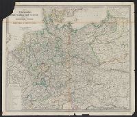
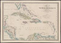
British possessions in America. and Map to shew the communication from the N.W. Coast of America to China and Australia
Description:
Includes insets of "Map to shew the communication from the N.W. Coast of America to China and Australia" and "British possessions in America.", Library's copy 2 dissected and mounted on linen, 50 x 70 cm., and Relief shown by hachures.
Publisher:
J. Wyld, geographer to the Queen, Charing Cross E,
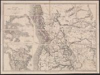
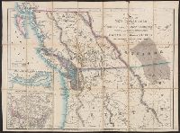
Cut and mounted on linen; "Wyld's new maps" advertisement on verso., Forts; boundaries; Indians; proposed railway; gold; coal., and Insets: Strait of San Juan de Fuca. -- on an enlarged scale. -- 7.4 x 8 cm.; British possessions in North America. -- scale [1:34
Publisher:
James Wyld,
Subject (Geographic):
British Columbia--Maps and Canada--Boundaries--United States--Maps
Subject (Topic):
Coal mines and mining--North America, Western--Maps, Gold mines and mining--British Columbia--Maps, and Indians--North America, Western--Maps
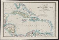
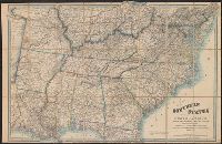
A list of other maps and atlases by Wyld is pasted on the verso., Description derived from published bibliography., and General map showing "dividing line between the free & slave-holding states."