Siege of Sevastopol and The environs of Sevastopol with the batteries & approaches
Description:
Composite map showing the placement of English, French, Turkish and Russian troops, batteries and encampments., Includes list of Wyld's new publications., Inset: Eupatoria with the attack of 17th Feby. 1855., and Relief shown by land form drawings. Depths shown
Publisher:
Published by James Wyld ... Charing Cross East & 2 Royal Exchange,
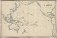
Insets: Plan of the entrance to Port Manoukao -- Plan of Victoria Bay of Islands New Zealand -- Port Nicholson -- Plan of Dusky Bay -- Plan of Southern Port, Stewarts Island -- -Oyerri or Pelorus River -- Plan of the bar and part of the Hokianga River . and Plan of Port Nicholson and Oyerri by permission of the New Zealand Land Company.
Publisher:
James Wyld, geographer to the Queen, Charing Cross East,
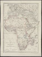
At head of sheet: "Wylds Military Map". and Insets: Enlarged map [of the route from Coomassie to Anamaboe and Cape Coast Castle; Location maps of Africa and West Africa].