Skip to search
Skip to main content
Skip to first result
Search
You Searched For
Date
Unknown
Format
cartographic
Resource Type
Maps, Atlases & Globes
Date Created
[Missing]
New Search
Search Results
Call Number:
1977 +392
Collection Title:
A survey of the cities of London and Westminster : containing the original, antiquity, increase
Image Count:
1
Resource Type:
Maps, Atlases & Globes
Description:
Plate between p. 108-109.
Subject (Geographic):
London (England)--History
Collection Created:
London : Printed for A. Churchill, J. Knapton, R. Knaplock, J. Walthoe [and 6 others], 1720
Found in:
Beinecke Rare Book and Manuscript Library > A mapp of the parishes of St. Clements Danes, St. Mary Savoy; with the Rolls Liberty and Lincolns Inn, taken from the last survey with corrections and additions
Call Number:
1977 +392
Collection Title:
A survey of the cities of London and Westminster : containing the original, antiquity, increase
Image Count:
1
Resource Type:
Maps, Atlases & Globes
Description:
Plate between p. 26-27.
Subject (Geographic):
London (England)--History
Collection Created:
London : Printed for A. Churchill, J. Knapton, R. Knaplock, J. Walthoe [and 6 others], 1720
Found in:
Beinecke Rare Book and Manuscript Library > A mapp of the parishes of St. Saviours Southwark and St. Georges taken from the last survey with corrections
Creator:
Call Number:
623 1750
Container / Volume:
BRBL_00333
Image Count:
1
Resource Type:
Maps, Atlases & Globes
Alternative Title:
Nubia & Abissinia
Description:
From Bowen's A complete system of geography, 1747., Includes text and ill., and Relief shown pictorially.
Publisher:
Printed for W. Innys, R. Ware [etc.], 1747]
Subject (Geographic):
Africa, Eastern--Maps--Early works to 1800 and Africa, North--Maps--Early works to 1800
Subject (Name):
Bowen, Emanuel, d. 1767. Complete system of geography
Found in:
Beinecke Rare Book and Manuscript Library > A new and accurate map of Nubia & Abissinia, together with all the kingdoms tributary thereto, and bordering upon them / laid down from the latest & best authorities and regulated by astronl. observations ny Emanl. Bowen.
Creator:
Call Number:
Lanman 11 1659A
Image Count:
1
Resource Type:
Maps, Atlases & Globes
Alternative Title:
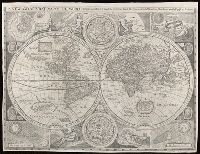
New and accurat map of the world and New and accurate map of the world
Description:
Attributed to Robert Walton; based on a map by John Speed., From Denis Petau's History of the world (1659)., Includes insets of "The heavens and elements," "The eclipse of the sunn," "A figure of the spheare," and "The eclipse of the moone," 2 celestial hemispheres, historical notes, and illustrations., Relief shown pictorially., Shows California as an island., and Watermark.
Subject (Name):
Petau, Denis, 1583-1652 and Speed, John, 1552?-1629
Subject (Topic):
World maps--Early works to 1800
Found in:
Beinecke Rare Book and Manuscript Library > A new and accvrat map of the world : drawne according to ye truest descriptions latest discoveries & best observations y[e]t have beene made by English or strangers.
Call Number:
1973 Folio 114
Collection Title:
The English pilot: describing the West-India navigation, from Hudson's-Bay to the river Amazones
Image Count:
1
Resource Type:
Maps, Atlases & Globes
Subject (Geographic):
Atlantic Ocean --Maps --Early works to 1800 and Newfoundland and Labrador --Maps --Early works to 1800
Subject (Topic):
Navigation --Early works to 1800, Pilot guides --Atlantic Coast (U.S.) --Early works to 1800, and Pilot guides --Caribbean Area --Early works to 1800
Collection Created:
London : Printed for W. and J. Mount, T. Page and son, on Tower-Hill, MDCCLIX [1759]
Found in:
Beinecke Rare Book and Manuscript Library > A new and correct chart of the coast of New Foundland from Cape Raze to Cape Bonavista
Call Number:
1973 Folio 114
Collection Title:
The English pilot: describing the West-India navigation, from Hudson's-Bay to the river Amazones
Image Count:
1
Resource Type:
Maps, Atlases & Globes
Subject (Geographic):
Atlantic Ocean --Maps --Early works to 1800, Canada --Maps --Early works to 1800, and Newfoundland and Labrador --Maps --Early works to 1800
Subject (Topic):
Navigation --Early works to 1800, Pilot guides --Atlantic Coast (U.S.) --Early works to 1800, and Pilot guides --Caribbean Area --Early works to 1800
Collection Created:
London : Printed for W. and J. Mount, T. Page and son, on Tower-Hill, MDCCLIX [1759]
Found in:
Beinecke Rare Book and Manuscript Library > A new and correct chart of the north part of America from New Found Land to Hudsons Bay
Call Number:
1973 Folio 114
Collection Title:
The English pilot: describing the West-India navigation, from Hudson's-Bay to the river Amazones
Image Count:
1
Resource Type:
Maps, Atlases & Globes
Subject (Geographic):
Africa --Maps --Early works to 1800, Antarctic Ocean --Maps, Atlantic Ocean --Maps --Early works to 1800, Europe --Maps --Early works to 1800, North America --Maps --Early works to 1800, and South America --Maps --Early works to 1800
Subject (Topic):
Navigation --Early works to 1800, Pilot guides --Atlantic Coast (U.S.) --Early works to 1800, and Pilot guides --Caribbean Area --Early works to 1800
Collection Created:
London : Printed for W. and J. Mount, T. Page and son, on Tower-Hill, MDCCLIX [1759]
Found in:
Beinecke Rare Book and Manuscript Library > A new and correct chart of the western and southern oceans ...
Call Number:
1973 Folio 114
Collection Title:
The English pilot: describing the West-India navigation, from Hudson's-Bay to the river Amazones
Image Count:
1
Resource Type:
Maps, Atlases & Globes
Subject (Geographic):
Atlantic Ocean --Maps --Early works to 1800 and West Indies --Maps --Early works to 1800
Subject (Topic):
Navigation --Early works to 1800, Pilot guides --Atlantic Coast (U.S.) --Early works to 1800, and Pilot guides --Caribbean Area --Early works to 1800
Collection Created:
London : Printed for W. and J. Mount, T. Page and son, on Tower-Hill, MDCCLIX [1759]
Found in:
Beinecke Rare Book and Manuscript Library > A new and correct large chart of the tradeing part of the West Indies
Call Number:
1973 Folio 114
Collection Title:
The English pilot: describing the West-India navigation, from Hudson's-Bay to the river Amazones
Image Count:
1
Resource Type:
Maps, Atlases & Globes
Subject (Geographic):
Atlantic Ocean --Maps --Early works to 1800, Cuba --Maps --Early works to 1800, Haiti --Maps --Early works to 1800, Hispaniola --Maps --Early works to 1800, Jamaica --Maps --Early works to 1800, and West Indies --Maps --Early works to 1800
Subject (Topic):
Navigation --Early works to 1800, Pilot guides --Atlantic Coast (U.S.) --Early works to 1800, and Pilot guides --Caribbean Area --Early works to 1800
Collection Created:
London : Printed for W. and J. Mount, T. Page and son, on Tower-Hill, MDCCLIX [1759]
Found in:
Beinecke Rare Book and Manuscript Library > A new chart of the Bahama Islands and the Windward passage
Creator:
Call Number:
1977 Folio 78
Collection Title:
A New and accurate chart of the West-India Islands and coast, with the gulf passage through the New
Image Count:
1
Resource Type:
Maps, Atlases & Globes
Subject (Geographic):
Caribbean Area., Central America., Cuba., Florida., Hispaniola., Jamaica., Louisiana., Puerto Rico., and West Indies
Subject (Topic):
Nautical charts
Collection Created:
London, Printed for Robert Sayer and John Bennett, Fleet-Street, 1779
Found in:
Beinecke Rare Book and Manuscript Library > A new general chart of the West Indies from the latest marine journals and surveys. Regulated and ascertained by astronomical observations
Branch:v1.61.6 ,Deployed:2024-06-12T09:55:31-04:00