Skip to search
Skip to main content
Skip to first result
Search
You Searched For
Extent of Digitization
Partially digitized
Genre
Maps
Genre
Maps in books
New Search
Search Results
Creator:
Published / Created:
[1732]
Call Number:
E1015 M66 1732
Collection Title:
Atlas minor: or a set of sixty-two new and correct maps, of all parts of the world. All composed
Image Count:
1
Resource Type:
Maps, Atlases & Globes
Description:
Autograph of Gravely. Autograph of Baldock. Autograph of Aston. Autograph of W. Alington. and Teaching resource: Professor John Mack Faragher, History 141: The American West.
Subject (Geographic):
America--Maps, Europe, Northern--Maps--Early works to 1800, Great Britain--Maps--Early works to 1800, and Ireland--Maps--Early works to 1800
Subject (Topic):
Atlases--Early works to 1800
Collection Created:
London :
Found in:
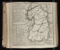
Beinecke Rare Book and Manuscript Library > A general map of Great Britain and Ireland with part of Germany, Holland, Flanders, France &c. agreeable to modern history
Creator:
Call Number:
Egg +755E
Collection Title:
Geographical, historical, political, philosophical and mechanical essays : the first, containing an
Image Count:
1
Description:
Hand-colored illustrations. and Tipped in facing p. 32.
Subject (Geographic):
Erie, Lake., Middle Atlantic States--Maps., Ohio River Valley--Maps., and Ontario, Lake (N.Y. and Ont.)
Subject (Topic):
Voyages and travels
Collection Created:
Philadelphia: Printed by B. Franklin, and D. Hall. MDCCLV. And sold by R. and J. Dodsley, in Pall-Mall, London. [1755]
Found in:
Beinecke Rare Book and Manuscript Library > A general map of the middle British colonies in America
Call Number:
1973 Folio 114
Collection Title:
The English pilot: describing the West-India navigation, from Hudson's-Bay to the river Amazones
Image Count:
1
Resource Type:
Maps, Atlases & Globes
Subject (Geographic):
Atlantic Ocean --Maps --Early works to 1800 and South Carolina --Maps --Early works to 1800
Subject (Topic):
Navigation --Early works to 1800, Pilot guides --Atlantic Coast (U.S.) --Early works to 1800, and Pilot guides --Caribbean Area --Early works to 1800
Collection Created:
London : Printed for W. and J. Mount, T. Page and son, on Tower-Hill, MDCCLIX [1759]
Found in:
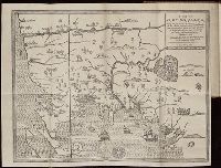
Beinecke Rare Book and Manuscript Library > A large draft of South Carolina from Cape Roman to Port Royall
Call Number:
1973 Folio 114
Collection Title:
The English pilot: describing the West-India navigation, from Hudson's-Bay to the river Amazones
Image Count:
1
Resource Type:
Maps, Atlases & Globes
Subject (Geographic):
Antigua --Maps --Early works to 1800, Atlantic Ocean --Maps --Early works to 1800, and West Indies --Maps --Early works to 1800
Subject (Topic):
Navigation --Early works to 1800, Pilot guides --Atlantic Coast (U.S.) --Early works to 1800, and Pilot guides --Caribbean Area --Early works to 1800
Collection Created:
London : Printed for W. and J. Mount, T. Page and son, on Tower-Hill, MDCCLIX [1759]
Found in:
Beinecke Rare Book and Manuscript Library > A large draft of the island Antegua
Published / Created:
1742
Call Number:
1976 1232
Collection Title:
Chorographia Britanniæ, or, A set of maps of all the counties in England and Wales ... : to the
Image Count:
1
Subject (Geographic):
Cambridgeshire (England)--Maps--Early works to 1800, England --Maps --Early works to 1800, and Great Britain --Road maps --Early works to 1800
Subject (Topic):
Roads --Great Britain
Collection Created:
Holbourne : Printed for and sold by W.H. Toms, engraver, in Union Court, near Hatton Garden, 1742
Found in:
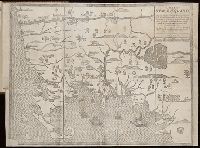
Beinecke Rare Book and Manuscript Library > A map of Cambridge Shire
Creator:
Published / Created:
[ca. 1814]
Call Number:
Zc10 814Le
Collection Title:
History of the expedition under the command of Captains Lewis and Clark, to the sources of the
Image Count:
2
Resource Type:
Maps, Atlases & Globes
Description:
Verso blank.
Subject (Geographic):
Columbia River, Missouri River, and West (U.S.)
Subject (Topic):
Lewis and Clark Expedition (1804-1806)
Collection Created:
Philadelphia : Bradford & Inskeep ; New York : A.H. Inskeep : J. Maxwell, Printer, 1814
Found in:
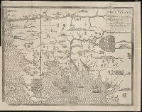
Beinecke Rare Book and Manuscript Library > A map of Lewis and Clark's track, across the western portion of North America fom the Mississippi to the Pacific Ocean; by order of the Executive of the United States . In 1804, 5 & 6
Published / Created:
undated
Call Number:
Vanderbilt 74
Collection Title:
The present state of New-England ; being a narrative of the troubles with the Indians in New
Image Count:
2
Description:
Imperfect: map wanting and supplied in facsimile; only a remnant of original map remains. This copy has what is considered the correct map for this edition, the mound immediately beneath the title being designated as "The Wine Hills", the Boston edition h
Subject (Geographic):
New England --History --Colonial period, ca. 1600-1775
Subject (Topic):
Indians of North America --New England, King Philips War, 1675-1676., and Pequot War, 1636-1638.
Collection Created:
London : Printed for Tho. Parkhurst ... , 1677
Found in:
Beinecke Rare Book and Manuscript Library > A map of New-England, being the first that ever was here cut, and done by the best pattern that could be had, which being in some places defective, it made the other less exact, yet it doth sufficiently shew the scituation of the countrey, and convenientl
Branch:v1.61.8 ,Deployed:2024-06-20T11:15:04-04:00