Skip to search
Skip to main content
Skip to first result
Search
You Searched For
Access
Public
Publication Place
London :
New Search
Search Results
Creator:
Call Number:
71 1776
Container / Volume:
BRBL_00687
Image Count:
1
Resource Type:
Maps, Atlases & Globes
Description:
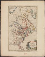
According to Sellers and Van Ee, this map is the 2nd state., At lower margin "London, printed for R. Sayer & J. Bennett, map & sea chartseller, no. 53, Fleet Street, as the act directs, Augst. 17th 1776., Includes a list of British colonies and territories., and Relief shown pictorially.
Publisher:
[Printed and sold by R. Sayer and J. Bennett, map and print seller, no. 53, Fleet St. 1776]
Subject (Geographic):
North America--Maps--Early works to 1800
Subject (Name):
Carver, Jonathan, 1710-1780, Jefferys, Thomas, d. 1771. American atlas, and Robert Sayer and John Bennett (Firm)
Found in:
Beinecke Rare Book and Manuscript Library > A map of the British Empire, in North America / by Samuel Dunn, mathematician, improved from the surveys of Capt. Carver.
Published / Created:
1776
Call Number:
755 1776L
Container / Volume:
BRBL_00430
Image Count:
1
Resource Type:
Maps, Atlases & Globes
Publisher:
R. Sayer & J. Bennett,
Subject (Geographic):
Canada--Maps--Early works to 1800 and East (U.S.)--Maps--Early works to 1800
Found in:
Beinecke Rare Book and Manuscript Library > A map of the British Empire, in North America. By Samuel Dunn, Mathematician, improved from the surveys of Capt. Carver.
Creator:
Published / Created:
[1773]
Call Number:
71 1773
Container / Volume:
BRBL_00365
Image Count:
4
Resource Type:
Maps, Atlases & Globes
Description:
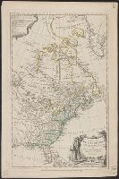
"Longitude west from London.", First impression of 3d ed., Includes text and inset "A new map of Hudson's Bay and Labrador from the late surveys of those coasts.", and Relief shown pictorially.
Publisher:
Printed for Jefferys and Faden, geographers to the King,
Subject (Geographic):
North America--Maps--Early works to 1800
Subject (Name):
Jefferys and Faden, London and Kitchin, Thomas, d. 1784
Subject (Topic):
British--America--Maps--Early works to 1800
Found in:
Beinecke Rare Book and Manuscript Library > A map of the British and French dominions in North America : with the roads, distances, limits, and extent of the settlements, humbly inscribed to the Right Honourable the Earl of Halifax, and the other Right Honourable the Lords Commissioners for Trade &
Creator:
Published / Created:
[1775?]
Call Number:
71 1755A
Container / Volume:
BRBL_00363
Image Count:
8
Resource Type:
Maps, Atlases & Globes
Description:
Fourth ed., In bottom margin: Publish'd by the author Febry 13th 1755 according to act of Parliament., Includes text and inset "A new map of Hudson's Bay and Labrador from the late surveys of those coasts.", Relief shown pictorially., and Yale's copy stamped on b
Publisher:
Printed for Jefferys and Faden, geographers to the King,
Subject (Geographic):
North America--Maps--Early works to 1800
Subject (Name):
Jefferys and Faden, London and Kitchin, Thomas, d. 1784
Subject (Topic):
British--America--Maps--Early works to 1800
Found in:
Beinecke Rare Book and Manuscript Library > A map of the British colonies in North America : with the roads, distances, limits, and extent of the settlements, humbly inscribed to the Right Honourable the Earl of Halifax, and the other Right Honourable the Lords Commissioners for Trade & Plantations
Published / Created:
1776
Call Number:
71 1776M
Container / Volume:
BRBL_00726
Image Count:
1
Resource Type:
Maps, Atlases & Globes
Publisher:
Printed for R. Sayer & J. Bennett,
Subject (Geographic):
North America--Maps--Early works to 1800
Found in:
Beinecke Rare Book and Manuscript Library > A map of the British empire in North America / by Samuel Dunn, mathematician ; improved from the surveys of Capt. Carver.
Creator:
Published / Created:
Augst. 17th. 1776.
Call Number:
755 1776F
Container / Volume:
BRBL_00430
Image Count:
1
Resource Type:
Maps, Atlases & Globes
Publisher:
Printed for R. Sayer & J. Bennett, map & sea chartsellers, no. 53 Fleet Street, as the act directs,
Subject (Geographic):
Great Britain--Colonies--America--Maps--Early works to 1800 and North America--Maps--Early works to 1800
Subject (Name):
Robert Sayer and John Bennett (Firm)
Found in:
Beinecke Rare Book and Manuscript Library > A map of the British empire in North America / by Samuel Dunn, mathematician, improved from the surveys of Capt. Carver.
Published / Created:
1774
Call Number:
71 1774
Container / Volume:
BRBL_00726
Image Count:
1
Resource Type:
Maps, Atlases & Globes
Publisher:
Printed for R. Sayer,
Subject (Geographic):
North America--Maps--Early works to 1800
Found in:
Beinecke Rare Book and Manuscript Library > A map of the British empire in North America / by Samuel Dunn, mathematician.
Published / Created:
1804
Call Number:
3655 1804
Container / Volume:
BRBL_00144
Image Count:
1
Resource Type:
Maps, Atlases & Globes
Description:
2 copies.
Publisher:
Wm. Faden,
Subject (Geographic):
Schleswig-Holstein (Germany)--Maps
Found in:
Beinecke Rare Book and Manuscript Library > A map of the Dutchy of Holstein ...
Creator:
Published / Created:
30th Septr. 1780.
Call Number:
27 1780
Container / Volume:
BRBL_00683
Image Count:
1
Resource Type:
Maps, Atlases & Globes
Description:
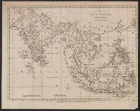
"Jn. Lodge, sculp." and Mounted on linen. Cross Collection 70.
Publisher:
Published ... by J. Bew, Pater Noster Row,
Subject (Geographic):
East Indies--Maps--Early works to 1800
Subject (Name):
Bew, John, -1793
Found in:
Beinecke Rare Book and Manuscript Library > A map of the East Indies [cartographic material] : from the best authorities.
Branch:v1.61.6 ,Deployed:2024-06-12T09:55:36-04:00