
You Searched For
« Previous
| 1 - 10 of 11 |
Next »
Search Results
- Creator:
- Schweizerischer Juraverein
- Published / Created:
- [1940]-
- Call Number:
- 37 J974 1940
- Image Count:
- 2
- Resource Type:
- Maps, Atlases & Globes
- Alternative Title:
- Spezialkarte des Jura
- Description:
- French and German., Relief shown by contours, gradient tints, and spot heights. Contours at 20 meter intervals., Sheets 2-6 wanting., and Shows hiking trails and paths.
- Publisher:
- Institut géographique Kümmerly & Frey,
- Subject (Geographic):
- Jura Mountains (France and Switzerland)--Maps
- Subject (Name):
- Kümmerly + Frey
- Subject (Topic):
- Hiking--Jura Mountains (France and Switzerland)--Maps and Trails--Jura Mountains (France and Switzerland)--Maps
- Found in:
- Beinecke Rare Book and Manuscript Library > Carte du Jura = Spezialkarte des Jura / editée par le Schweizerischen Juraverein.

- Published / Created:
- [1900]
- Call Number:
- 37 1900
- Image Count:
- 2
- Resource Type:
- Maps, Atlases & Globes
- Description:
- Imperfect: dissected and mounted on linen. and Legend in French and German.
- Publisher:
- Kummerly & Frey,
- Subject (Geographic):
- Switzerland--Maps
- Found in:
- Beinecke Rare Book and Manuscript Library > Carte générale de la Suisse.
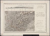
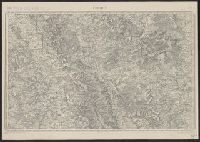
4.

- Creator:
- France. Corps d'état-major
- Published / Created:
- 1912
- Call Number:
- 38281cbf M46 1912
- Container / Volume:
- BRBL_00177
- Image Count:
- 1
- Resource Type:
- Maps, Atlases & Globes
- Description:
- "Revisée en 1912." and Original publication details printed in lower margin: Levée par les Officiers du Corps d'Etat-Major, et publiée par le Dépôt de la Guerre en 1832. Gravée le trait par Thuillier, la lettre par Hacq, le figuré du terrain par Henneq
- Publisher:
- Corps d'état major,
- Subject (Geographic):
- Île-de-France (France)--Maps
- Subject (Name):
- Dépôt de la guerre (France)
- Found in:
- Beinecke Rare Book and Manuscript Library > Meaux.
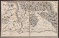
5.
- Creator:
- Sickler, Friedrich, 1773-1836, cartographer
- Published / Created:
- 1816
- Call Number:
- 400 R66 1816
- Container / Volume:
- BRBL_00233
- Image Count:
- 1
- Resource Type:
- Maps, Atlases & Globes
- Description:
- Copy 2: Hand colored. Bookseller's label: Venance Monaldini ... Rome. Autograph: A.J. Eckford., Plan of the Roman countryside with classical and contemporary place-names., and Relief shown by form lines and hachures.
- Publisher:
- Chez Venance Monaldini Libraire Place d'Espagne N.79,
- Subject (Geographic):
- Campagna di Roma (Italy)--Maps
- Subject (Name):
- Eckford, A. J.--Autograph, Monaldini, Venanzio, bookseller, and Ruga, Pietro, engraver
- Found in:
- Beinecke Rare Book and Manuscript Library > Plan topographique de la campagne de Rome [cartographic material] / dessiné et expliqué par F. Ch. L. Sickler D. à l'usage des voyageurs ; P. Ruga inc.
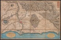
6.
- Creator:
- Sickler, Friedrich, 1773-1836, cartographer
- Published / Created:
- 1816
- Call Number:
- 400 R66 1816
- Container / Volume:
- BRBL_00233
- Image Count:
- 1
- Resource Type:
- Maps, Atlases & Globes
- Description:
- Copy 1: Booksellers' labels: Vasi ... Rome; Venance Monaldini ... Rome., Plan of the Roman countryside with classical and contemporary place-names., and Relief shown by form lines and hachures.
- Publisher:
- Chez Venance Monaldini Libraire Place d'Espagne N.79,
- Subject (Geographic):
- Campagna di Roma (Italy)--Maps
- Subject (Name):
- Ruga, Pietro, engraver and Vasi
- Found in:
- Beinecke Rare Book and Manuscript Library > Plan topographique de la campagne de Rome [cartographic material] / dessiné et expliqué par F. Ch. L. Sickler D. à l'usage des voyageurs ; P. Ruga inc.
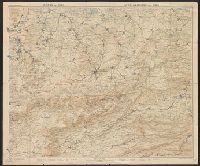
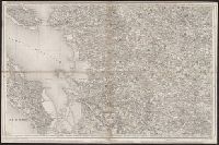
7.

- Creator:
- France. Corps d'état-major
- Published / Created:
- 1912
- Call Number:
- 3829cbf So37 1912
- Container / Volume:
- BRBL_00177
- Image Count:
- 1
- Resource Type:
- Maps, Atlases & Globes
- Description:
- "Revisée en 1912." and Original publication details printed in lower margin: Levée par les Officiers du Corps d'Etat-Major, et publiée par le Dépôt de la Guerre en 1834. Gravée le trait par Boclet, la lettre par Hacq, le figuré du terrain par Hennequin
- Publisher:
- Corps d'état major,
- Subject (Geographic):
- Picardy (France)--Maps
- Subject (Name):
- Dépôt de la guerre (France)
- Found in:
- Beinecke Rare Book and Manuscript Library > Soissons.

- Creator:
- Great Britain. War Office. General Staff. Geographical Section
- Published / Created:
- 1919?]
- Call Number:
- 434fd 1919
- Container / Volume:
- BRBL_00251
- Image Count:
- 1
- Resource Type:
- Maps, Atlases & Globes
- Alternative Title:
- Czecho-Slovakia
- Description:
- "G.S.G.S. No. 2758.", "S.G.A. 2.4.19.", Also shows portions of Germany, Poland, Austria, Hungary, and Romania., In French and English., Relief shown by contours and spot heights., and Shows proposed boundaries and roads.
- Publisher:
- G.S.G.S.,
- Subject (Geographic):
- Czechoslovakia--Boundaries--Maps and Czechoslovakia--Maps
- Subject (Topic):
- Roads--Czechoslovakia--Maps
- Found in:
- Beinecke Rare Book and Manuscript Library > Tcheco-Slovaquie [cartographic material] = Czecho-Slovakia.
9.
- Creator:
- France. Corps d'état-major
- Published / Created:
- 1917
- Call Number:
- 38315cbf V585 1913
- Container / Volume:
- BRBL_00177
- Image Count:
- 1
- Resource Type:
- Maps, Atlases & Globes
- Description:
- "R.21.5.17.", "Revisée en 1913.", and Original publication details printed in lower margin: Levée par les Officiers du Corps d'Etat-Major, et publiée par le Dépôt de la Guerre en 1835. Gravée le trait par Thierry, la lettre par Hacq, le figure du terrain
- Publisher:
- Corps d'état major,
- Subject (Geographic):
- Lorraine (France)--Maps and Verdun (France)--Maps
- Subject (Name):
- Dépôt de la guerre (France)
- Subject (Topic):
- World War, 1914-1918--France--Lorraine
- Found in:
- Beinecke Rare Book and Manuscript Library > Verdun.
10.
- Creator:
- Dépôt de la guerre (France)
- Published / Created:
- 1837-1869.
- Call Number:
- 38 1848
- Container / Volume:
- BRBL_00755-759
- Image Count:
- 14
- Resource Type:
- Maps, Atlases & Globes
- Alternative Title:
- Carte topographique de France de l'Etat-Major., Etat-Major carte de France., and Etat-Major nouvelle carte de France.
- Description:
- Imperfect: sheets 39 and 126-150 wanting; copies of sheets 131, 132, 141-144 and copy 2 of sheet 214 trimmed to neat line. Sheets dissected and m, Multiple copies of some sheets., and Some sheets imprinted "levée par les Officiers du Corps Royal d'Etat-Major."
- Publisher:
- Dépôt de la Guerre,
- Subject (Geographic):
- France--Maps
- Found in:
- Beinecke Rare Book and Manuscript Library > [Carte de France de l'Etat-Major] / levée par les Officiers du Corps d'Etat-Major ... gravée et publiée par le Dépôt de la Guerre.