Search
You Searched For
Search Results
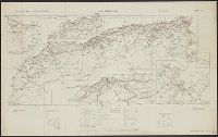
- Creator:
- Great Britain. War Office. General Staff. Geographical Section
- Published / Created:
- 1942
- Call Number:
- 66gmb 1942
- Container / Volume:
- BRBL_00348
- Image Count:
- 1
- Resource Type:
- Maps, Atlases & Globes
- Found in:
- Beinecke Rare Book and Manuscript Library > Africa road map 1:2,000,000 and 1:500,000, Maroc-Algerie-Tunisie.
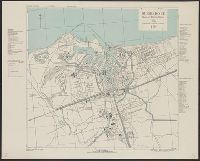
- Creator:
- Great Britain. Inter-service Topographical Dept
- Published / Created:
- 1943, 1944 printing.
- Call Number:
- 38 D742 1944
- Container / Volume:
- BRBL_00157
- Image Count:
- 1
- Resource Type:
- Maps, Atlases & Globes
- Found in:
- Beinecke Rare Book and Manuscript Library > Douarnenez-Tréboul [cartographic material] : plan of port and town / compiled and drawn by Inter-Service Topographical Dept. ; produced under the Superintendence of Vice-Admiral John Edgell, hydrographer.
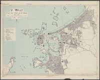
- Creator:
- Great Britain. Inter-service Topographical Dept
- Published / Created:
- 1943
- Call Number:
- 38 D92 1943
- Container / Volume:
- BRBL_00157
- Image Count:
- 1
- Resource Type:
- Maps, Atlases & Globes
- Found in:
- Beinecke Rare Book and Manuscript Library > Dunkerque [cartographic material] : plan of port & town / compiled and drawn by Inter-Service Topographical Dept. ; produced under the Superintendence of Vice-Admiral John Edgell, hydrographer.
- Creator:
- Great Britain. Inter-service Topographical Dept
- Published / Created:
- 1943, 1944 printing.
- Call Number:
- 38 F31 1944
- Container / Volume:
- BRBL_00157
- Image Count:
- 1
- Resource Type:
- Maps, Atlases & Globes
- Found in:
- Beinecke Rare Book and Manuscript Library > Fécamp, plan of port and town [cartographic material] / compiled and drawn by Inter-Service Topographical Dept. ; produced under the Superintendence of Vice-Admiral John Edgell, hydrographer.
- Creator:
- Great Britain. Inter-service Topographical Dept
- Published / Created:
- 1943, 1944 printing.
- Call Number:
- 38 R81 1944
- Container / Volume:
- BRBL_00165
- Image Count:
- 1
- Resource Type:
- Maps, Atlases & Globes
- Found in:
- Beinecke Rare Book and Manuscript Library > Royan [cartographic material] : plan of town / compiled and drawn by Inter Service Topographical Dept. ; produced under the Superintendence of Vice-Admiral John Edgell, hydrographer.
- Creator:
- Great Britain. Inter-service Topographical Dept
- Published / Created:
- 1943, 1944 printing.
- Call Number:
- 38 Sa233 1944
- Container / Volume:
- BRBL_00165
- Image Count:
- 1
- Resource Type:
- Maps, Atlases & Globes
- Found in:
- Beinecke Rare Book and Manuscript Library > St. Malo [cartographic material] : plan of port and town / compiled and drawn by Inter-Service Topographical Dept. ; produced under the Superintendence of Vice-Admiral John Edgell, hydrographer.