Search
You Searched For
Search Results
- Creator:
- Warren, Gouverneur Kemble, 1830-1882
- Published / Created:
- 1858]
- Call Number:
- 80 1858
- Container / Volume:
- Sheet 1
- Image Count:
- 2
- Found in:
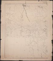
- Beinecke Rare Book and Manuscript Library > Map of the territory of the United States from the Mississippi River to the Pacific Ocean : ordered by Jeff'n Davis, Secretary of War to accompany the reports of the explorations for a railroad route
- Creator:
- United States. War Department. Corps of Engineers, cartographer, publisher
- Published / Created:
- [1881]
- Call Number:
- 831 1881A
- Image Count:
- 2
- Resource Type:
- cartographic image
- Found in:
- Beinecke Rare Book and Manuscript Library > Montana Territory
- Creator:
- United States. War Department. Corps of Engineers, cartographer, publisher
- Published / Created:
- [1875?]
- Call Number:
- 831 1875
- Image Count:
- 1
- Resource Type:
- cartographic image
- Found in:
- Beinecke Rare Book and Manuscript Library > Montana Territory
- Creator:
- United States. General Land Office
- Published / Created:
- [1908]
- Call Number:
- BrSides Zc35 908un
- Image Count:
- 2
- Resource Type:
- cartographic image
- Found in:
- Beinecke Rare Book and Manuscript Library > Sectionized map of Cheyenne River and Standing Rock Indian Reservation opened by act of May 29, 1908 [cartographic material]
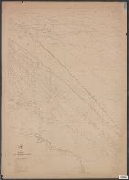
- Creator:
- Maury, Matthew Fontaine, 1806-1873, cartographer
- Published / Created:
- 1847-1852.
- Call Number:
- Maury Charts 11cfk 1850A-4 1
- Image Count:
- 8
- Found in:
- Beinecke Rare Book and Manuscript Library > Wind and current chart of the North Atlantic [cartographic material]
- Creator:
- Maury, Matthew Fontaine, 1806-1873, cartographer
- Published / Created:
- 1847-1852.
- Call Number:
- Maury Charts 11cfk 1850A-4 2
- Image Count:
- 5
- Found in:
- Beinecke Rare Book and Manuscript Library > Wind and current chart of the North Atlantic [cartographic material]