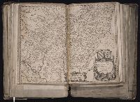
[Atlas factice of 96 maps by Blaeu, Visscher, Jansson, Hondius and others]
Image Count:
1
Description:
Imperfect: mutilated along fold and in upper right, with some loss of text. Reinforced along edges with manuscript waste. Sheet measures 39 x 50.1 cm. No. 29 of 92 maps bound together.
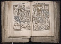
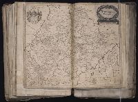
[Atlas factice of 96 maps by Blaeu, Visscher, Jansson, Hondius and others]
Image Count:
1
Description:
Each map hand col. Sheet measures 38.8 x 48 cm. Reinforced along edges with manuscript waste. No. 46 of 92 maps bound together. and Numbered 50 on verso.
Publisher:
Christoffel Froschauer
Subject (Geographic):
Zurich (Switzerland : Canton) --Maps --Early works to 1800
Froschauer, Christoph, d. 1564, printer Stumpf, Johannes, 1500-1576?
Published / Created:
[ca. 1556?]
Call Number:
1983 Folio 19
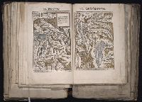
Collection Title:
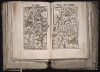
[Atlas factice of 96 maps by Blaeu, Visscher, Jansson, Hondius and others]
Image Count:
1
Description:
Each map hand col. Sheet measures 38.5 x 47.9 cm. Reinforced along edges with manuscript waste. No. 47 of 92 maps bound together. and Numbered 51 on verso.
Blanks not scanned., Imperfect, wanting 16 plates and 1 map., Order of plates does not follow that of descriptions in vol. 1., Some plates are numbered, some plates are unnumbered and interspersed. Two possible arrangements outlined in v. 1 which these seem not to follow closely. With the exception of the port. of Selim III (frontis. of text vol.), all other plates including the 2 remaining maps are bound together., and Two plates trimmed and laid in loose.
Publisher:
Chez les editeurs ... ; De l’Imprimerie de P. Didot, l’aine, M.DCCCXIX
Subject (Geographic):
Bosporus (Turkey) --Pictorial works, Istanbul (Turkey) --Description and travel, Istanbul (Turkey) --Pictorial works, Marmara, Sea of (Turkey), Turkey --Court and courtiers --Clothing --Pictorial works, Turkey --French influences, and Turkey --History --Ottoman Empire, 1288-1918 --Pictorial works
Subject (Name):
Desmaisons, 1780-1834?,
Kauffer, Francois,
Leve, Mlle.,
Michel, F. P., Barbie du Bocage, Jean Denis, 1760-1825, Bovinet, Edme, 1767-1832, Cardano, Jose´ Maria, Coiny, Jacques Joseph, 1761-1809, Dequevauviller, Francois-Nicolas-Barth elemy, 1745-1807, Desaulx, Jean, Duparc, Marie-Alexandre, Duplessi-Bertaux, Jean, 1750-1818, Hadice, Sultan, sister of Selim III, Sultan of the Turks, 1762- --Palaces --Pictorial works, Lacretelle, Charles, 1766-1855, Le Gouaz, Yves Marie, 1742-1816, Le Rouge, Jean-Nicolas, b. ca. 1776, Marillier, Clement Pierre, 1740-1808, Melling, Antoine Ignace, 1763-1831, Nee, Francois Denis, 1732-1817, Pigeot, Francois, 1775-after 1834, Pillemont, Victor, 1767-1814, Queverdo, Louis-Marie-Yves, 1788-, Reville, Jean Baptiste, 1767-1825, Schroeder, Friedrich, 1768-1839, and Selim III, Sultan of the Turks, 1761-1808 --Homes and haunts --Pictorial works
Map of San Francisco imperfect: torn along fold at upper right., Maps linen backed and bound in on tabs., Numerous pagination errors., and Printer’s dummy[?] with printed title page and "avant propos." Text consists of mounted newspaper clippings[?] and original illustrations in pencil and watercolor as well as several prints (from other sources) and two hand drawn and colored maps of San Francisco and Northern California.
Publisher:
Imp. Comm. (Margritat G., Dr)
Subject (Geographic):
California--Maps, Manuscript and San Francisco (Calif.)--Maps, Manuscript
Subject (Topic):
California --Gold discoveries and Voyages to the Pacific coast
[Atlas factice of 96 maps by Blaeu, Visscher, Jansson, Hondius and others]
Image Count:
1
Description:
Imperfect: cartouche cut out and replaced in ms. with title Wurtemberg Ducatus; edges reinforced with ms waste. Sheet measures 38.5 x 48.9 cm. No. 68 of 92 maps bound together. and Numbered 73 on verso.
Publisher:
Willem Janszoon Blaeu
Subject (Geographic):
Wurttemberg-Baden (Germany) --Maps --Early works to 1800
Froschauer, Christoph, d. 1564, printer Stumpf, Johannes, 1500-1576?
Published / Created:
[ca. 1556?]
Call Number:
1983 Folio 19
Collection Title:
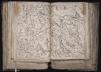
[Atlas factice of 96 maps by Blaeu, Visscher, Jansson, Hondius and others]
Image Count:
1
Description:
Each map hand col. Sheet measures 38.8 x 47.5 cm. Reinforced along edges with manuscript waste. No. 49 of 92 maps bound together. and Numbered 52 on verso.
Publisher:
Christoffel Froschauer
Subject (Geographic):
Basel (Canton) (Switzerland) --Maps--Early works to 1800 and Valais (Switzerland)--Maps--Early works to 1800
Guessefeld, F. L. (Franz Ludwig), 1744-1807 Harenberg, Johann Christoph, 1696-1774 Hase, Johann Matthias, 1684-1742 Homann Erben (Firm) Homann, Johann Baptist, 1663-1724 Lopez, D. T. Mayer, Tobias, 1723-1762 Rizzi-Zannoni, Giovanni Antonio, 1736-1814 Sperges, Joseph, Freiherr von, 1725-1791
Published / Created:
[1710-1786]
Call Number:
1983 Folio 23
Image Count:
2
Abstract:
A collection of maps issued by the Johann Baptist Homann or the Homann Erben firm between 1710 and 1786, made by various cartographers besides the Homann and the Homann Erben firm.
Cosmographia Petri Apiani / per Gemmam Frisium apud Louanienses medicum et mathematicum insignem, iam demum ab omnibus vindicata mendis, ac nonnullis quoque locis aucta, & annotationibus marginalibus illustrata. ; Additis eiusdem argumenti