Search
You Searched For
Search Results
- Creator:
- Bowen, Emanuel, 1693 or 1694-1767
- Published / Created:
- [1785?]
- Call Number:
- BrSides Double Folio 2019 91
- Image Count:
- 1
- Resource Type:
- Maps, Atlases & Globes
- Found in:
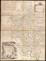
- Beinecke Rare Book and Manuscript Library > An accurate map of Buckingham Shire divided into its hundreds : drawn from the best authorities assisted by the most approved modern maps with various improvements. Illustrated with historical extracts relative to natural history, produce, trade and manufactures and the present state of the principal towns / by Eman. Bowen, Geogr. to His Majesty.
- Published / Created:
- 1794?]
- Call Number:
- 32 1794A
- Container / Volume:
- BRBL_00044
- Image Count:
- 1
- Resource Type:
- Maps, Atlases & Globes
- Found in:
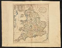
- Beinecke Rare Book and Manuscript Library > An accurate map of England and Wales ... Doolittle sc. Newhaven.
- Published / Created:
- [1750?]
- Call Number:
- 32 1750A
- Container / Volume:
- BRBL_00043
- Image Count:
- 1
- Resource Type:
- Maps, Atlases & Globes
- Found in:
- Beinecke Rare Book and Manuscript Library > An accurate map of England and Wales ... by Thos. Kitchin ...
- Published / Created:
- 1814?]
- Call Number:
- 32gmb 1814A
- Container / Volume:
- BRBL_00076
- Image Count:
- 1
- Resource Type:
- Maps, Atlases & Globes
- Found in:
- Beinecke Rare Book and Manuscript Library > An accurate map of England and Wales with the principal roads from the best authorities.
- Published / Created:
- 1795?]
- Call Number:
- 32gmb 1795A
- Container / Volume:
- BRBL_00076
- Image Count:
- 1
- Resource Type:
- Maps, Atlases & Globes
- Found in:
- Beinecke Rare Book and Manuscript Library > An accurate map of England and Wales with the principal roads from the best authorities. Doolittle sc., Newhaven.
- Published / Created:
- 1795
- Call Number:
- 30 1795
- Container / Volume:
- BRBL_00030
- Image Count:
- 1
- Resource Type:
- Maps, Atlases & Globes
- Found in:
- Beinecke Rare Book and Manuscript Library > An accurate map of Europe from the best authorities. Engrav'd by S. Hill, Boston.
- Published / Created:
- 1795
- Call Number:
- 30 1795
- Container / Volume:
- BRBL_00030
- Image Count:
- 1
- Resource Type:
- Maps, Atlases & Globes
- Found in:
- Beinecke Rare Book and Manuscript Library > An accurate map of Europe from the best authorities. Engrav'd by S. Hill, Boston.
- Creator:
- Carey, Mathew, 1760-1839
- Published / Created:
- 1817]
- Call Number:
- 59 1817A
- Container / Volume:
- BRBL_00317
- Image Count:
- 1
- Resource Type:
- Maps, Atlases & Globes
- Found in:
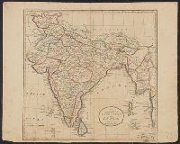
- Beinecke Rare Book and Manuscript Library > An accurate map of Hindostan or India, from the best authorities.
- Published / Created:
- [1804?]
- Call Number:
- 59 1804
- Container / Volume:
- BRBL_00316
- Image Count:
- 1
- Resource Type:
- Maps, Atlases & Globes
- Found in:
- Beinecke Rare Book and Manuscript Library > An accurate map of Hindoston or India from the best authorities. J.T. Scott sculp. Engraved for Carey's American edition of Guthrie's Geography Improved.
- Creator:
- Blanchard, Joseph, d. 1758
- Published / Created:
- 1761
- Call Number:
- 762 1761
- Container / Volume:
- BRBL_00450
- Image Count:
- 2
- Resource Type:
- Maps, Atlases & Globes
- Found in:
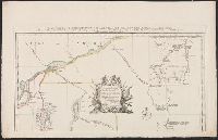
- Beinecke Rare Book and Manuscript Library > An accurate map of His Majesty's Province of New-Hampshire in New England, taken from actual surveys of all the inhabited part, and from the best information of what is uninhabited, together with the adjacent countries, which exhibits the theatre of this