
You Searched For
« Previous
| 1 - 10 of 15 |
Next »
Search Results
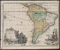
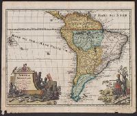
- Creator:
- L'Isle, Guillaume de, 1675-1726
- Published / Created:
- [1734?]
- Call Number:
- 90 1734
- Container / Volume:
- BRBL_00731
- Image Count:
- 1
- Resource Type:
- Maps, Atlases & Globes
- Description:
- Relief shown pictorially. and Sheet measures 36.5 x 44 cm. Ms. title on verso with ms no. "101." Franklin Collection no. 131 1734-1.
- Publisher:
- Sumtibus C. Weigelii viduae, Norimbergae,
- Subject (Geographic):
- South America--Maps--Early works to 1800
- Found in:
- Beinecke Rare Book and Manuscript Library > America Meridionalis / studio Guilielmi de L'Isle ...
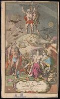
3.
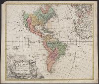
- Creator:
- Homann Erben (Firm)
- Published / Created:
- MDCCXXXXVI [1746]
- Call Number:
- 70 1746H
- Container / Volume:
- BRBL_00724
- Image Count:
- 1
- Resource Type:
- Maps, Atlases & Globes
- Description:
- At least three states of the 1746 map exist: one state has the privilige statement "Cum Privil S.C.M." following publisher and preceding date in the cartouche, but without engraver statement "Seb. Dorn, sc." below neat line; another state has no privilege statement, but has engraver statement below neat line; and another state has no privilege statement or engraver statement, but lists "Falkland" below I. Malouines (off the southern coast of Argentia), which is missing from all other states., Relief shown pictorially., and With privilege statement in cartouche. Sheet measures 50 x 59.5 cm. Verso: "8" in ink ms. Franklin Collection.
- Publisher:
- In lucem proferentibus Homannianis Heredibus,
- Subject (Geographic):
- America--Maps--Early works to 1800 and Western Hemisphere--Maps--Early works to 1800
- Subject (Name):
- Boehme, August Gottlieb, 1719-1797 and Hase, Johann Matthias, 1684-1742
- Found in:
- Beinecke Rare Book and Manuscript Library > Americae mappa generalis : secundum legitimas projectionis stereographicae regulas, relationesque recentissimas et observationes socioru[m] Acad. reg. sc. quae Parisiis est, aliorumque auctorum, nec non secundum mentem D.I.M. Hasii M.P.P. in partes suas m
4.
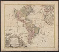
- Creator:
- Homann Erben (Firm)
- Published / Created:
- MDCCXXXXVI [1746]
- Call Number:
- 70 1746A
- Container / Volume:
- BRBL_00355
- Image Count:
- 1
- Resource Type:
- Maps, Atlases & Globes
- Description:
- At least three states of the 1746 map exist: one state has the privilige statement "Cum Privil S.C.M." following publisher and preceding date in the cartouche, but without engraver statement "Seb. Dorn, sc." below neat line; anot and Relief shown pictorially.
- Publisher:
- In lucem proferentibus Homannianis Heredibus,
- Subject (Geographic):
- America--Maps--Early works to 1800 and Western Hemisphere--Maps--Early works to 1800
- Subject (Name):
- Boehme, August Gottlieb, 1719-1797 and Hase, Johann Matthias, 1684-1742
- Found in:
- Beinecke Rare Book and Manuscript Library > Americae mappa generalis : secundum legitimas projectionis stereographicae regulas, relationesque recentissimas et observationes socioru[m] Acad. reg. sc. quae Parisiis est, aliorumque auctorum, nec non secundum mentem D.I.M. Hasii M.P.P. in partes suas m
5.
- Creator:
- Luiken, Caspar, 1672-1708
- Published / Created:
- [approximately 1710]
- Call Number:
- BrSides Folio 2019 86
- Image Count:
- 2
- Resource Type:
- Maps, Atlases & Globes
- Description:
- Imperfect: chipped. Accompanied by manuscript title page in Italian, "Nuovo Atlante sopra l'universo mondo ..." with imprint "Norinberga à spese dell' Autore stampato da Gio. Ernesto Adelbalner, 1714." and Title page for Johann Baptist Homann's Atlas novus terrarum orbis imperia.
- Publisher:
- [Johann Baptist Homann],
- Subject (Name):
- Homann, Johann Baptist, 1663-1724. Atlas novus terrarum orbis imperia.
- Found in:
- Beinecke Rare Book and Manuscript Library > Atlas novus terrarum orbis imperia, regna et status exactis tabulis geographicè demonstrans operâ Iohannis Baptistae Homanni ... Noribergae / Caspar Luycken fecit.
6.
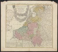
- Creator:
- Homann Erben (Firm)
Mayer, Tobias, 1723-1762 - Published / Created:
- 1748
- Call Number:
- 33 1748
- Container / Volume:
- BRBL_00077
- Image Count:
- 1
- Resource Type:
- Maps, Atlases & Globes
- Alternative Title:
- Carte des XVII. provinces ou de l'Allemagne inferievre, dresseé suivant la projection stereographique, et appüyée par les mesures faites de Mess. Cassini, Snellius et Mouschenbrok, par Mr. Tob. Majer de la Societé geographique, et publiée par les Her
- Description:
- Includes coat-of-arms and 5 bar scales., Relief shown pictorially., Sheet measures 54.6 x 61.5 cm., and Title in Latin and French; legend in Latin.
- Publisher:
- Cura et Studio Homannianorum Heredum,
- Subject (Geographic):
- Benelux countries--Maps--Early works to 1800
- Found in:
- Beinecke Rare Book and Manuscript Library > Belgii universi seu inferioris Germaniae quam XVII provinciae Austriaco Gallico et Batavo sceptro parentes constituunt nova tabula geographica / a Tobia Majero, Math. Cult. ad leges legitimae delineationis revocata.
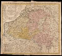
- Creator:
- Mayer, Tobias, 1723-1762
- Call Number:
- BrSides Double Folio 2019 29
- Image Count:
- 1
- Resource Type:
- Maps, Atlases & Globes
- Alternative Title:
- Belgium Catholicum seu decem provinciae Germaniae inferioris and Carte des Pais Bas catholiques où des X provinces de l'Allegmagne inférieure, etc. dessinée au juste selon les exactes observations astronomiques et opérations géometriques des Messur. Cass
- Description:
- "Avec privil. Imperial" above neat line., Includes 8 bar scales., Includes coats-of-arms of ten provinces., Relief shown pictorially., and Watermark. Manuscript number in upper right corner: 262[?]. From the Karpinski-von Wieser Map Collection.
- Publisher:
- Edentibus Homannianis heredib.,
- Subject (Geographic):
- Belgium--Maps--Early works to 1800. and Luxembourg--Maps--Early works to 1800.
- Subject (Name):
- Cassini, César-François, 1714-1784, Homann Erben (Firm), and Snellius, Willebrord, 1580-1626
- Found in:
- Beinecke Rare Book and Manuscript Library > Belgivm Catholicvm seu decem provinciae Germaniae inferioris : cum confiniis Germaniae svp. et Franciae legitime omnia delineata et ad ductum observationum astronomicarum, nec non geometricarum operationum a Cassinio Snellio Muschenbrokio aliisqve rite ha
8.
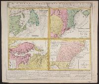
- Creator:
- Homann Erben (Firm)
- Published / Created:
- [1740?]
- Call Number:
- 755 1740
- Container / Volume:
- BRBL_00426
- Image Count:
- 1
- Resource Type:
- Maps, Atlases & Globes
- Alternative Title:
- Gros-Britannische Colonie-Lænder in Nord-America, in accuraten Special-Mappen nach den London. Originalien gretreulich mitgetheilt und heraussgegeben von Homaennischen Erben
- Description:
- A. New Foundland od. Terra Nova, S. Laurentii Bay, die Fisch-Bank, Acadia, nebst einem Theil New Schotland -- B. New Engelland, New York, New Yersey und Pensilvania -- C. Virginia und Maryl, Consists of four maps on one plate., and In Latin, German and English.
- Publisher:
- Homannianis Hered.,
- Subject (Geographic):
- Atlantic Coast (Canada)--Maps--Early works to 1800, Atlantic Coast (U.S.)--Maps--Early works to 1800, and Great Britain--Colonies--America--Maps--Early works to 1800
- Subject (Name):
- Moll, Herman, d. 1732
- Found in:
- Beinecke Rare Book and Manuscript Library > Dominia Anglorum in America Septentrionali : specialibus mappis Londini primum a Mollio edita, nunc recusa ab Homannianis Hered. = Die Gros-Britannische Colonie-Lænder in Nord-America, in accuraten Special-Mappen nach den London. Originalien getreulich mi
9.
- Creator:
- Homann Erben (Firm)
- Published / Created:
- [1760?]
- Call Number:
- 755 1740A
- Container / Volume:
- BRBL_00426
- Image Count:
- 1
- Resource Type:
- Maps, Atlases & Globes
- Alternative Title:
- Gros-Britannische Colonie-Lænder in Nord-America, in accuraten Special-Mappen nach den London. Originalien gretreulich mitgetheilt und heraussgegeben von Homaennischen Erben
- Description:
- "Mit Kayserl. allergn. Privil." and A. New Foundland od. Terra Nova, S. Laurentii Bay, die Fisch-Bank, Acadia, nebst einem Theil New Schotland -- B. New Engelland, New York, New Yersey und Pensilvania -- C. Virginia und Maryland -- D. Carolina nebst einem The
- Publisher:
- Homannianis Hered.,
- Subject (Geographic):
- Atlantic Coast (Canada)--Maps--Early works to 1800, Atlantic Coast (U.S.)--Maps--Early works to 1800, and Great Britain--Colonies--America--Maps--Early works to 1800
- Subject (Name):
- Moll, Herman, d. 1732
- Found in:
- Beinecke Rare Book and Manuscript Library > Dominia Anglorum in America Septentrionali : specialibus mappis Londini primum a Mollio edita, nunc recusa ab Homannianis Hered. = Die Gros-Britannische Colonie-Lænder in Nord-America, in accuraten Special-Mappen nach den London. Originalien getreulich mi
10.
- Creator:
- Homann Erben (Firm)
- Published / Created:
- [1740?]
- Call Number:
- 755 1740B
- Container / Volume:
- BRBL_00728
- Image Count:
- 1
- Resource Type:
- Maps, Atlases & Globes
- Alternative Title:
- Gros-Britannische Colonie-Lænder in Nord-America, in accuraten Special-Mappen nach den London. Originalien gretreulich mitgetheilt und heraussgegeben von Homaennischen Erben
- Description:
- A. New Foundland od. Terra Nova, S. Laurentii Bay, die Fisch-Bank, Acadia, nebst einem Theil New Schotland -- B. New Engelland, New York, New Yersey und Pensilvania -- C. Virgin, In Latin, German and English., and Sheet measures 56 x 64 cm. Franklin Collection.
- Publisher:
- Homannianis Hered.,
- Subject (Geographic):
- Atlantic Coast (Canada)--Maps--Early works to 1800, Atlantic Coast (U.S.)--Maps--Early works to 1800, and Great Britain--Colonies--America--Maps--Early works to 1800
- Subject (Name):
- Moll, Herman, d. 1732
- Found in:
- Beinecke Rare Book and Manuscript Library > Dominia Anglorum in America Septentrionali : specialibus mappis Londini primum a Mollio edita, nunc recusa ab Homannianis Hered. = Die Gros-Britannische Colonie-Lænder in Nord-America, in accuraten Special-Mappen nach den London. Originalien getreulich mi