Search
You Searched For
Search Results
- Published / Created:
- 1919
- Call Number:
- 383 1919
- Container / Volume:
- BRBL_00177
- Image Count:
- 1
- Resource Type:
- Maps, Atlases & Globes
- Description:
- "G.S.G.S. No. 2909".
- Publisher:
- War Office,
- Subject (Geographic):
- France, Eastern--Maps
- Found in:
- Beinecke Rare Book and Manuscript Library > Alsace-Lorraine.
- Published / Created:
- [191-?]
- Call Number:
- 11hcf 1919D-41
- Container / Volume:
- BRBL_00010X
- Image Count:
- 1
- Resource Type:
- Maps, Atlases & Globes
- Publisher:
- s.n.,
- Subject (Geographic):
- Alsace (France)--Maps
- Found in:
- Beinecke Rare Book and Manuscript Library > Alsace.
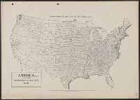
- Creator:
- Goode, J. Paul, 1862-1932
- Published / Created:
- c1910.
- Call Number:
- 75fb 1910A
- Container / Volume:
- BRBL_00410
- Image Count:
- 1
- Resource Type:
- Maps, Atlases & Globes
- Alternative Title:
- Goode's series of base maps ; no. 32B
- Description:
- Shows county boundaries.
- Publisher:
- University of Chicago Press,
- Subject (Geographic):
- United States--Administrative and political divisions--Maps and United States--Maps
- Found in:
- Beinecke Rare Book and Manuscript Library > America (U.S.) by counties.
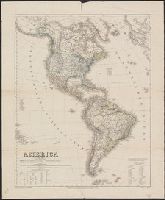
- Creator:
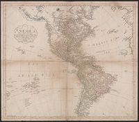
- Arrowsmith, John, 1790-1873
- Published / Created:
- 1832 February 15
- Call Number:
- 70 1832
- Container / Volume:
- BRBL_00359
- Image Count:
- 1
- Resource Type:
- Maps, Atlases & Globes
- Description:
- In upper right margin: 39. and Relief shown by hachures.
- Publisher:
- J. Arrowsmith, 35 Essex Strand,
- Subject (Geographic):
- America--Maps
- Found in:
- Beinecke Rare Book and Manuscript Library > America / by J. Arrowsmith.
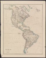
- Creator:
- Arrowsmith, John, 1790-1873
- Published / Created:
- 1844 February 15
- Call Number:
- 70 1844
- Container / Volume:
- BRBL_00359
- Image Count:
- 1
- Resource Type:
- Maps, Atlases & Globes
- Description:
- "39.", From the author's London atlas of universal geography. 1842-[1850]., and Relief shown by hachures.
- Publisher:
- J. Arrowsmith, 10 Soho Square,
- Subject (Geographic):
- America--Maps
- Subject (Name):
- Arrowsmith, John, 1790-1873. London atlas of universal geography
- Found in:
- Beinecke Rare Book and Manuscript Library > America / by J. Arrowsmith.
- Creator:
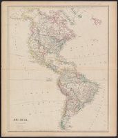
- Mannert, Konrad, 1756-1834
- Published / Created:
- 1796
- Call Number:
- 70 1796
- Container / Volume:
- BRBL_00725
- Image Count:
- 1
- Resource Type:
- Maps, Atlases & Globes
- Description:
- "Melville Insel" added in ink ms., Franklin Collection no. 131 1796 5., Prime meridian: Ferro., and Relief shown pictorially.
- Publisher:
- Bey Adam Gottlieb Schneider u. Weigel,
- Subject (Geographic):
- America--Maps--Early works to 1800
- Subject (Name):
- Adam Gottlieb Schneider u. Weigel
- Found in:
- Beinecke Rare Book and Manuscript Library > America : nach der zweyten Ausgabe von Arrowsmiths Weltcharte und dessen Globular Projection nach den Berichten der Jesuiten und anderer Reisebeschreiber, und nach Raymals, Gatterers, Angaben entworfen / von C. Mannert.