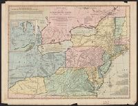
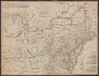
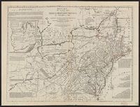
Includes historical notes, text, 3 distance charts, and inset, "A sketch of the remaining part of Ohio R. &c.", Prime meridians: Philadelphia and London., Relief shown pictorially., Table of distances in the margin., and Watermark.
Publisher:
Printed for the proprietors, Bowles & Carver, No. 69 in St. Paul's Church Yard, London,
Subject (Geographic):
Canada--Maps--Early works to 1800 and Northeastern States--Maps
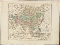
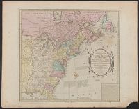
Date taken from description by Stevens and Tree in Tooley's Mapping of America, p. 81, item 56., Includes historical notes and table of "Methodical di, Prime meridian: Ferro., Relief shown pictorially., and Yale's copy stamped on verso: Yale, Horace Brown, 1900S.
Publisher:
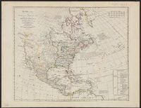
Printed for the proprietor Carington Bowles,
Subject (Geographic):
North America--Maps--Early works to 1800
Subject (Name):
Bowles, Carington, 1724-1793 and Palairet, Jean, 1697-1774