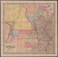
Geographical and geological map of the San Juan Mining Region, Colorado
Description:
"Entered according to Act of Congress, 1881 by A.F. Kibbe in the office of the Librarian of Congress at Washington.", Includes inset of "Map of the state of Colorado.", and Library's copy stamped in lower left margin: Library of Congress, city of Washington, copyright Jun 1, 1881, duplicate.
Publisher:
Geo. H. Adams & Son,
Subject (Geographic):
Colorado--Maps
Subject (Name):
American Photo-Lithographic Company and Geo. H. Adams & Son
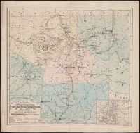
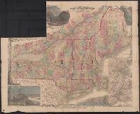
Border of state seals. and Hand-colored cerographic map showing the free soil and slave states along with the territories of the United States. Gila River Mexican War settlement boundary shown. Oregon trial and other routes to the Oregon territory are shown.
"Entered according to act of Congress in the year A.D. 1858 by G.W. Lewis in the clerks office of the district court for the southern district of New York." and Relief shown by hachures.
Publisher:
Lith. & pub. by G.W. Lewis,
Subject (Geographic):
Canada--Maps, Overland Trails--Maps, and West (U.S.)--Maps
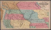
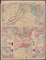
[Virginia, Maryland, Delaware] -- United States -- District of Columbia -- New Orleans, mouth of Mississippi -- Savannah -- Mobile Bay -- Galveston Bay -- Map of Mississippi River [2 maps] -- Cairo -- Pensacola Bay -- Norfolk Harbor -- Hampton Roads. and Reli
Publisher:
H.H. Lloyd : and Published under the auspices of the American Geographical and Statistical Society,
Subject (Geographic):
United States--Maps
Subject (Name):
American Geographical and Statistical Society, Haskins, Charles, and Viele, Egbert L. (Egbert Ludovicus), 1825-1902