Skip to search
Skip to main content
Skip to first result
Search
You Searched For
Genre
Maps
Language
Latin
Publication Place
[Amsterdam] :
New Search
Search Results
Creator:
Published / Created:
[1652?]
Call Number:
BrSides Double Folio 2019 66
Image Count:
1
Resource Type:
Maps, Atlases & Globes
Alternative Title:
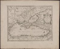
Pontus Euxinus and Pontvs Euxinvs
Description:
Relief shown pictorially., Verso blank., and Watermark. Manuscript number in upper left corner: 35.
Publisher:
[Jan Jansson],
Subject (Geographic):
Black Sea Region and Black Sea Region--History--Maps--Early works to 1800.
Subject (Name):
Jansson, Jan, 1588-1664 and Ortelius, Abraham, 1527-1598
Found in:
Beinecke Rare Book and Manuscript Library > Pontos Euxeinos = Pontus Euxinus : æquor Iasonio pulsatum remige primum / ex conatibus Abrahami Ortelii ; Petrus Kaerius caelavit.
Published / Created:
[1635?]
Call Number:
3334 1635
Container / Volume:
BRBL_00084
Image Count:
2
Resource Type:
Maps, Atlases & Globes
Alternative Title:
Qvarta pars Brabantiæ cujus caput Sylvadvcis
Description:
Preliminary record. and Verso: Text.
Publisher:
G. Blaeu,
Subject (Geographic):
North Brabant (Netherlands)--Maps--Early works to 1800
Found in:
Beinecke Rare Book and Manuscript Library > Quarta pars Brabantiæ cujus caput Sylvaducis ...
Published / Created:
[1650?]
Call Number:
408 1650
Container / Volume:
BRBL_00238
Image Count:
2
Resource Type:
Maps, Atlases & Globes
Alternative Title:
Sicilia regnvm
Description:
Verso: Latin text.
Publisher:
Apud Guiljelmum Blaeu,
Subject (Geographic):
Sicily (Italy)--Maps--Early works to 1800
Found in:
Beinecke Rare Book and Manuscript Library > Sicilia regnum.
Published / Created:
[1650?]
Call Number:
408 1650
Container / Volume:
BRBL_00238
Image Count:
1
Resource Type:
Maps, Atlases & Globes
Alternative Title:
Sicilia regnvm
Description:
Verso: Latin text.
Publisher:
Apud Guiljelmum Blaeu,
Subject (Geographic):
Sicily (Italy)--Maps--Early works to 1800
Found in:
Beinecke Rare Book and Manuscript Library > Sicilia regnum.
Published / Created:
[1635?]
Call Number:
3334 B453 1635
Container / Volume:
BRBL_00084
Image Count:
2
Resource Type:
Maps, Atlases & Globes
Description:
Preliminary record. and Verso: Text.
Publisher:
G. Blaeuw,
Subject (Geographic):
Bergen (Netherlands)--Maps--Early works to 1800 and North Brabant (Netherlands)--Maps--Early works to 1800
Found in:
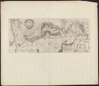
Beinecke Rare Book and Manuscript Library > Tabula Bergarum ad Zomam Slenbergæ et novorum ibi operum.
Published / Created:
[1635]
Call Number:
966 1635
Container / Volume:
BRBL_00676
Image Count:
1
Resource Type:
Maps, Atlases & Globes
Publisher:
G. Blaeu,
Subject (Geographic):
Magellan, Strait of (Chile and Argentina)--Maps--Early works to 1800
Found in:
Beinecke Rare Book and Manuscript Library > Tabula Magellanico, qua Tierrae del fuego, cum celerrimis fretis a F. Magellano et L. Le Maire detectis novissima et accuratissimo descriptio exhibetur.
Creator:
Published / Created:
[ca. 1680?]
Call Number:
51 1680
Container / Volume:
BRBL_00278
Image Count:
1
Resource Type:
Maps, Atlases & Globes
Alternative Title:
Promissionis, olim Palestina
Description:
"20" in upper right corner., Along the top of the map is a garland supported by a cherubim; at bottom center, the encapment of the tribes flanked by Moses and Aaron is pictured., Appears in various editions of Wit's Atlas., Relief shown pictorially., and Sheet me
Publisher:
Gedruckt tot Amsterdam by Frederick de Wit in de Calverstraet by den Dam inde Witte Paskaert,
Subject (Geographic):
Palestine--History--To 70 A.D.--Maps and Palestine--Maps--Early works to 1800
Subject (Name):
Wit, Frederik de. Atlas
Found in:
Beinecke Rare Book and Manuscript Library > Terra Sancta, sive Promissionis, olim Palestina / recens delineata, et in lucem edita per Fredericum de Wit.
Creator:
Published / Created:
[approximately 1700?]
Call Number:
BrSides Double Folio 2019 67
Image Count:
1
Resource Type:
Maps, Atlases & Globes
Description:
Manuscript number in upper left corner: 29., Relief shown pictorially., and Verso blank.
Publisher:
[Jan Jansson],
Subject (Geographic):
Thessaly (Greece)--Maps--Early works to 1800.
Subject (Name):
Jansson, Jan, 1588-1664
Found in:
Beinecke Rare Book and Manuscript Library > Thessaliae accurata descriptio / autore I. Laurenbergio.
Creator:
Published / Created:
[between 1652 and 1684]
Call Number:
BrSides Double Folio 2019 57
Image Count:
1
Resource Type:
Maps, Atlases & Globes
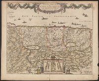
Alternative Title:
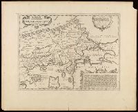
Thraciae veteris typus and Thraciae veteris typvs
Description:
Appeared in various editions of Jan Jansson's Accuratissima orbis antiqui delineatio., Descriptive text in lower right cartouche beginning "Thraciae aliquot incogniti situs loca ...", Manuscript number in upper left corner: 22., Relief shown pictorially., Title in Greek and Latin; text in Latin., and Verso blank.
Publisher:
[Jan Jansson],
Subject (Geographic):
Bulgaria--Maps--Early works to 1800., Thrace--Maps--Early works to 1800., and Turkey--Maps--Early works to 1800.
Subject (Name):
Jansson, Jan, 1588-1664. Accuratissima orbis antiqui delineatio. and Ortelius, Abraham, 1527-1598
Found in:
Beinecke Rare Book and Manuscript Library > Thrakē = Thraciae veteris typus / ex conatibus geographicis Abrah. Ortelij. ; Petrus Kaerius caelavit.
Published / Created:
[ca. 1652]
Call Number:
380 1652
Container / Volume:
BRBL_00173
Image Count:
1
Resource Type:
Maps, Atlases & Globes
Alternative Title:
Typvs Galliae veteris
Publisher:
Excudebat Guiljelmus Blaeu,
Subject (Topic):
Gaul--Maps--Early works to 1800
Found in:
Beinecke Rare Book and Manuscript Library > Typus Galliae veteris [cartographic material] : ex conatib[us] geograph[icis] Abrah[ami] Ortelii.
Branch:v1.61.8 ,Deployed:2024-06-20T11:15:04-04:00