Search
You Searched For
Search Results
- Creator:
- United States. Office of Strategic Services. Research and Analysis Branch
- Published / Created:
- 1943
- Call Number:
- 36cb 1943
- Container / Volume:
- BRBL_00127
- Image Count:
- 1
- Resource Type:
- Maps, Atlases & Globes
- Alternative Title:
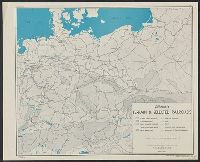
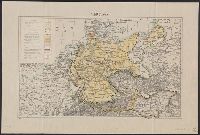
- Germany, terrain and selected railroads.
- Description:
- "Map no. 2905, 21 December 1943.", "Reliability code: 1B-1A-2.", and Relief shown by gradient tints.
- Publisher:
- Lithographed in the Reproduction Branch, OSS,
- Subject (Geographic):
- Europe, Central--Maps and Germany--Maps
- Subject (Topic):
- Railroads--Europe, Central--Maps and Railroads--Germany--Maps
- Found in:
- Beinecke Rare Book and Manuscript Library > Germany, terrain & selected railroads / compiled and drawn in the Branch of Research and Analysis, OSS.
- Creator:
- United States. Office of Strategic Services. Research and Analysis Branch
- Published / Created:
- 1945
- Call Number:
- 36fb 1945C
- Container / Volume:
- BRBL_00128
- Image Count:
- 1
- Resource Type:
- Maps, Atlases & Globes
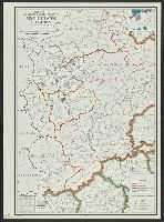
- Description:
- "No. 6245." and Location map inset.
- Publisher:
- R & A, OSS,
- Subject (Geographic):
- Germany (West)--Administrative and political divisions--Maps
- Found in:
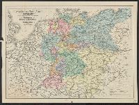
- Beinecke Rare Book and Manuscript Library > Germany, western border regions, administrative divisions.
- Creator:
- United States. Office of Strategic Services. Research and Analysis Branch
- Published / Created:
- 1945
- Call Number:
- 36gfa 1945
- Container / Volume:
- BRBL_00130
- Image Count:
- 1
- Resource Type:
- Maps, Atlases & Globes
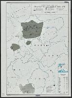
- Description:
- "No. 6249.", Index to valley dams., and Location map inset.
- Publisher:
- R & A, OSS,
- Subject (Geographic):
- Germany (West)--Maps
- Subject (Topic):
- Water-supply--Germany (West)--Maps
- Found in:
- Beinecke Rare Book and Manuscript Library > Germany, western border regions, stream control and industrial water supply.
- Creator:
- United States. Department of State. Division of Map Intelligence and Cartography
- Published / Created:
- 1946
- Call Number:
- 36fd 1946
- Container / Volume:
- BRBL_00129
- Image Count:
- 1
- Resource Type:
- Maps, Atlases & Globes
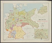
- Description:
- "10139 March 1946." and Inset map: Greater Berlin.
- Publisher:
- Dept. of State, Division of Map Intelligence and Cartography,
- Subject (Geographic):
- Germany--Administrative and political divisions--Maps
- Found in:
- Beinecke Rare Book and Manuscript Library > Germany, zones of occupation.
- Published / Created:
- 1919]
- Call Number:
- 11hcf 1919B-16
- Container / Volume:
- BRBL_00010O
- Image Count:
- 1
- Resource Type:
- Maps, Atlases & Globes
- Description:
- Ms. notes of changed political boundaries following the first World War.
- Publisher:
- s.n.,
- Subject (Geographic):
- Europe, Central--Maps and Germany--Maps
- Subject (Topic):
- Boundaries--Europe, Central--Maps and World War, 1914-1918--Europe, Central--Maps
- Found in:
- Beinecke Rare Book and Manuscript Library > Germany.
- Published / Created:
- 1919]
- Call Number:
- 11hcf 1919B-22
- Container / Volume:
- BRBL_00010P
- Image Count:
- 1
- Resource Type:
- Maps, Atlases & Globes
- Publisher:
- s.n.,
- Subject (Geographic):
- Europe, Central--Maps
- Found in:
- Beinecke Rare Book and Manuscript Library > Germany.
- Published / Created:
- [1795?]
- Call Number:
- 36 1795A
- Container / Volume:
- BRBL_00119
- Image Count:
- 1
- Resource Type:
- Maps, Atlases & Globes
- Subject (Geographic):
- Germany--Maps--Early works to 1800
- Found in:
- Beinecke Rare Book and Manuscript Library > Germany.
- Creator:
- George Philip & Son
- Published / Created:
- [1853?]
- Call Number:
- 36 1853
- Container / Volume:
- BRBL_00120
- Image Count:
- 1
- Resource Type:
- Maps, Atlases & Globes
- Description:
- No. in upper right corner of margin: 27.
- Publisher:
- George Philip & Son,
- Subject (Geographic):
- Germany--Maps
- Found in:
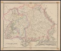
- Beinecke Rare Book and Manuscript Library > Germany. Northern part.
- Creator:
- George Philip & Son
- Published / Created:
- [1853?]
- Call Number:
- 36 1853A
- Container / Volume:
- BRBL_00120
- Image Count:
- 1
- Resource Type:
- Maps, Atlases & Globes
- Description:
- No. in upper right corner of margin: 28.
- Publisher:
- George Philip & Son,
- Subject (Geographic):
- Germany--Maps
- Found in:
- Beinecke Rare Book and Manuscript Library > Germany. Southern part.
- Published / Created:
- [1860?]
- Call Number:
- 36gm 1860
- Container / Volume:
- BRBL_00130
- Image Count:
- 1
- Resource Type:
- Maps, Atlases & Globes
- Description:
- "Gezeichnet von Theophil Koenig".
- Publisher:
- R. Drawert,
- Subject (Geographic):
- Germany--Maps
- Subject (Topic):
- Railroads--Germany--Maps and Shipping--Germany--Maps
- Found in:
- Beinecke Rare Book and Manuscript Library > Geschäfts und Reise-Karte von Deutschland und den angrenzenden Ländern mit Angabe aller Eisenbahnen, Poststrassen und Dampfschiffslinien.