Skip to search
Skip to main content
Skip to first result
Search
You Searched For
Genre
Maps
Genre
Maps in books
Genre
Prints (Visual works)
New Search
Search Results
Call Number:
1977 +392
Collection Title:
A survey of the cities of London and Westminster : containing the original, antiquity, increase
Image Count:
1
Resource Type:
Maps, Atlases & Globes
Description:
Plate between p. 90-91.
Subject (Geographic):
London (England)--History
Collection Created:
London : Printed for A. Churchill, J. Knapton, R. Knaplock, J. Walthoe [and 6 others], 1720
Found in:
Beinecke Rare Book and Manuscript Library > Bishop Gate Street Ward taken from the last survey and corrected
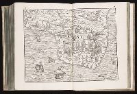
Published / Created:
[1565?]
Call Number:
2001 +204 3
Collection Title:
Terzo volume delle nauigationi et viaggi / raccolto gia da m. Gio. Battista Ramusio
Image Count:
1
Description:
Bound in as leaves 427 and 428 and West (Ponente) oriented map.
Subject (Geographic):
Brazil--Maps--Early works to 1800
Collection Created:
In Venetia : nella stamperia de Giunti., lanno 1565
Found in:
Beinecke Rare Book and Manuscript Library > Brasil
Published / Created:
[1565?]
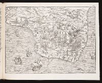
Call Number:
Taylor 115 3
Collection Title:
Terzo volume delle nauigationi et viaggi / raccolto gia da m. Gio. Battista Ramusio
Container / Volume:
v. 3
Image Count:
1
Description:
Folded map (single sheet) marked as leaves 427 & 428. and West (Ponente) oriented map.
Subject (Geographic):
Brazil--Maps--Early works to 1800
Collection Created:
In Venetia : nella stamperia de' Giunti.,
Found in:
Beinecke Rare Book and Manuscript Library > Brasil
Published / Created:
[1565?]
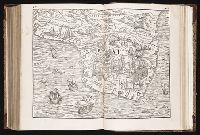
Call Number:
1977 +251
Collection Title:
Terzo volume delle nauigationi et viaggi / raccolto gia da m. Gio. Battista Ramusio
Container / Volume:
v. 3
Image Count:
1
Description:
Bound in as leaves 427 & 428. and West (Ponente) oriented map.
Subject (Geographic):
Brazil--Maps--Early works to 1800
Collection Created:
In Venetia : nella stamperia de Giunti., lanno 1565
Found in:
Beinecke Rare Book and Manuscript Library > Brasil
Call Number:
1977 +392
Collection Title:
A survey of the cities of London and Westminster : containing the original, antiquity, increase
Image Count:
1
Resource Type:
Maps, Atlases & Globes
Description:
Plate between p. 14-15.
Subject (Geographic):
London (England)--History
Collection Created:
London : Printed for A. Churchill, J. Knapton, R. Knaplock, J. Walthoe [and 6 others], 1720
Found in:
Beinecke Rare Book and Manuscript Library > Bread Street Ward and Cordwainer Ward with it's division into parishes taken from the last survey
Published / Created:
1610
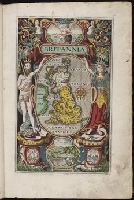
Call Number:
Ede +610C
Collection Title:
Britain, or, A chronographicall description of the most flourishing kingdomes, England, Scotland
Image Count:
1
Resource Type:
Books, Journals & Pamphlets
Subject (Geographic):
Great Britain
Collection Created:
Londini : impensis G. Bishop & I. Norton, 1610
Found in:
Beinecke Rare Book and Manuscript Library > Britannia
Call Number:
1977 +392
Collection Title:
A survey of the cities of London and Westminster : containing the original, antiquity, increase
Image Count:
1
Resource Type:
Maps, Atlases & Globes
Description:
Plate between p. 150-151.
Subject (Geographic):
London (England)--History
Collection Created:
London : Printed for A. Churchill, J. Knapton, R. Knaplock, J. Walthoe [and 6 others], 1720
Found in:
Beinecke Rare Book and Manuscript Library > Candlewick Ward with its division into parishes. Corrected from the last survey
Creator:
Call Number:
Pequot H41
Collection Title:
Aenmerckelycke historische reys-beschryvinge door verscheyde landen veel grooter als die van geheel
Image Count:
1
Description:
Map: Carte dun nouueau monde, entre le Nouueau Mexique et la mer Glaciale, novellement decouvert par le R.P. Louis Hennepin, missionnire recollect natif dAht. en Hainaut, dediee a Sa Majeste britanique, le roy Guilaume Troisieme. Gasp. Bouttats fecit. [n.
Subject (Geographic):
Mississippi River Valley--Maps., Mississippi River--Discovery and exploration., New France--Discovery and exploration., New France--Maps, and North America--Discovery and exploration.
Collection Created:
Tot Utrecht : By A. Schouten, 1698
Found in:
Beinecke Rare Book and Manuscript Library > Carte d'un nouueau monde, entre le nouueau Mexique et la mer glacialle
Published / Created:
1632
Call Number:
Taylor 317
Collection Title:
Les voyages de la Novvelle France occidentale, dicte Canada / faits par le Sr. de Champlain
Image Count:
1
Description:
Bound in before p. 1
Subject (Geographic):
America --Discovery and exploration --French, Canada --Discovery and exploration, and New France --Maps
Subject (Topic):
Navigation --Early works to 1800
Collection Created:
A Paris, Chez Pierre LeMvr, dans la grand salle du Palais. M.DC.XXXII. Auec priuilege du roy
Found in:
Beinecke Rare Book and Manuscript Library > Carte de la Nouuelle France, augmentee depuis la derniere, seruant a la navigation faicte en son vray meridien, par le sr. de Champlain, capitaine pour le Roy en la Marine; lequel depuis lan 1603 jusques en lannee 1629; a descouuert plusieurs costes, terr
Published / Created:
1808
Call Number:
Folio Q115 H84 3A
Collection Title:
Atlas geographique et physique du royaume de la Nouvelle-Espagne, fonde sur des observations
Image Count:
1
Resource Type:
Maps, Atlases & Globes
Description:
At foot: Dessine par G. Grossman, termine par F. Friesen a Berlin 1807 et par A. Humboldt a Paris 1808 / Grave par Barriere - et l'Ecriture par L. Aubert pere and Longitude Occidentale de Paris
Subject (Geographic):
Mexico
Subject (Topic):
Mountains
Collection Created:
Paris : F. Schoell, 1811
Found in:
Beinecke Rare Book and Manuscript Library > Carte de la Vallee de Mexico et des Montagnes Voisines esquissee sur les Lieux en 1804, par Don Louis Martin redigee et corrigee en 1807 d'apres les operations trigonometriques de Don Joaquin Velasquez et d'apres les observations astronomiques et les mesu
Branch:v1.61.8 ,Deployed:2024-06-20T11:15:02-04:00