Search
You Searched For
Search Results
- Call Number:
- 1973 Folio 114
- Collection Title:
- The English pilot: describing the West-India navigation, from Hudson's-Bay to the river Amazones
- Image Count:
- 1
- Resource Type:
- Maps, Atlases & Globes
- Found in:
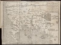
- Beinecke Rare Book and Manuscript Library > A large draft of South Carolina from Cape Roman to Port Royall
- Call Number:
- 1973 Folio 114
- Collection Title:
- The English pilot: describing the West-India navigation, from Hudson's-Bay to the river Amazones
- Image Count:
- 1
- Resource Type:
- Maps, Atlases & Globes
- Found in:
- Beinecke Rare Book and Manuscript Library > A large draft of the island Antegua
- Published / Created:
- 1742
- Call Number:
- 1976 1232
- Collection Title:
- Chorographia Britanniæ, or, A set of maps of all the counties in England and Wales ... : to the
- Image Count:
- 1
- Found in:
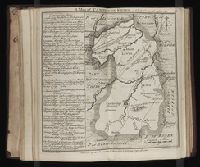
- Beinecke Rare Book and Manuscript Library > A map of Cambridge Shire
- Published / Created:
- 1797
- Call Number:
- 3213 1797
- Container / Volume:
- BRBL_00055
- Image Count:
- 1
- Resource Type:
- Maps, Atlases & Globes
- Found in:
- Beinecke Rare Book and Manuscript Library > A map of Kent.
- Creator:
- Clark, William, 1770-1838
Lewis, Samuel, 1753 or 4-1822
- Published / Created:
- [ca. 1814]
- Call Number:
- Zc10 814Le
- Collection Title:
- History of the expedition under the command of Captains Lewis and Clark, to the sources of the
- Image Count:
- 2
- Resource Type:
- Maps, Atlases & Globes
- Found in:
- Beinecke Rare Book and Manuscript Library > A map of Lewis and Clark's track, across the western portion of North America fom the Mississippi to the Pacific Ocean; by order of the Executive of the United States . In 1804, 5 & 6
- Published / Created:
- 1677
- Call Number:
- Pequot H91
- Collection Title:
- A narrative of the troubles with the Indians in New-England, : from the first planting thereof in
- Image Count:
- 1
- Found in:
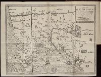
- Beinecke Rare Book and Manuscript Library > A map of New-England, being the first that ever was cut, and done by the best pattern that could be had, which being in some places defective, it made the other less exact : yet doth it sufficiently shew the scituation of the country, and conveniently wel
- Published / Created:
- 1677
- Call Number:
- Pequot H91
- Collection Title:
- A narrative of the troubles with the Indians in New-England, : from the first planting thereof in
- Image Count:
- 1
- Found in:
- Beinecke Rare Book and Manuscript Library > A map of New-England, being the first that ever was cut, and done by the best pattern that could be had, which being in some places defective, it made the other less exact : yet doth it sufficiently shew the scituation of the country, and conveniently wel
- Published / Created:
- undated
- Call Number:
- Vanderbilt 74
- Collection Title:
- The present state of New-England ; being a narrative of the troubles with the Indians in New
- Image Count:
- 2
- Found in:
- Beinecke Rare Book and Manuscript Library > A map of New-England, being the first that ever was here cut, and done by the best pattern that could be had, which being in some places defective, it made the other less exact, yet it doth sufficiently shew the scituation of the countrey, and convenientl
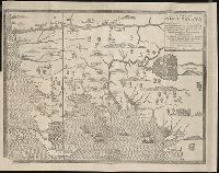
- Published / Created:
- 1742
- Call Number:
- 1976 1232
- Collection Title:
- Chorographia Britanniæ, or, A set of maps of all the counties in England and Wales ... : to the
- Image Count:
- 1
- Found in:
- Beinecke Rare Book and Manuscript Library > A map of Northampton Shire
- Creator:
- Dawes, William, 1762-1836
- Published / Created:
- 1791 March
- Call Number:
- DU170 H85+ Oversize
- Collection Title:
- An historical journal of the transactions at Port Jackson and Norfolk island, with the discoveries
- Image Count:
- 1
- Resource Type:
- Books, Journals & Pamphlets
- Found in:
- Beinecke Rare Book and Manuscript Library > A map of all those parts of the territory of New South Wales which have been seen by any person belonging to the settlement established at Port Jackson, in the said territory ...