Search
You Searched For
Search Results
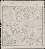
- Published / Created:
- 1896
- Call Number:
- 777cbf B21 1894
- Container / Volume:
- BRBL_00504
- Image Count:
- 36
- Resource Type:
- Maps, Atlases & Globes
- Found in:
- Beinecke Rare Book and Manuscript Library > City of Baltimore topographical survey / made under the direction of H.T. Douglas, chief engineer.
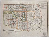
- Published / Created:
- 1889
- Call Number:
- 827 1889
- Container / Volume:
- BRBL_00577
- Image Count:
- 1
- Resource Type:
- Maps, Atlases & Globes
- Found in:
- Beinecke Rare Book and Manuscript Library > Indian territory / compiled under the direction of the Hon. John H. Oberly, Commissioner of Indian Affairs, by C.A. Maxwell ; John Olberg, draftsman.
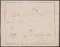
- Creator:
- Gibbon, Lardner
- Published / Created:
- [1854]
- Call Number:
- 98 1854A
- Container / Volume:
- BRBL_00679
- Image Count:
- 1
- Resource Type:
- Maps, Atlases & Globes
- Found in:
- Beinecke Rare Book and Manuscript Library > Map of the Andes drawn by Lieut. Lardner Gibbon, U.S. Navy, to accompany his report. 1854.
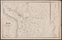
- Creator:
- Gibbon, Lardner
- Published / Created:
- [1854]
- Call Number:
- 98 1854
- Container / Volume:
- BRBL_00679
- Image Count:
- 1
- Resource Type:
- Maps, Atlases & Globes
- Found in:
- Beinecke Rare Book and Manuscript Library > Map drawn by Lieut. Lardner Gibbon to accompany his Report, 1854.
- Published / Created:
- [1940].
- Call Number:
- 762 K251 1940
- Container / Volume:
- BRBL_00450
- Image Count:
- 1
- Resource Type:
- Maps, Atlases & Globes
- Found in:
- Beinecke Rare Book and Manuscript Library > The Yale Forest in Keene and Swanzey, N.H., 1940.
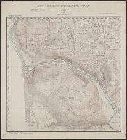
- Published / Created:
- 1894
- Call Number:
- 777 B21 1894A
- Container / Volume:
- BRBL_00503
- Image Count:
- 1
- Resource Type:
- Maps, Atlases & Globes
- Found in:
- Beinecke Rare Book and Manuscript Library > City of Baltimore topographical survey : Sheet 1N. - 4W. / made under the direction of H.T. Douglas, chief engineer.
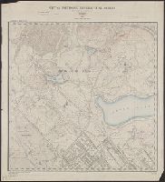
- Published / Created:
- 1894
- Call Number:
- 777 B21 1894A
- Container / Volume:
- BRBL_00503
- Image Count:
- 1
- Resource Type:
- Maps, Atlases & Globes
- Found in:
- Beinecke Rare Book and Manuscript Library > City of Baltimore topographical survey : Sheet 2N. - 2W. / made under the direction of H.T. Douglas, chief engineer.
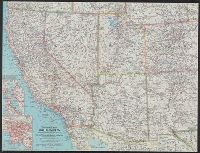
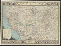
- Creator:
- National Geographic Society (U.S.). Cartographic Section
- Published / Created:
- 1940
- Call Number:
- 7821 1940
- Container / Volume:
- BRBL_00506
- Image Count:
- 1
- Resource Type:
- Maps, Atlases & Globes
- Found in:
- Beinecke Rare Book and Manuscript Library > The southwestern United States / executed in the Cartographic Section of the National geographic magazine ; James M. Darley, chief cartographer ; culture by Apphia E. Holdstock ; research by Wellman Chamberlin ; physiography by John J. Brehm and H.E. East
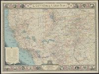
- Creator:
- National Geographic Society (U.S.). Cartographic Division
- Published / Created:
- c1959
- Call Number:
- 7821 1959
- Container / Volume:
- BRBL_00506
- Image Count:
- 1
- Resource Type:
- Maps, Atlases & Globes
- Found in:
- Beinecke Rare Book and Manuscript Library > Southwestern United States / compiled and drawn in the Cartographic Division of the National Geographic Society for the National geographic magazine ; James M. Darley, chief cartographer.
- Creator:
- National Geographic Society (U.S.). Cartographic Section
- Published / Created:
- 1940
- Call Number:
- 7821 1940
- Container / Volume:
- BRBL_00506
- Image Count:
- 1
- Resource Type:
- Maps, Atlases & Globes
- Found in:
- Beinecke Rare Book and Manuscript Library > The southwestern United States / executed in the Cartographic Section of the National geographic magazine ; James M. Darley, chief cartographer ; culture by Apphia E. Holdstock ; research by Wellman Chamberlin ; physiography by John J. Brehm and H.E. East