Skip to search
Skip to main content
Skip to first result
Search
You Searched For
Format
cartographic
New Search
Search Results
Creator:
Published / Created:
1882
Call Number:
847 Y12 1882A
Container / Volume:
BRBL_00627
Image Count:
2
Resource Type:
Maps, Atlases & Globes
Alternative Title:
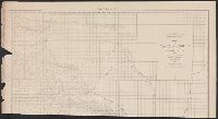
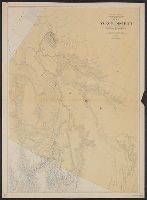
Map of Yakima Region, Washington Ter., eastern sheet
Description:
"Photolithographed preliminary sheet for the use of the parties in the field, and subject to revision.", "There is a slight discordance in projecting the U.S. Land Survey upon this map. A part of the S.W. corner is taken from the U.S. Land Office plats.", and n top margin: Eastern sheet.
Publisher:
Northern Transcontinental Survey?],
Subject (Geographic):
Yakima River Valley (Wash.)--Maps, Topographic
Subject (Name):
Goode, Richard Urquhart, 1858-1903, Julius Bien & Co, Northern Transcontinental Survey, Owen, F. D, and Tweedy, Frank, 1854-1937
Found in:
Beinecke Rare Book and Manuscript Library > Map of Yakima Region, Washington Ter. / Northern Transcontinental Survey, Raphael Pumpelly, director ; A.D. Wilson, chief topographer ; R.U. Goode, topographer ; Frank Tweedy, Asst. ; Fred D. Owen, chief draughtsman.
Creator:
Published / Created:
1903
Call Number:
739 Y12 1903
Container / Volume:
BRBL_00391
Image Count:
1
Resource Type:
Maps, Atlases & Globes
Description:
"Land divisions in red, mining divisions in brown." and Relief shown by spot heights.
Publisher:
Colonist litho.,
Subject (Geographic):
British Columbia--Administrative and political divisions--Maps
Subject (Topic):
Mining districts--British Columbia--Maps
Found in:
Beinecke Rare Book and Manuscript Library > Map of Yale district and portion of adjacent districts, British Columbia / compiled and drawn in the Lands and Works Department, Victoria, B.C.
Creator:
Published / Created:
1921
Call Number:
739fcm 1921
Container / Volume:
BRBL_00391
Image Count:
1
Resource Type:
Maps, Atlases & Globes
Description:
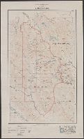
"Base map from Chief Geographer's Map of Rocky and Selkirk Mountains." and Relief by contours and spot hts.
Publisher:
Dept. of the Interior,
Subject (Geographic):
Yoho National Park (B.C.)--Maps
Found in:
Beinecke Rare Book and Manuscript Library > Map of Yoho Park [cartographic material].
Published / Created:
[1947?]
Call Number:
844 Y78 1947
Container / Volume:
BRBL_00611
Image Count:
2
Resource Type:
Maps, Atlases & Globes
Alternative Title:
1947 map of Yolo County, California and Yolo County map-guide :
Description:
Advertisements, text, ill., and "1947 map of Winters" on verso., At head of title: 1947., Dates on panel: 1947, 1948., Includes advertisements, "Map of the city of Davis, Jan. 1947," and "1947 map of Woodland.", and Library's copy stamped: Triplicate, the Library of Congress duplicate.
Publisher:
California Map Publishers,
Subject (Geographic):
Yolo County (Calif.)--Maps
Subject (Topic):
Roads--California--Yolo County--Maps
Found in:
Beinecke Rare Book and Manuscript Library > Map of Yolo County, California / compiled with the cooperation of the Yolo County, Davis, and Winters Chambers of Commerce and those represented in this folder.
Published / Created:
1872
Call Number:
761 Y82 1872
Container / Volume:
BRBL_00449
Image Count:
2
Resource Type:
Maps, Atlases & Globes
Description:
"6" and "7" inside right-hand margin., Map removed from unknown atlas., On verso: Statistics of York County, business directories for Biddeford and Saco, Maine., and Stamped on verso: "Yale Univ. Lib. Map Coll. Sep 9 1964".
Publisher:
s.n. ,
Subject (Geographic):
York (Me.)--Maps
Found in:
Beinecke Rare Book and Manuscript Library > Map of York Co. Maine.
Published / Created:
[1400?]
Call Number:
32 1400
Container / Volume:
BRBL_00042
Image Count:
2
Resource Type:
Maps, Atlases & Globes
Description:
Text verso.
Subject (Geographic):
England--Maps--Early works to 1800
Found in:
Beinecke Rare Book and Manuscript Library > Map of York, Shrewesbury, Lancaster, Richmond.
Creator:
Published / Created:
1909
Call Number:
844fcm Y83 1909
Container / Volume:
BRBL_00615
Image Count:
1
Resource Type:
Maps, Atlases & Globes
Description:
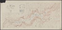
Includes "Index map" and table of "Elevations of principal points." and Relief shown by contours and spot heights.
Publisher:
The Survey,
Subject (Geographic):
Yosemite Valley (Calif.)--Maps
Subject (Name):
Douglas, Edward Morehouse, 1855-1932, Marshall, R. B. (Robert Bradford), 1867-1949, and Matthes, François, 1874-1948
Found in:
Beinecke Rare Book and Manuscript Library > Map of Yosemite Valley, Mariposa County, California / U.S. Geological Survey, George Otis Smith, Director ; E.M. Douglas, geographer ; State of California, George C. Pardee, Govenor.
Creator:
Published / Created:
[1918]
Call Number:
844fcm Y83 1918
Container / Volume:
BRBL_00615
Image Count:
1
Resource Type:
Maps, Atlases & Globes
Alternative Title:
Yosemite Valley, Yosemite National Park, California
Description:
"Surveyed in 1905-1906 in cooperation with the State of California.", At head of title: Department of the Interior., Contour interval 50 feet. Datum is mean sea level., Includes location map and table of "Elevations of principal points.", and Relief shown by contours and spot heights.
Publisher:
U.S. Geological Survey,
Subject (Geographic):
Yosemite Valley (Calif.)--Maps
Subject (Name):
Douglas, Edward Morehouse, 1855-1932, Marshall, R. B. (Robert Bradford), 1867-1949, Matthes, François, 1874-1948, and Urquhart, C. F
Found in:
Beinecke Rare Book and Manuscript Library > Map of Yosemite Valley, Yosemite National Park, California, Mariposa County / U.S. Geological Survey ; State of California ; E.M. Douglas, geographer ; R.B. Marshall, in charge of section ; topography by F.E. Matthes ; triangulation by C.F. Urquhart.
Creator:
Published / Created:
March 1898.
Call Number:
796 Y68 1898
Container / Volume:
BRBL_00528
Image Count:
1
Resource Type:
Maps, Atlases & Globes
Alternative Title:
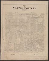
Young County
Description:
"Drg. 912.71.", Cadastral map., and Shows lots by number and/or name.
Publisher:
General Land Office,
Subject (Geographic):
Young County (Tex.)--Maps
Subject (Name):
Geo. D. Barnard & Co
Subject (Topic):
Real property--Texas--Young County--Maps
Found in:
Beinecke Rare Book and Manuscript Library > Map of Young County / litg. Geo. D. Barnard & Co.
Creator:
Published / Created:
1903
Call Number:
741 1903
Container / Volume:
BRBL_00395
Image Count:
1
Resource Type:
Maps, Atlases & Globes
Description:
Canada., James White, F.R.G.S., geographer., Relief shown by contours and spot heights., and Shows grid.
Publisher:
Department of the Interior,
Subject (Geographic):
British Columbia--Maps and Yukon--Maps
Subject (Name):
White, James
Subject (Topic):
Geomorphology--British Columbia--Maps and Geomorphology--Yukon Territory--Maps
Found in:
Beinecke Rare Book and Manuscript Library > Map of Yukon District [cartographic material] : with the adjacent northern part of British Columbia.
Branch:v1.61.6 ,Deployed:2024-06-12T09:55:31-04:00