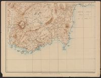
Carte de la partie occidentale de l 'Asie mineure and Map of the western part of Asia Minor
Description:
Covers western Anatolia and islands in Aegean Sea., Map in German; title in German, French, and English., Relief shown by shading and spot heights., and Sheet XV. only
Publisher:
Verlag von Dietrich Reimer,
Subject (Geographic):
Aegean Islands (Greece and Turkey)--Maps and Turkey--Maps
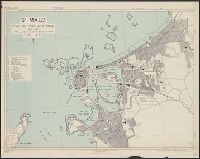
France 1:6,000, Geographical Section, General Staff ; no. 4234, GSGS (Series) ; 4234., Saint Malo, and St. Malo, plan of port and town
Description:
"G.S.G.S. edition, 1943.", "Grid provisional. Lambert zone I grid.", "I-44.", "War Office, 1943.", Principal street names, important buildings and port facilities are indicated., Relief shown by rock drawings., and Street names and some places of interest in French
"4-43.", "Copied from CB 1804, map 27.", "French Lambert zone II grid.", Major street names and place names in French., Relief shown by rock drawings., and Some streets and buildings are named.
Descriptio ac delineatio geographica detectionis freti, sive, transitus ad occasum supra terras
Image Count:
1
Abstract:
Map depicts the Coat of Arms of the United Kingdom (era of the Union of the Crowns), reigning between the years 1603-1707.
Alternative Title:
Tabula nautica, qua repraesentantur orae maritimae, meatus, ac freta, noviter a H. Hudsono Anglo ad Caurum supra Novam Franciam
Description:
Bound in after p. [2]., In pencil on recto: 170., Map cut and folded irregularly., Map has multiple small stains on both the recto and verso., and Scale [ca. 1:9,000,000].
Descriptio ac delineatio geographica detectionis freti, sive, transitus ad occasum supra terras
Image Count:
1
Abstract:
Map depicts the Coat of Arms of the United Kingdom (era of the Union of the Crowns), reigning between the years 1603-1707.
Alternative Title:
Tabula nautica ...
Description:
Bound in after p. [6]., In ink on recto: place names "Okkak", "Nain"[?] and one longer handwritten note on the bottom margin., Map cut and folded irregularly., Map has been repaired with multiple pieces of tape on verso., Map has multiple small stains on both the recto and verso., Printed on recto in lower right corner: A1., and Scale [ca. 1:9,000,000].
Subject (Geographic):
North Atlantic Ocean --Maps --Early works to 1800
Subject (Name):
Hudson, Henry, d. 1611
Collection Created:
Amsterodami Ex officina Hesse lij Gerardi. Anno 1613
Great Britain. War Office. General Staff. Geographical Section
Published / Created:
1919?]
Call Number:
434fd 1919
Container / Volume:
BRBL_00251
Image Count:
1
Resource Type:
Maps, Atlases & Globes
Alternative Title:
Czecho-Slovakia
Description:
"G.S.G.S. No. 2758.", "S.G.A. 2.4.19.", Also shows portions of Germany, Poland, Austria, Hungary, and Romania., In French and English., Relief shown by contours and spot heights., and Shows proposed boundaries and roads.
Publisher:
G.S.G.S.,
Subject (Geographic):
Czechoslovakia--Boundaries--Maps and Czechoslovakia--Maps
Henri Crublier d'Opterre journal and maps, [1776]-1783.
Container / Volume:
Bsd folder 10
Image Count:
3
Subject (Geographic):
America--Maps--Early works to 1800, Portsmouth (N.H.)--Maps--Early works to 1800, and United States--History--Revolution, 1775-1783--Maps--Early works to 1800.