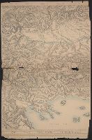
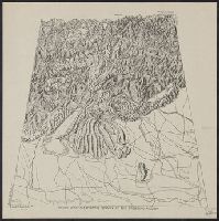
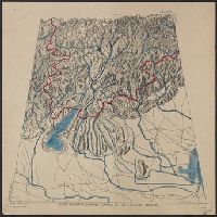
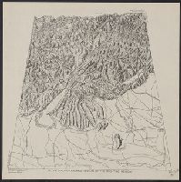
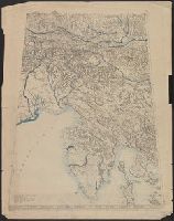
"Approximate scale in center of diagram 1:150,000, vertical exaggeration about 1 1/2 times.", 11hcf 1919E: Hand col. Sheet 1 with typed descriptive notes attached., and Relief shown by shading, land form drawing, hachures and spot heights.
Publisher:
American Geographical Society,
Subject (Geographic):
Friuli (Italy)--Maps, Istria (Croatia and Slovenia)--Maps, and Trieste Region (Italy)--Maps
Subject (Topic):
Block diagrams--Friuli (Italy : Province) and Block diagrams--Istria (Croatia and Slovenia)
Negative photostat. and Soundings in feet, shoreline hachured; beaches stippled; rocks shown by small circles lighthouses shown in outline, tinted red by hand. New haven entrance shown just above compass rose at center of chart. Publisher's name and place of