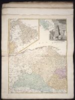
The English pilot: describing the sea-coasts, capes, head-lands, rivers, bays, roads, havens
Image Count:
1
Description:
Most maps numbered in pencil on verso, some on recto.
Subject (Geographic):
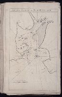
Atlantic Ocean --Maps --Early works to 1800 and Boston Harbor (Mass.) --Maps --Early works to 1800
Subject (Topic):
Navigation --Early works to 1800, Pilot guides --Atlantic Coast (U.S.) --Early works to 1800, and Pilot guides --Caribbean Area --Early works to 1800
Collection Created:
London : Printed for John Thornton, at the sign of the England, Scotland, and Ireland, in the Minories, and Richard Mount, at the Postern on Tower-Hill, 1698London : Printed for John Thornton, at the sign of the England, Scotland, and Ireland, in the Minories, and Richard Mount, at the Postern on Tower-Hill, 1698
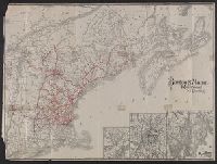
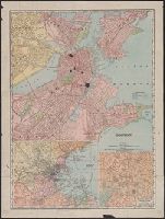
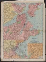
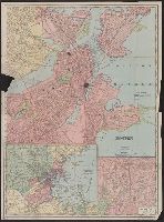
Includes insets: Environs of Boston and Business portion of Boston., On verso: Trolley maps of Massachusetts, 21 x 39 cm., and Part of Rand, McNally & Co.'s new business atlas map of Boston.
Publisher:
Rand-McNally,
Subject (Geographic):
Boston (Mass.)--Maps and Massachusetts--Maps
Subject (Topic):
Central business districts--Massachusetts--Boston--Maps