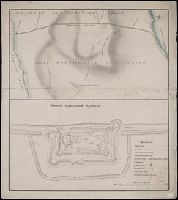
Cartographer's name in lower right corner illegible., Coordinates not present on map and are approximated., Manuscript number at bottom: 334., and Manuscript number on verso: 2170.
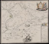
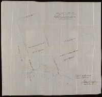
"Verstes russiennes dont une contient 500 toises de 7 pieds d'angleter"., Coordinates converted by cataloger to express longitude as measured from the Greenwich meridian., Includes map key of marble quarry locations, unidentified royal crown stamp, and shelf mark (K.3a)., and Relief shown by hachures.
Subject (Geographic):
Leningradskai︠a︡ oblastʹ (Russia)--Maps--Early works to 1800.
Subject (Topic):
Marble industry and trade--Russia (Federation)--Leningradskai︠a︡ oblastʹ--Maps--Early works to 1800.
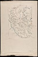
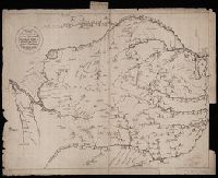
Чертезъ украинским и черкаскимъ городамъ от Москвы до Киева, и въ крымскую землу, дороги болшие, красные, черние, малшие.
Description:
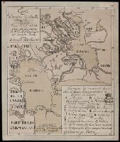
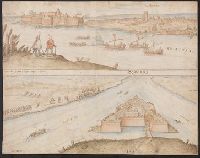
Relief shown pictorially. and Stamp: Koenigl. Kartograph. Institut, Berlin. On verso in manuscript: "Mappa Expeditionis Moscovitica Duce Galicin Aõ 1681". Piece of paper with shelf mark attached at upper edge: "Cl. N. 16 [undeciphered].
Subject (Geographic):
Kiev (Ukraine : Oblast)--Maps--Early works to 1800.