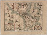
Carte de l'Ameriqve, L'Amerique [cartographic material], and L'Ameriqve [cartographic material]
Description:
Includes ill., text, and insets of Greenland area and Antarctica., Mounted on linen. Stamp on verso: Karpinski-von Wieser Map Collection., Relief shown pictorially., and State 1 according to Burden.
Publisher:
P. Bertius,
Subject (Geographic):
America--Maps--Early works to 1800 and Western Hemisphere--Maps--Early works to 1800
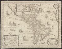
Has watermark., Includes text in margins, insets of Greenland region and "Terre Antarctique incognue," and ill., Library's copy stamped on backing: Yale University Library, Karpinski-Von Wieser Map Collection., and Relief shown pictorially.
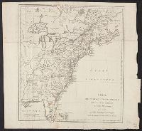
"Avec une Description Géographique de cette Partie, In upper left cartouche "Remarques Les Possessions des Francois, sont colorées en Bleu, Celles des Anglois en Jaune, Et celles des Espagnols en Rouge.", Includes three bar scales., and Prime meridian: Paris.
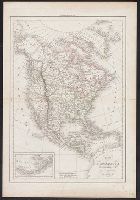
Includes text and inset of "Supplément à la partie nord de l'Amérique.", Library's copy stamped on backing: Yale University Library, Karpinski-Von Wieser Map Collection., Prime meridian: Greenwich and Paris., and Relief shown pictorially.
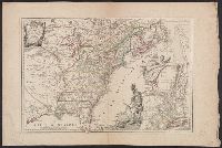
Relief shown pictorially., Similar to map by Jean Palairet described in LC Maps of North America, 1750-1789, 16., and Yale's copy annotated in ink in upper right margin and verso, "13." Also stamped on verso, "Yale, Horace Brown, 1900S."