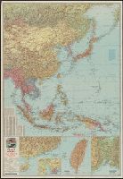
Japan and adjacent Asiatic mainland [cartographic material]., The Pacific Theater [cartographic material]., and War map III featuring the Pacific Theater
Description:
Chart of variants in Chinese place names. and recto. Esso War Map: The Pacific Theater.--South China Coast with inset of Canton-Hong Kong area.--Formosa.--Vladivostok and vicinity.--verso. Esso War map: Japan and adjacent Asiatic mainland.--Philippine Island
Publisher:
Esso Marketers,
Subject (Geographic):
East Asia--Maps and Pacific Ocean--Maps
Subject (Topic):
World War, 1939-1945--Campaigns--Pacific Ocean and World War, 1939-1945--Maps
Esso Marketers Esso Standard Oil Company General Drafting Company
Published / Created:
[1942?]
Call Number:
11hd 1942
Image Count:
2
Resource Type:
Maps, Atlases & Globes
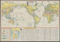
Alternative Title:
War map, featuring transportation, the key to every successful campaign
Description:
"Copyright, General Drafting Co., Inc.", Accompanying texts: [1.] Flattening the globe -- [2.] Over the top of the world -- [3.] Transportation: Key to victory., Ancillary map: [North pole.], Index., and Text and ills. on verso.
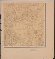
Mexico. Dirección de Estudios Geográficos y Climatológicos
Published / Created:
1927?]
Call Number:
8819 1927
Container / Volume:
BRBL_00652
Image Count:
6
Resource Type:
Maps, Atlases & Globes
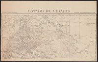
Description:
Includes text., Insets: Diagrama hidrológico -- Carta minera -- Plano de la Ciudad de Chihuahua / por J.F. Parada. Scale 1:20 000., and Relief shown by shading.
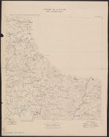
Mexico. Dirección de Estudios Geográficos. Sección de Cartografía y Dibujo
Published / Created:
1919
Call Number:
8813 1919
Container / Volume:
BRBL_00650
Image Count:
4
Resource Type:
Maps, Atlases & Globes
Description:
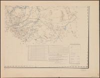
"Datos que se han utilizado en la formación de esta carta construida bajo la inspección immediata del sr. ing. Pastor Rouaix. Archivo particular del sr. ing. Pastor Rouiax. Planos levantados por los ingenieros Pastor Rouaix y C. Patoni ... Mapa del E. de Durango por los ingenieros Pastor Rouiax y C. Patoni."
Publisher:
Secretaría de Agricultura y Fomento, Dirección de Estudios Geográficos,
Subject (Geographic):
Durango (Mexico : State)--Maps
Subject (Name):
López Sorcini, Luciano, Patoni, Carlos, 1853-1918, Rouaix, Pastor, 1874-1950, and Scanlan, Santiago
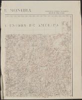
Includes chart showing international commerce in 1906 and 1907., Inset chart showing coffee exports., Inset showing postion on world map., and Map title in Spanish and French.