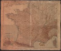
"Stielers Hand Atlas"., Inset maps: Paris und Umgebung. Scale 1:150,000 -- Corse = Corsica. Scale 1:1,500,000., and Relief shown by hachures and spot heights.
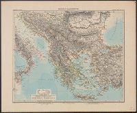
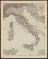
"Stieler's Hand-Atlas.", 40 1891: Mounted together on linen., Includes 2 insets: Palermo und weitere Umgegend -- Rom und weitere Umgegend., and Relief shown by hachures and spot heights. Depths shown by bathymetric isolines.
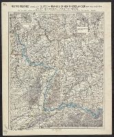
Karte der deutsch-französischen Grenzländer von Köln bis Bern und von Metz bis Ulm
Description:
"No. 1." and Includes 6 insets: Landau -- Germersheim -- Saarlouis -- Die Festung Mainz -- Die Festung Ulm und Umgegend -- Die Festung Rastatt und Umgegend.
Publisher:
Perthes,
Subject (Geographic):
France--Boundaries--Germany--Maps and Germany--Boundaries--France--Maps