Skip to search
Skip to main content
Skip to first result
Search
You Searched For
Extent of Digitization
Partially digitized
Access
Public
Format
cartographic
New Search
Search Results
Creator:
Published / Created:
[1732]
Call Number:
E1015 M66 1732
Collection Title:
Atlas minor: or a set of sixty-two new and correct maps, of all parts of the world. All composed
Image Count:
1
Resource Type:
Maps, Atlases & Globes
Description:
Autograph of Gravely. Autograph of Baldock. Autograph of Aston. Autograph of W. Alington. and Teaching resource: Professor John Mack Faragher, History 141: The American West.
Subject (Geographic):
America--Maps, Europe, Northern--Maps--Early works to 1800, Great Britain--Maps--Early works to 1800, and Ireland--Maps--Early works to 1800
Subject (Topic):
Atlases--Early works to 1800
Collection Created:
London :
Found in:
Beinecke Rare Book and Manuscript Library > A general map of Great Britain and Ireland with part of Germany, Holland, Flanders, France &c. agreeable to modern history
Creator:
Call Number:
Egg +755E
Collection Title:
Geographical, historical, political, philosophical and mechanical essays : the first, containing an
Image Count:
1
Description:
Hand-colored illustrations. and Tipped in facing p. 32.
Subject (Geographic):
Erie, Lake., Middle Atlantic States--Maps., Ohio River Valley--Maps., and Ontario, Lake (N.Y. and Ont.)
Subject (Topic):
Voyages and travels
Collection Created:
Philadelphia: Printed by B. Franklin, and D. Hall. MDCCLV. And sold by R. and J. Dodsley, in Pall-Mall, London. [1755]
Found in:
Beinecke Rare Book and Manuscript Library > A general map of the middle British colonies in America
Creator:
Call Number:
1976 Folio 139
Collection Title:
The English pilot: describing the sea-coasts, capes, head-lands, soundings, sands, shoals, rocks
Image Count:
1
Subject (Topic):
Nautical charts--Europe--To 1800
Collection Created:
[London, Printed by J. Darby] and are to be sold by the author at the signe of the Marriners Compass, at the Hermitage-stairs in Wapping [1671-72]
Found in:
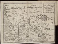
Beinecke Rare Book and Manuscript Library > A large description of the two chanells in the River Dwina goeing up to the citty of Archangel by John Seller
Call Number:
1973 Folio 114
Collection Title:
The English pilot: describing the West-India navigation, from Hudson's-Bay to the river Amazones
Image Count:
1
Resource Type:
Maps, Atlases & Globes
Subject (Geographic):
Atlantic Ocean --Maps --Early works to 1800 and South Carolina --Maps --Early works to 1800
Subject (Topic):
Navigation --Early works to 1800, Pilot guides --Atlantic Coast (U.S.) --Early works to 1800, and Pilot guides --Caribbean Area --Early works to 1800
Collection Created:
London : Printed for W. and J. Mount, T. Page and son, on Tower-Hill, MDCCLIX [1759]
Found in:
Beinecke Rare Book and Manuscript Library > A large draft of South Carolina from Cape Roman to Port Royall
Call Number:
1973 Folio 114
Collection Title:
The English pilot: describing the West-India navigation, from Hudson's-Bay to the river Amazones
Image Count:
1
Resource Type:
Maps, Atlases & Globes
Subject (Geographic):
Antigua --Maps --Early works to 1800, Atlantic Ocean --Maps --Early works to 1800, and West Indies --Maps --Early works to 1800
Subject (Topic):
Navigation --Early works to 1800, Pilot guides --Atlantic Coast (U.S.) --Early works to 1800, and Pilot guides --Caribbean Area --Early works to 1800
Collection Created:
London : Printed for W. and J. Mount, T. Page and son, on Tower-Hill, MDCCLIX [1759]
Found in:
Beinecke Rare Book and Manuscript Library > A large draft of the island Antegua
Published / Created:
1742
Call Number:
1976 1232
Collection Title:
Chorographia Britanniæ, or, A set of maps of all the counties in England and Wales ... : to the
Image Count:
1
Subject (Geographic):
Cambridgeshire (England)--Maps--Early works to 1800, England --Maps --Early works to 1800, and Great Britain --Road maps --Early works to 1800
Subject (Topic):
Roads --Great Britain
Collection Created:
Holbourne : Printed for and sold by W.H. Toms, engraver, in Union Court, near Hatton Garden, 1742
Found in:
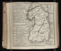
Beinecke Rare Book and Manuscript Library > A map of Cambridge Shire
Published / Created:
1797
Call Number:
3213 1797
Container / Volume:
BRBL_00055
Image Count:
1
Resource Type:
Maps, Atlases & Globes
Description:
Missing northern half of map. and Preliminary record.
Publisher:
J. Stockdale,
Subject (Geographic):
Kent (England)--Maps--Early works to 1800
Found in:
Beinecke Rare Book and Manuscript Library > A map of Kent.
Creator:
Published / Created:
[ca. 1814]
Call Number:
Zc10 814Le
Collection Title:
History of the expedition under the command of Captains Lewis and Clark, to the sources of the
Image Count:
2
Resource Type:
Maps, Atlases & Globes
Description:
Verso blank.
Subject (Geographic):
Columbia River, Missouri River, and West (U.S.)
Subject (Topic):
Lewis and Clark Expedition (1804-1806)
Collection Created:
Philadelphia : Bradford & Inskeep ; New York : A.H. Inskeep : J. Maxwell, Printer, 1814
Found in:
Beinecke Rare Book and Manuscript Library > A map of Lewis and Clark's track, across the western portion of North America fom the Mississippi to the Pacific Ocean; by order of the Executive of the United States . In 1804, 5 & 6
Branch:v1.61.8 ,Deployed:2024-06-20T11:14:46-04:00