Skip to search
Skip to main content
Skip to first result
Search
You Searched For
Genre
Maps
Creator
American Geographical Society of New York
Publication Place
New York :
New Search
Search Results
Creator:
Published / Created:
[1918?]
Call Number:
11hcf 1919-14
Container / Volume:
BRBL_00010J
Image Count:
1
Resource Type:
Maps, Atlases & Globes
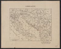
Description:
Ms. notes showing Italian land claims following World War I.
Publisher:
American Geographical Society,
Subject (Geographic):
Adriatic Sea Region--Maps
Subject (Topic):
World War, 1914-1918--Maps
Found in:
Beinecke Rare Book and Manuscript Library > Adriatic [Sea region].
Creator:
Published / Created:
[1914?]
Call Number:
11hcf 1919B-13
Container / Volume:
BRBL_00010O
Image Count:
3
Resource Type:
Maps, Atlases & Globes
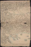
Description:
Sheet 2 fragile, in 3 fragments.
Publisher:
American Geographical Society,
Subject (Geographic):
Austria--Maps and Europe, Eastern--Maps
Found in:
Beinecke Rare Book and Manuscript Library > Austria-Hungary [cartographic material].
Creator:
Published / Created:
[1918]
Call Number:
11hcf 1919C-2
Container / Volume:
BRBL_00010T
Image Count:
2
Resource Type:
Maps, Atlases & Globes
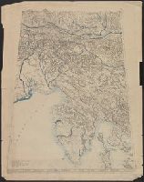
Description:
Relief shown by shading and spot heights.
Publisher:
The American Geographical Society,
Subject (Geographic):
Balkan Peninsula--Maps
Subject (Topic):
Slopes (Physical geography)--Balkan Peninsula--Maps
Found in:
Beinecke Rare Book and Manuscript Library > Block diagram showing terrain of the Balkan Peninsula.
Creator:
Published / Created:
1918
Call Number:
11hcf 1919E
Image Count:
1
Resource Type:
Maps, Atlases & Globes
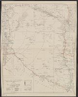
Description:
"Approximate scale in center of diagram 1:150,000, vertical exaggeration about 1 1/2 times.", 11hcf 1919E: Hand col. Sheet 1 with typed descriptive notes attached., and Relief shown by shading, land form drawing, hachures and spot heights.
Publisher:
American Geographical Society,
Subject (Geographic):
Friuli (Italy)--Maps, Istria (Croatia and Slovenia)--Maps, and Trieste Region (Italy)--Maps
Subject (Topic):
Block diagrams--Friuli (Italy : Province) and Block diagrams--Istria (Croatia and Slovenia)
Found in:
Beinecke Rare Book and Manuscript Library > Block diagram showing terrain of the Trieste-Isonzo region.
Creator:
Published / Created:
1929
Call Number:
923 1929
Container / Volume:
BRBL_00673
Image Count:
1
Resource Type:
Maps, Atlases & Globes
Description:
"Contours and altitudes in meters.", Relief shown by contours and spot heights. River depths shown by soundings., and Shows rivers - surveyed and unsurveyed, astronomical points, roads, trails, fortines/[bunkers] (Bolivian, Paraguayan or Argentine), settlements, indian settlements and mission stations.
Publisher:
American Geographical Society of New York,
Subject (Geographic):
Chaco Boreal (Paraguay and Bolivia)--Maps
Subject (Topic):
Chaco War, 1932-1935--Maps
Found in:
Beinecke Rare Book and Manuscript Library > Map of the Chaco Boreal [cartographic material] / compiled by the American Geographical Society of New York.
Creator:
Published / Created:
1918
Call Number:
11hcf 1919B-42
Image Count:
1
Resource Type:
Maps, Atlases & Globes
Description:
"Boundary according to the Treaty of Bucharest, May 7, 1918."
Publisher:
American Geographical Society,
Subject (Geographic):
Romania--Maps and Romania--Maps--1918
Found in:
Beinecke Rare Book and Manuscript Library > Roumania [cartographic material].
Branch:v1.61.6 ,Deployed:2024-06-12T09:55:37-04:00